Circular walk between Sainte-Croix Abbey and Passelourdin Cave

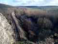
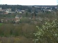
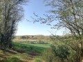
A short walk through woods and fields, with a beautiful view of the Clain Valley, near the famous Passelourdin Cave

Details

935934
Creation:
Last update:
Last review:
  • Walking
    Activity: Walking
  • ↔
    Distance: 2.72 mi
  • ◔
    Average duration: 1h 20 
  • ▲
    Difficulty: Easy

  • ⚐
    Back to start: Yes
  • ↗
    Ascent: + 89 ft
  • ↘
    Descent: - 89 ft

  • ▲
    Highest point: 394 ft
  • ▼
    Lowest point: 282 ft

Photos

Description of the walk

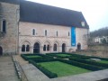
Park near Sainte-Croix Abbey. Please note: the abbey has announced that its car park is no longer accessible to passing motorists.

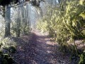
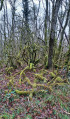
(S/E) Return to the D741 in front of the ‘beware of wild animals’ sign and take the path leading into the meadow. Walk along the edge of the woodland heading south-west. About a hundred metres past the electricity pylon, turn right and go through the hedge. Cross the woodland, following the path to the D88. At the ‘automatic speed limit sign’ showing ‘70’, take the path that continues westwards.

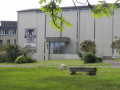
(1) At the ‘no parking’ sign, turn right towards the grey building, then continue left, heading uphill towards the bridge over the railway line, and head into the woods, following a wall uphill. Opposite the entrance gate to Mauroc, turn left onto the Clain Valley path, marked in blue.

(2) When you reach the road, continue to the left. To admire the view over the Clain Valley, climb the small flight of steps. Access to the Passelourdin Cave is prohibited under a 2001 local by-law. You can turn right, going round the gates, and follow the small path, but be careful – danger! Dangerous cliffs.

(3) Once you’ve left the area of dangerous cliffs, take the tarmac road on the right and head eastwards.

(2) Continue along Avenue des Grottes de Passelourdain.

(4) At the Stop sign, take the D88 towards Smarves on the right; after 50 metres, turn left and, in front of the IME Mauroc, take the small path that winds through the woods until you reach the D641. The entrance to the abbey is almost directly opposite. Cross the two roads carefully, go over the railway bridge and turn left towards the abbey (S/E).

Waypoints

  1. S/E : mi 0 - alt. 371 ft - Abbaye Sainte Croix (bénédictines)
  2. 1 : mi 0.8 - alt. 289 ft - No parking sign
  3. 2 : mi 1.26 - alt. 377 ft - Junction of the circular loop
  4. 3 : mi 1.38 - alt. 328 ft - Passelourdin Cave
  5. 4 : mi 1.78 - alt. 384 ft - Stop sign, Rue de Mauroc, D88.
  6. S/E : mi 2.72 - alt. 371 ft - Abbaye Sainte Croix (bénédictines)

Notes

Shop, toilets and drinking water point at the abbey.

Worth a visit

Reviews and comments

4.2 / 5
Based on 3 reviews

Reliability of the description
4 / 5
Ease of following the route
4.3 / 5
Route interest
4.3 / 5
Netra
Netra ★

Hello,

I’m sorry to hear that incidents of misuse have led you to take this decision. I’ve just amended the description of the walk: (i) the car park is no longer listed as a parking option and (ii) your message has been included right at the start of the walk.

A follow-up question: what practical parking solutions, which do not obstruct other road users, can we recommend in the vicinity? Thank you in advance for your advice.

Machine-translated

Abbaye Sainte-Croix
Abbaye Sainte-Croix

From now on, the Abbey will no longer allow its grounds to be used as a car park... This decision has been taken following serious misuse. Thank you!

Machine-translated

fabienlacaze
fabienlacaze

Overall rating : 5 / 5

Date of your route : Jul 14, 2019
Reliability of the description : ★★★★★ Very good
Ease of following the route : ★★★★★ Very good
Route interest : ★★★★★ Very good

Very good
The cave isn’t easy to find, but it’s well worth a look
A lovely mix of woodland, dirt tracks and lovely views
I highly recommend it

Machine-translated

philouis
philouis

Overall rating : 3 / 5

Date of your route : Oct 20, 2018
Reliability of the description : ★★★☆☆ Average
Ease of following the route : ★★★☆☆ Average
Route interest : ★★★☆☆ Average

The cave section remains unclear. Too much tar.

Machine-translated

upar
upar

Overall rating : 4.7 / 5

Date of your route : Jul 05, 2018
Reliability of the description : ★★★★☆ Good
Ease of following the route : ★★★★★ Very good
Route interest : ★★★★★ Very good

I have nothing further to add

Machine-translated

Other walks in the area

For more walks, use our search engine .

The GPS track and description are the property of this route's author. Please do not copy them without permission.