From the coast towards Sant’Amanza and Ascallia

A very varied walk in the Pietrosella hills. It is a challenging walk that alternates between tracks, paths through the maquis or woods, and gentle ascents and steep descents.
It is also a variation on the ‘Around Mare and Sole’ walk
In hot weather, don’t forget to take plenty of water with you.

Details

12174880
Creation:
Last update:
Last review:
  • Walking
    Activity: Walking
  • ↔
    Distance: 7.35 mi
  • ◔
    Average duration: 4h 40 
  • ▲
    Difficulty: Moderate

  • ⚐
    Back to start: Yes
  • ↗
    Ascent: + 1,470 ft
  • ↘
    Descent: - 1,473 ft

  • ▲
    Highest point: 1,417 ft
  • ▼
    Lowest point: 16 ft

Photos

Description of the walk

Park in the car park of the Vival supermarket, Route de Mare É Sole.

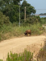
(S/E) From the car park, take the road that runs alongside the campsite and, just before the bridge over the Ruppione, turn right, then immediately right again, and take the track that climbs uphill. Follow this track until you reach a junction.

(1) Ignore the track branching off to the right – you’ll use this on the way back – and carry on straight ahead towards Sant’Amanza.

(2) At the junction (elevation 143), carry on straight ahead, passing close to a fountain. Just before the hamlet of Sant’Amanza, you’ll catch a glimpse of the first buildings from a hairpin bend.

(3) To the right of the gate, take a small path leading into the woods; it is marked by a small yellow sign reading ‘Ascallia 1 h’. The path climbs, first alongside a vegetable garden, then deeper into the woods. The climb is quite steep.

(4) At this junction with another path, beneath the high-voltage power line, carry on straight ahead, following the yellow markings. You’ll reach a three-way junction.

(5) Be careful here: ignore the yellow markings that suggest turning left onto a stony path, and carry on straight ahead along the same track. Pass beneath Crispolaju.

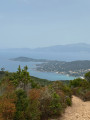
(6) Here, enjoy a beautiful view of Argent Beach below. Carry on, passing under the high-voltage power line, then reach a junction of six paths or tracks.

(7) Take the narrowest track directly opposite you, on the right. This track goes round a water treatment plant and joins a signposted path just before a tarmac road.

(8) Do not take the road: the path is marked with theGR® colours (red and white). Turn immediately right to find the start ofthe GR® trail, which heads deep into the woods. Be careful: the vegetation is dense and the path isn’t used very often, so you may have to search for it a little.

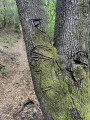
(9) The path descends very steeply; it can be very slippery, so you must be careful and sometimes hold onto the trees to avoid falling. Carvings on the trees (Corsican motifs, Moor’s head, etc.) mark the route.

At the end of the descent, you’ll reach a field of bamboo and brambles where you’ll also need to be careful as the ground is muddy. Planks allow you to cross over the stream. You may need to use a branch to clear a path through the brambles to avoid getting scratched. Once you’ve passed this section, head back to the starting junction.

(1) Turn left and retrace your steps along the same path you took on the way out to reach the supermarket car park (S/E).

Waypoints

  1. S/E : mi 0 - alt. 56 ft - Vival Supermarket, Route de Mare É Sole
  2. 1 : mi 0.46 - alt. 85 ft - Junction
  3. 2 : mi 1.64 - alt. 479 ft - Elevation 143
  4. 3 : mi 3.83 - alt. 1,122 ft - Path to Ascallia
  5. 4 : mi 4.57 - alt. 1,417 ft - Continue straight ahead along the path
  6. 5 : mi 4.68 - alt. 1,371 ft - Leave the yellow markings
  7. 6 : mi 5.33 - alt. 1,240 ft - A very beautiful view of Argent Beach
  8. 7 : mi 6.32 - alt. 610 ft - Crossroads with 6 paths
  9. 8 : mi 6.47 - alt. 551 ft - Junction
  10. 9 : mi 6.59 - alt. 335 ft - Steep descent
  11. S/E : mi 7.35 - alt. 59 ft - Vival Supermarket, Route de Mare É Sole

Notes

There are no water sources along the route.

Please note: the walk passes through scrubland; do not set off in strong winds and take care to avoid starting fires.

Worth a visit

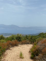
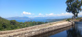
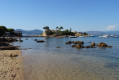
There are some lovely views of Argent Beach or the Gulf of Ajaccio.

Always be cautious and plan ahead when you're outdoors. Visorando and the author of this route cannot be held responsible for any accidents occurring on this route.

The GR® and PR® markings are the intellectual property of the Fédération Française de Randonnée Pédestre.

Reviews and comments

3.9 / 5
Based on 4 reviews

Reliability of the description
4.5 / 5
Ease of following the route
3.8 / 5
Route interest
3.5 / 5
User 19299546

Overall rating : 4.7 / 5

Date of your route : Jun 27, 2026
Reliability of the description : ★★★★★ Very good
Ease of following the route : ★★★★☆ Good
Route interest : ★★★★★ Very good
Very busy route : No

A lovely walk with beautiful sea views in the second half.
Please note there are few shaded areas.
At point 8, there are no GR markings before the road; there is a sloping meadow – take the path on the far right (when facing the road). From this point onwards, the descents are steeper but mainly through woodland.

Machine-translated

rebecca2a
rebecca2a
• Edited:

Overall rating : 2 / 5

Date of your route : Jul 10, 2023
Reliability of the description : ★★★★☆ Good
Ease of following the route : ★☆☆☆☆ Very disappointing
Route interest : ★☆☆☆☆ Very disappointing
Very busy route : No

Personally, I’ll never do this hike again; apart from the view over Ajaccio Bay and Porticcio, there’s nothing to see. I took a detour via the ‘abandoned’ village of Sant’Amanza, which isn’t (or isn’t any longer) abandoned at all; as for the return journey, I’ll have very bad memories of it. The descent isn’t just a bit of a risk – in my opinion, it’s actually dangerous. I fell several times even though I was using walking poles, and I hurt myself quite badly. Honestly, if you want to see the lovely view over Ajaccio Bay, find somewhere else you can reach by car. It’s simply not worth the trouble.

Machine-translated

colo26
colo26

Overall rating : 4.7 / 5

Date of your route : Nov 20, 2022
Reliability of the description : ★★★★★ Very good
Ease of following the route : ★★★★★ Very good
Route interest : ★★★★☆ Good
Very busy route : No

To avoid the final descent, which runs through scrubland and is very steep, I took an alternative route from point 7. I turned right onto the wide forest track that leads back to point 2.
You need to follow it straight on, ignoring the few tracks branching off, particularly to the right. Along the way, the track passes through a beautiful eucalyptus forest.
Once you reach point 2, simply turn left and head back down towards the start.
There are lovely views of Ajaccio Golf Course at point 6.

Machine-translated

Jonat
Jonat

Overall rating : 4.3 / 5

Date of your route : Jun 12, 2022
Reliability of the description : ★★★★☆ Good
Ease of following the route : ★★★★★ Very good
Route interest : ★★★★☆ Good
Very busy route : No

Adjust the starting point – it’s not appropriate to use the traders’ car park; the route is mainly along forest tracks. The final descent is quite a risk. There are some lovely views of Ajaccio Bay.

Machine-translated

Other walks in the area

For more walks, use our search engine .

The GPS track and description are the property of this route's author. Please do not copy them without permission.