Accelasca and the Chiavari Forest

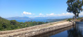
For the first ten kilometres, this magnificent walk follows the hillside, offering splendid views over Ajaccio Bay. Then, after the former Cotti Chiavari prison, it continues through the Chiavari forest before a final climb back to the starting point.

Details

28173483
Creation:
Last update:
Last review:
  • Walking
    Activity: Walking
  • ↔
    Distance: 10.91 mi
  • ◔
    Average duration: 6h 05 
  • ▲
    Difficulty: Moderate

  • ⚐
    Back to start: Yes
  • ↗
    Ascent: + 1,217 ft
  • ↘
    Descent: - 1,237 ft

  • ▲
    Highest point: 1,247 ft
  • ▼
    Lowest point: 82 ft
  • ⚐ Country: France
  • ⚐ City: Pietrosella (20166)
  • ⚑
    Start/End: N 41.821533° / E 8.789363°
  • ❏
    IGN map(s): Ref. 4153OT
  • Hour-by-hour weather

Description of the walk

The starting point is situated on the hills above the village of Accelasca. It is easily accessible by car and there is a car park available.

(S/E) To start the walk, take the concrete path leading uphill from the car park. Continue straight on, passing a pumping station. The concrete path then turns into a track, which you should follow until you reach a star-shaped junction.

(1) Take the second path on your right (you’ll return via the first one). The path runs along the hillside and offers beautiful views of the valley, the sea and the beaches. After several kilometres, you’ll reach a junction shaped like an inverted Y.

(2) Ignore the track on your left and carry on straight ahead. Continue for some time along the hillside whilst enjoying the views of Ajaccio.

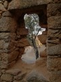
(3) Go through the gate and continue to the right for a few hundred metres to reach the former Chiavari Penitentiary. It has been converted into a wedding venue and is not open to the public.

(4) Take the path leading down to your right to wind your way gently into the Cotti Chiavari forest.

(5) At the Y-junction, follow the path leading down to the left, surrounded by magnificent trees, until you reach a small, fenced-off cemetery with a few crosses and gravestones.

(6) Continue along the path that runs to the right of this. You’ll reach another Y-junction (elevation 38).

(7) Take the path branching off to the right and continue along the winding track for about 2.5 km.

(8) Leave the track and take the path branching off to your left, which descends into the valley. The next 500 m represent the only ‘difficult’ part of the walk. After a fairly steep 100 m descent, you’ll reach the valley floor; wade across the stream and head back up the slope opposite you. About 150 metres further on, pass to the left of a pretty little ruined building. Immediately afterwards, do not follow the ‘Sentier du Myrte’ which branches off to the left, but take the small path on the right which climbs straight up to rejoin the road.

(9) Take the road on the right. A two-kilometre climb lies ahead to reach the star-shaped junction where you started.

(1) Turn left and continue to the car park (S/E).

Waypoints

  1. S/E : mi 0 - alt. 597 ft - Accelasca – Car park
  2. 1 : mi 0.19 - alt. 610 ft - Junction of the circular loop
  3. 2 : mi 3.5 - alt. 1,234 ft - Y-junction
  4. 3 : mi 6.27 - alt. 495 ft - Barrier
  5. 4 : mi 6.47 - alt. 472 ft - Former prison
  6. 5 : mi 7.05 - alt. 354 ft - Y-junction
  7. 6 : mi 7.15 - alt. 331 ft - Cemetery
  8. 7 : mi 7.88 - alt. 121 ft - Three-way junction, on the right
  9. 8 : mi 9.34 - alt. 144 ft - Path on the left
  10. 9 : mi 9.61 - alt. 246 ft - Vehicle track
  11. S/E : mi 10.91 - alt. 561 ft - Accelasca – Car park

Notes

Although a good part of the walk is shaded, it is nevertheless over 17 km long. It is therefore essential to take plenty of water, especially as there are no places to refill your water bottles along the route. I have estimated the duration at four hours, which allows for a half-hour picnic break.

Apart from a few hundred metres between points (8) and (9), the paths are easy and mostly shaded. This is why I have rated the difficulty as ‘moderate’.

An alternative route would be to set off from the Plage d’Argent car park, follow the road and turn right onto the track that passes near the electricity substation, joining the hike at point (9).

Worth a visit

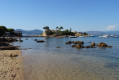
Magnificent views of Plage d’Argent and Ajaccio Bay.
The former Chiavari prison (not open to visitors).
The Chiavari forest.

Reviews and comments

4.4 / 5
Based on 3 reviews

Reliability of the description
4.7 / 5
Ease of following the route
4.7 / 5
Route interest
4 / 5
Linda50
Linda50

Overall rating : 4.3 / 5

Date of your route : Jul 07, 2025
Reliability of the description : ★★★★★ Very good
Ease of following the route : ★★★★★ Very good
Route interest : ★★★☆☆ Average
Very busy route : No

An easy walk, as almost the entire route follows a track. The elevation gain is not significant, as the climbs are gentle but long. There are lovely views throughout the walk. Please note that although the track does go through the forest, there is very little shade.
After the walk, head to the lovely beach that you can see throughout the route.

Machine-translated

Fredcops
Fredcops

Overall rating : 4.7 / 5

Date of your route : May 05, 2025
Reliability of the description : ★★★★★ Very good
Ease of following the route : ★★★★★ Very good
Route interest : ★★★★☆ Good
Very busy route : Yes

A perfect walk for exploring the forest, with lovely views of the sea.
The path was clear and there was no need to get the brush cutter out.

Machine-translated

Lolo K
Lolo K

Overall rating : 4.3 / 5

Date of your route : Aug 31, 2023
Reliability of the description : ★★★★☆ Good
Ease of following the route : ★★★★☆ Good
Route interest : ★★★★★ Very good
Very busy route : No

Some sections were a bit tricky; the vegetation has grown quite a lot.
But otherwise, it was a lovely route and easy to follow.

Machine-translated

Other walks in the area

For more walks, use our search engine .

The GPS track and description are the property of this route's author. Please do not copy them without permission.