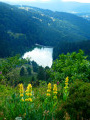
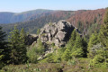
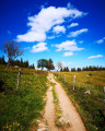
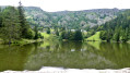
Dreieck, Lac Blanc, Lac du Forlet

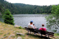
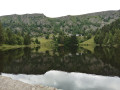
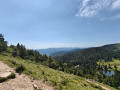
A hike along the ridges of the Hautes-Vosges, taking in both well-known and lesser-known paths. Magnificent views over a glacial valley with impressive rock faces. Stop off at the very welcoming Forlet farm-inn.

Details

n°69241885
Creation:
Last update:
Last review:
  • Walking
    Activity: Walking
  • ↔
    Distance: 8.36 mi
  • ◔
    Average duration: 5h 10 
  • ▲
    Difficulty: Moderate

  • ⚐
    Back to start: Yes
  • ↗
    Ascent: + 1,473 ft
  • ↘
    Descent: - 1,473 ft

  • ▲
    Highest point: 4,285 ft
  • ▼
    Lowest point: 3,133 ft

Description of the walk

Park at the car park known as ‘Dreieck’ on the Route des Crêtes (D61), overlooking Lac Vert. Please note: this is very busy during the high season. It is possible to park at the side of the road.

(S/E) Take the GR®5 path, marked with a Red Rectangle, which heads north towards the Gazon du Faing. Continue along the cliff edge and ignore the path that branches off to the left just before the flat rock perched on the edge of the precipice known as “Taubenklangfelsen”. Keep following the GR®5 until you reach a junction of paths at Gazon du Faing (elevation 1302).

(1) Turn left (north), staying on the ridge and following the GR®5, until you reach a crossroads (elevation 1296).

(2) Leave the GR®5, turn right onto the path leading into the blueberry bushes and follow the red-and-white Red Rectangle and Red Disc markings. Continue the descent, passing beneath Château Hans (a viewpoint on a rock overlooking Lac Blanc) to reach the dam.

(3) Turn right onto the GR®532 (Yellow Rectangle) and, much further on, leave the track to follow a path branching off to the right called the “Sentier Cornélius” to reach Lac Noir.

(4) Walk a few metres to the left along the D48.2. Leave this road at the right-angled bend and turn right onto the uphill path (red and white Red Rectangle and Green Disc). Cross the first track, then take the next one on the left (Red Disc). At the Fork in the road, take the left-hand track until you reach a large crossroads on a plateau.

(5) Continue straight on (Red Disc) and follow a level path through alpine meadows before entering the forest and descending towards the dam at Lac du Forlet (or Lac des Truites). Cross the dam and walk along the lake (Red Triangle) to the Forlet farmhouse inn, which is open from the start of the summer grazing season (food and drink, Munster cheese for sale). After this stop, return to the track, turn right, pass the large rock on the descent and, at the bend in the track, turn left onto a faint path that leads into a small valley. ‘See Practical Information’.

(6) Follow this unmarked path, passing through a gate and leaving the small chalet at the far end on your right, then climb up the valley. The path is often barely visible and damp (watch your step). Climb up the valley and, after passing the wet area, stay at the bottom of the valley as it widens, keeping the Altenwasen Refuge (private). Extraordinary views of the Ringbuhl and its rocky cliff face (chamois may be spotted). After a fairly steep climb, you’ll emerge onto a vast meadow below the refuge. Climb the three steps leading to the terrace in front of the refuge.

(7) Turn left onto the vaguely passable track leading to the refuge and descend a fairly steep slope to the junction with the Yellow Disc trail, near another refuge (Chalet Schoch). Take the path on the right. After a fairly steep climb, you’ll emerge onto a balcony-like meadow. The track remains level and passes by Chalet Erichson (Club Vosgien).

(8) After Chalet Erichson, you’ll come out onto an easier track at a hairpin bend (Red Disc). Follow this track to the right as far as the Dreieck car park (S/E).

Waypoints

  1. S/E : mi 0 - alt. 4,026 ft - Dreieck car park on the Route des Crêtes
  2. 1 : mi 1.57 - alt. 4,272 ft - Gazon du Faing
  3. 2 : mi 2.49 - alt. 4,252 ft - Crossroads at elevation 1296
  4. 3 : mi 3.39 - alt. 3,481 ft - Lac Blanc (massif des Vosges)
  5. 4 : mi 4.94 - alt. 3,133 ft - Lac Noir
  6. 5 : mi 5.79 - alt. 3,688 ft - Crossroads of the four paths
  7. 6 : mi 7 - alt. 3,560 ft - Start of unmarked path
  8. 7 : mi 7.51 - alt. 3,848 ft - Altenwasen Mountain Hut
  9. 8 : mi 7.87 - alt. 3,819 ft - Chalet Erichson
  10. S/E : mi 8.36 - alt. 4,026 ft - Dreieck car park

Notes

Club Vosgien signposting

(1) You can shorten the walk by heading directly to point (4) from point (1), via the Altenkraehkopf, which offers superb views of the Munster Valley, the Alsace plain, the Black Forest and the Bernese Alps in fine weather. To do this, follow the Yellow Triangle markings.
This shortcut takes you to the Forlet farmhouse inn.

Between (2) and (3): The Hans Castle rock is a good spot for a picnic.

(3) Refreshments are available at Lac Noir (refreshment bar) at the Forlet farmhouse inn. At the Altenwasen mountain hut, a drinking water spring feeds a tap located beneath the terrace next to the steps. This spring is tapped behind the hut in an unpolluted area and the water is channelled via a pipe.
Lac Blanc and Lac Noir are two interconnected lakes designed to generate electricity using gravity. Water is pumped into the upper lake during the day and flows back down to power the turbines.

Between (5) and (6), the path between the rock face and the forest is magnificent and little-used, but it crosses a wetland area, so sturdy footwear is recommended.
If you encounter difficulties, there is an alternative route from the bend in the Lac Forlet track: continue for about a hundred metres until you find a path leading uphill to the right, which joins a Yellow Disc-marked trail; follow this to Chalet Erichson.

This route passes through a protected area, which may be subject to special regulations:

Always be cautious and plan ahead when you're outdoors. Visorando and the author of this route cannot be held responsible for any accidents occurring on this route.

The GR® and PR® markings are the intellectual property of the Fédération Française de Randonnée Pédestre.

Reviews and comments

4 / 5
Based on 2 reviews

Reliability of the description
4 / 5
Ease of following the route
4 / 5
Route interest
4 / 5
etienne dziurlikowski

Overall rating : 4 / 5

Date of your route : Sep 26, 2026
Reliability of the description : ★★★★☆ Good
Ease of following the route : ★★★★☆ Good
Route interest : ★★★★☆ Good
Very busy route : Yes

A fairly long walk: nearly 14 km, elevation gain: 560 m
The first section along the ridge is interesting, offering a beautiful panoramic view; on a clear day, you can see as far as the Alps.
The view of Lac Blanc from Hans’s Rock is magnificent.
I would advise against the descent to Lac Blanc, as it is dangerous for people wearing unsuitable footwear or who have poor balance.
An alternative, less dangerous route is available: from the summit of the rock, take the southern path (marked with a Yellow Cross), which leads to the end of Lac Noir, and then follow the ‘Visorando’ route.

Machine-translated

Luc C
Luc C

Overall rating : 4 / 5

Date of your route : May 31, 2025
Reliability of the description : ★★★★☆ Good
Ease of following the route : ★★★★☆ Good
Route interest : ★★★★☆ Good
Very busy route : Yes

A lovely walk to go on if you’re used to challenging hikes, as the descent to Lac Blanc is no walk in the park.

Machine-translated

Other walks in the area

For more walks, use our search engine .

The GPS track and description are the property of this route's author. Please do not copy them without permission.