Three Gorges Adventure Tour

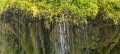
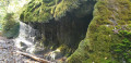
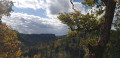
The route takes you along narrow paths through deep gorges, past impressive rock formations. This adventurous walk should only be undertaken in reasonably good weather. The gorges are often dangerous, particularly after heavy rainfall!

Details

n°29291313
Creation:
Last update:
Last review:
  • Walking
    Activity: Walking
  • ↔
    Distance: 5.86 mi
  • ◔
    Average duration: 3h 30 
  • ▲
    Difficulty: Moderate

  • ⚐
    Back to start: Yes
  • ↗
    Ascent: + 912 ft
  • ↘
    Descent: - 919 ft

  • ▲
    Highest point: 2,369 ft
  • ▼
    Lowest point: 1,926 ft

Description of the walk

Start: Drei-Schluchten-Halle car park, Schluchtweg 10, 79843 Löffingen
Parking at the start: Drei-Schluchten-Halle car park
Public transport: Wutachschlucht hiking bus

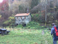
(S/E) The walk starts at the Drei-Schluchten-Halle in Bachheim. There, we can grab a bite to eat at the village kiosk in Bachheim before or after the walk. There are also toilets available at the Drei-Schluchten-Halle.

(1) The path takes us straight down into the gorge.

(2) We then head downstream to the Gauchach estuary. Here we cross the Kanadiersteg, a covered wooden bridge. Along this stretch of the route, we can marvel at the hallmark of the Wutach Gorge: the impressive rock galleries.

We now leave the Freiburg–Lake Constance cross-country trail and head left, walking upstream along the Gauchach towards Burgmühle.

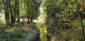
(3) The route takes us through the wild and romantic Gauchach Gorge, past Burgmühle to the Engeschlucht junction.

(4) There, we keep to the left. Even in dry weather, there are a few slippery patches and, time and again, narrow paths along the rocks where taut steel cables provide a handhold. You still need to be careful at these points, though! For less fit walkers, there is therefore a diversion.

(5) The path leads us out of the gorge to the left, up an embankment. We then turn right and follow meadow paths back towards the hiking car park.

(6) We cross Oberburg Road and turn right at the next junction, then take the second left and turn right to return to the hiking car park (S/E)

Waypoints

  1. S/E : mi 0 - alt. 2,365 ft - Drei-Schluchten-Halle, Bachheim
  2. 1 : mi 0.91 - alt. 1,975 ft - Wutach Gorge
  3. 2 : mi 2.11 - alt. 1,926 ft - Gauchach estuary
  4. 3 : mi 3.22 - alt. 2,123 ft - Burgmühle
  5. 4 : mi 3.61 - alt. 2,116 ft - Engeschlucht junction
  6. 5 : mi 4.83 - alt. 2,333 ft - Embankment
  7. 6 : mi 5.06 - alt. 2,359 ft - Oberburg
  8. S/E : mi 5.86 - alt. 2,369 ft

Notes

Equipment:
We recommend sturdy footwear! A sure foot and a head for heights are absolutely essential.

Reviews and comments

5 / 5
Based on 1 review

Reliability of the description
5 / 5
Ease of following the route
5 / 5
Route interest
5 / 5
User 4580850

Overall rating : 5 / 5

Date of your route : Jun 22, 2026
Reliability of the description : ★★★★★ Very good
Ease of following the route : ★★★★★ Very good
Route interest : ★★★★★ Very good
Very busy route : Yes

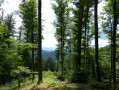
A very well-signposted route that follows watercourses. You’ll cross numerous bridges and walk along a path beside rocky outcrops. There’s dense vegetation and a café/refuge along the way.
The path can be slippery on narrow sections, so I wouldn’t recommend it in wet weather!
We were there during a heatwave; it’s cooler now but damp at times.

Machine-translated

Other walks in the area

For more walks, use our search engine .

The GPS track and description are the property of this route's author. Please do not copy them without permission.