Plan Glacier refuge from Les Houches

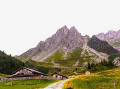
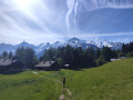
Access to a high-mountain refuge, just as you’d imagine it: nestled against the mountain in a rocky setting, with very few hikers, except between the top of the cable car and the Col de Tricot.

Details

n°68143181
Creation:
Last update:
Last review:
  • Walking
    Activity: Walking
  • ↔
    Distance: 15.05 mi
  • ◔
    Duration according to the author: 8 hrs 
  • ▲
    Difficulty: Very difficult

  • ⚐
    Back to start: Yes
  • ↗
    Ascent: + 7,142 ft
  • ↘
    Descent: - 7,133 ft

  • ▲
    Highest point: 8,871 ft
  • ▼
    Lowest point: 3,261 ft

Description of the walk

Park in the car park at the Bellevue cable car.

(S/E) Turn left towards Le Prarion and walk for about 80 m.

(1) Turn left to head up the Chemin du Bonnet. Follow a few hairpin bends, cross the ski run, and reach Belleface.

(2) Continue left along the road, passing Le Verney. Take the path that follows and carry on until you reach a crossroads.

(3) Turn left onto this path, heading towards Les Grands Bois. Walk past a small chalet, through a clearing (with a stream nearby), and reach a fork in the path.

(4) Carry on to the right, then turn right again about fifty metres further on. The path climbs through the forest to a Fork in the road.

(5) Turn right. The path initially climbs very steeply, then levels off slightly before emerging at the foot of a ski lift.

(6) Turn left down the slope. The well-marked path curves to the left and arrives near the summit of the Bellevue Cable Car (alt. 1,800 m).

(7) Head south-west towards the rack railway line, cross it, then descend the very steep path.

(8) At the bottom, turn left. Follow the track, then the path: there are a few easy, well-maintained sections and two gates before you reach the Alpe de l’Are.

(9) Turn right towards Col de Tricot and follow the path, which is a little uneven as it runs through a moraine. Cross the footbridge over the Torrent de Bionnassay and head up to the right. You’ll come to a fork in the path.

(10) Turn left to head up the Combe des Juments, pass the Chalets de Tricot on your left, and carry on straight towards the Combe de Tricot. Reach the Col de Tricot at an altitude of 2,120 metres.

(11) Turn left, pass under an arch and follow the narrow path. This is at times very narrow, fitted with cables and metal steps, and you’ll need to plan your route carefully.

(12) Pass through the Couloir de la Chèvre, where the path is barely visible, and head to the top of the first moraine.

(13) Turn left, cross the valley towards the other moraine, where the refuge is clearly visible at the top. Make your way to it.

(14) The return journey follows the same path back to the Bellevue cable car car park (S/E).

Waypoints

  1. S/E : mi 0 - alt. 3,264 ft - Bellevue cable car car park
  2. 1 : mi 0.06 - alt. 3,274 ft - Chemin du Bonnet
  3. 2 : mi 0.62 - alt. 3,766 ft - Route to the Col de Voza
  4. 3 : mi 1.27 - alt. 4,308 ft - Chemin du Nais
  5. 4 : mi 1.69 - alt. 4,692 ft - Les Grands Bois
  6. 5 : mi 1.94 - alt. 4,984 ft - Fork in the road, turn right
  7. 6 : mi 2.16 - alt. 5,348 ft - Grands Bois ski lift
  8. 7 : mi 2.67 - alt. 5,896 ft - Bellevue cable car terminus
  9. 8 : mi 2.79 - alt. 5,768 ft - Change of direction
  10. 9 : mi 3.59 - alt. 5,827 ft - Alpe de l’Are
  11. 10 : mi 3.96 - alt. 5,646 ft - Bionnassay footbridge
  12. 11 : mi 5.08 - alt. 6,952 ft - Col du Tricot
  13. 12 : mi 6.53 - alt. 8,009 ft - Couloir de la Chèvre
  14. 13 : mi 7.15 - alt. 8,465 ft - Moraine
  15. 14 : mi 7.52 - alt. 8,855 ft - Plan Glacier refuge
  16. S/E : mi 15.05 - alt. 3,264 ft - Bellevue cable car car park

Notes

As mentioned above, the path is sometimes very narrow: not recommended for those who are prone to vertigo.
This hike should only be undertaken in good weather. The distance and elevation gain are greater: the GPS reading shows an additional 1.3 km and 180 m of elevation gain.
(7) There is a refreshment bar at the top of the Bellevue cable car.

(14) The warden at the Plan Glacier refuge serves drinks and meals: see the refuge’s website.

Worth a visit

Between waypoints (11) and (13), the landscape is magnificent and very rocky; you are in the high mountains.
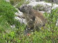
You may spot some ibex.

Reviews and comments

5 / 5
Based on 1 review

Reliability of the description
5 / 5
Ease of following the route
5 / 5
Route interest
5 / 5
Gilcool 1
Gilcool 1

Overall rating : 5 / 5

Date of your route : Aug 07, 2026
Reliability of the description : ★★★★★ Very good
Ease of following the route : ★★★★★ Very good
Route interest : ★★★★★ Very good
Very busy route : No

A very lovely route, which is best shortened by taking the Bellevue cable car both ways – although this does cost around twenty euros. The walk is indeed very long, and the return journey from Bellevue to the foot of the chairlift is of very little interest.

Machine-translated

Other walks in the area

For more walks, use our search engine .

The GPS track and description are the property of this route's author. Please do not copy them without permission.