Explore the Raddon springs at Saint-Bresson

This walk passes close to the headwaters of the Raddon de Saint-Bresson (see Practical Information).
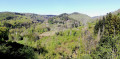
The route takes you through forests, grassy plateaus and valleys in the Saône Vosges, as well as a short stretch along quiet roads.

Details

45986062
Creation:
Last update:
Last review:
  • Walking
    Activity: Walking
  • ↔
    Distance: 5.20 mi
  • ◔
    Average duration: 2h 50 
  • ▲
    Difficulty: Moderate

  • ⚐
    Back to start: Yes
  • ↗
    Ascent: + 463 ft
  • ↘
    Descent: - 476 ft

  • ▲
    Highest point: 2,156 ft
  • ▼
    Lowest point: 1,670 ft

Photos

Description of the walk

Coming from Saint-Bresson, take the Route des Forts and park 2.5 km further on, at the side of the RD136, opposite the ‘Les Jeannery’ sign.

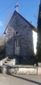
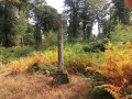
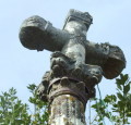
(S/E) Turn into the cul-de-sac and cross the Raddon de Saint-Bresson. You’ll reach the Chapelle des Jeannery at the end on the left.

(1) Follow the road, which turns into a footpath and goes round the last house on the right. Head up into the woods, ignoring the first path on the right. You’ll reach the next junction, where the path crosses a forest track.

(2) Continue along the path opposite, which is rarely used by walkers, and arrive at the edge of a meadow. Head up to the right, off the beaten track into the fir forest, whilst skirting the meadow, and emerge opposite an EDF electricity pole. Follow the power line to the left as it crosses the meadow and joins a main track.

(3) Take this path straight ahead and you’ll reach the hamlet of Béviau. You can refresh yourself at the fountain opposite the house (water not tested), whilst respecting this private property, which is open to hikers.

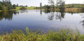
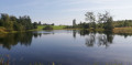
(4) After Béviau, take the path on the left and head for the Étang du Frai. The spring currently listed by IGN is situated 600 m upstream from the pond.

(5) Carry on straight ahead until the next junction, with the meadow on your left. This area can be muddy in wet weather.

(6) Turn left onto the path that runs behind the Auberge de la Montagne. You’ll come out onto the road; continue straight ahead to the crossroads.

(7) Take the road on the right, then turn right again immediately at the next junction.

(8) Turn right towards the Étang de Ladamont, which feeds into a branch of the Raddon-de-Saint-Bresson.

(9) Turn round.

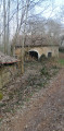
(8) Continue along the road to the right, crossing the stream flowing from the Étang de Ladamont. Carry on along the road to the hamlet of Les Béhauts and reach a farm shed 250 m further on (see note in the practical information).

(10) Turn left. The road quickly turns into a track leading out onto a meadow, after which it disappears. Carry on straight ahead, following the low wall on your right and then, further on, on your left. Climb over the electric fence at the far left end of the meadow. The fifty-metre stretch of path to reach the track below can be challenging as it is overgrown and brambles dominate (avoid wearing shorts).

(11) When you reach the track, turn left and head downhill to the next junction, ignoring a path that branches off to the right.

(12) Take the hairpin bend to the right and reach the road.

(13) Turn left onto it and return to the starting point by following the RD136 (S/E).

Waypoints

  1. S/E : mi 0 - alt. 1,699 ft - RD 136, sign for Les Jeannery. Car park at the start - Raddon de Saint-Bresson (rivière) - Affluent du Rhône par le Breuchin
  2. 1 : mi 0.25 - alt. 1,670 ft - Junction - Chapelle - Les Jeannery
  3. 2 : mi 0.57 - alt. 1,860 ft - Crossroads
  4. 3 : mi 1.09 - alt. 2,080 ft - Crossroads; straight on towards Béviau
  5. 4 : mi 1.3 - alt. 2,067 ft - Junction, towards the Étang du Frai
  6. 5 : mi 1.56 - alt. 2,073 ft - Étang du Frai
  7. 6 : mi 2.02 - alt. 2,136 ft - Junction: take the path on the left
  8. 7 : mi 2.35 - alt. 2,113 ft - Road junction
  9. 8 : mi 2.43 - alt. 2,103 ft - Junction. Return trip to the lake
  10. 9 : mi 2.7 - alt. 2,142 ft - Étang de Ladamont (Saint-Bresson)
  11. 10 : mi 3.84 - alt. 2,041 ft - Farm shed
  12. 11 : mi 4.37 - alt. 1,847 ft - Path on the left
  13. 12 : mi 4.6 - alt. 1,860 ft - Turn right at the junction
  14. 13 : mi 4.91 - alt. 1,683 ft - Turn left onto the RD136
  15. S/E : mi 5.2 - alt. 1,699 ft - RD 136, sign for Les Jeannery. Car park at the start

Notes

The Raddon de Saint-Bresson has its source in the area of the same name. The official source is located by the IGN and the Sandre to the north of Château Grenouille and flows through the Étang du Frai (5). However, on the map of the Canton of Faucogney, drawn up under the auspices of Prefect Hippolyte Dieu and dating from 1858, the source is clearly identified and situated at Mont-du-Tronc, to the north of the Étang de Ladamont.

At (2), for walkers who are wary of straying off the path, it is possible to reach the point (3) by heading up to the right along the forest track.

At (7), you can shorten the walk by taking the small road down towards Les Blondots (closed to heavy goods vehicles), which leads directly back to the starting point.

(8) On the way back, after crossing the stream, you’ll find another small stream crossing the road at the next left-hand bend. It is this stream that is fed by the spring marked on the 1858 map, cited below.

You may be tempted to take one of the paths on the left before the point (10) at Les Béhauts. Please note that these paths are not maintained and are difficult to access.

It will be easier to follow the route with a GPS, as some of the paths have disappeared from the landscape. Avoid wearing shorts and trainers, as there are brambles along the route.

There is a bakery and a bar in the centre of the village of Saint-Bresson.

Worth a visit

The village of Saint-Bresson, with its church, chapel and châlot.
The ‘Mille Étangs’ area.
The Val-d’Ajol and its specialities of smoked meats (andouilles, gandoyau, etc.)

Reviews and comments

3.8 / 5
Based on 4 reviews

Reliability of the description
4 / 5
Ease of following the route
4 / 5
Route interest
3.5 / 5
gazok54
gazok54 ★

Hello, everyone.
Just as an aside , I have some friends we call the dudus ..
Getting back to the hike, Visorando’s route descriptions are specifically designed to compensate for the lack of signposting.
Thank you for choosing and enjoying this hike.

Machine-translated

les bubus
les bubus

Overall rating : 3.3 / 5

Date of your route : Mar 04, 2026
Reliability of the description : ★★★☆☆ Average
Ease of following the route : ★★★☆☆ Average
Route interest : ★★★★☆ Good
Very busy route : No

This route isn't signposted, but if you follow the VISORANDO app, it's no problem

Machine-translated

gazok54
gazok54 ★

Hello User 3772940
You have not used the description, yet you say that the description does not correspond to the route. This surprises me a little, and if you could give me some examples of incorrect information, I would appreciate it.
This route passes by my house, so I will be able to react quickly to adapt the description. Nevertheless, I will check this technical data sheet right away.
Regards

Machine-translated

User 3772940

Overall rating : 1 / 5

Date of your route : Oct 20, 2025
Reliability of the description : Not used / Not applicable
Ease of following the route : Not used / Not applicable
Route interest : ★☆☆☆☆ Very disappointing
Very busy route : No

Hello,

There are no markings on the route and the description of the site does not match the route.
There are far too many inconsistencies.
Kind regards

Machine-translated

gazok54
gazok54 ★

Good evening.
I’ll continue this conversation via private message.

Machine-translated

le saut de bonneille

Hi, I’ve seen your reply
I hope my comment doesn’t cause you any trouble, as the rest of the walk is very good
However, I’ve also done two other walks since Jeannery, which I thought were brilliant
Lovely spots for hiking
Kind regards

Machine-translated

gazok54
gazok54 ★

Hello and thank you, the Bonneille waterfall
It’s true that the pond is nothing out of the ordinary, but as my aim was to introduce people to the Raddon springs, I couldn’t overlook these two small ponds, which are easy to access, unlike the other springs.
See you soon on the trails of Saint-Bresson…

Machine-translated

le saut de bonneille

Overall rating : 4 / 5

Date of your route : Feb 09, 2025
Reliability of the description : ★★★★☆ Good
Ease of following the route : ★★★★☆ Good
Route interest : ★★★★☆ Good
Very busy route : No

A lovely walk with a slight climb at the start, but no problems after that
A peaceful and pleasant path
The only thing is, the walk to the pond isn’t anything special, so you don’t have to do the whole round trip

Machine-translated

gazok54
gazok54 ★

Hello, and thank you, Marc1.xsi, for this very encouraging initial feedback from the field. I’m glad you enjoyed the walk and that, from what I can tell, you didn’t encounter any difficulties.
Enjoy the rest of your walks with Visorando

Machine-translated

Marc1.xsi
Marc1.xsi

Overall rating : 5 / 5

Date of your route : Feb 09, 2025
Reliability of the description : ★★★★★ Very good
Ease of following the route : ★★★★★ Very good
Route interest : ★★★★★ Very good
Very busy route : No

Even without the map, this walk is very enjoyable. There’s a bit of a road to cover, but the views of the forests and mountains make you forget the rest. I’d recommend it – it’s doable even with children, but be careful: the first kilometre is quite steep.

Machine-translated

Other walks in the area

For more walks, use our search engine .

The GPS track and description are the property of this route's author. Please do not copy them without permission.