The Montdahin Monumental Cross via the Petite Forêt

A circular walk starting from Les Jeannery in Saint-Bresson, passing through the Petite Forêt, the Croix du Montdahin and a few lovely ponds.

Details

n°33187160
Creation:
Last update:
Last review:
  • Walking
    Activity: Walking
  • ↔
    Distance: 4.74 mi
  • ◔
    Average duration: 2h 45 
  • ▲
    Difficulty: Easy

  • ⚐
    Back to start: Yes
  • ↗
    Ascent: + 646 ft
  • ↘
    Descent: - 646 ft

  • ▲
    Highest point: 2,087 ft
  • ▼
    Lowest point: 1,470 ft

Photos

Description of the walk

Coming from Raddon-et-Chapendu, drive through the village of Saint-Bresson and park on the right, 2.5 km further on, alongside the D136 at the junction with the Jeannery cul-de-sac. There is space to park several vehicles.

(S/E) Head towards Les Jeannery until you reach the chapel at the end of the cul-de-sac on the left.

(1) Retrace your steps and head down the path on the left, which runs alongside the Raddon stream below. Cross the Raddon and reach a small road.

(2) Turn left until you reach the next junction, then turn left again. Almost immediately, leave the Route des Mottots and head up the stony path on the right. Continue along this path, which overlooks the Route des Mottots on your left, until you reach a small pond and a house by the roadside.

(3) Carry on along the road straight ahead, which climbs slightly, until you reach the start of a track on the left.

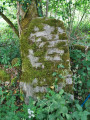
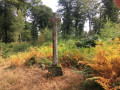
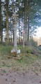
(4) Leave the road and follow the track to the Montdahin Memorial Cross.

(5) Take the road on the left for 600 metres and look out for another path on the left.

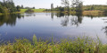
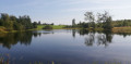
(6) Follow it past the edge of a pond. Continue along it for about 200 metres.

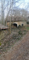
(7) Turn left onto a small, barely visible path leading to the ruins of a convent.

(8) Walk round the ruins and follow the path uphill to reach a lovely track on the Haut Voiney plateau. Continue straight on along the track until you reach the D136. Walk down the road to the left until you reach the starting point (S/E).

Waypoints

  1. S/E : mi 0 - alt. 1,699 ft - D136. Towards the - Chapelle - Les Jeannery
  2. 1 : mi 0.27 - alt. 1,683 ft - Chapelle - Les Jeannery
  3. 2 : mi 0.86 - alt. 1,483 ft - Road, turn left - Raddon de Saint-Bresson (rivière) - Affluent du Rhône par le Breuchin
  4. 3 : mi 1.93 - alt. 1,850 ft - Pond. Turn right
  5. 4 : mi 2.06 - alt. 1,923 ft - Path to the Montdahin Monumental Cross
  6. 5 : mi 2.42 - alt. 2,001 ft - Croix Monumentale du Montdahin (610m)
  7. 6 : mi 2.84 - alt. 2,008 ft - Turn left towards the pond
  8. 7 : mi 3.13 - alt. 2,037 ft - Turn left towards the Convent
  9. 8 : mi 3.35 - alt. 1,946 ft - Le Couvent: head right towards the plateau
  10. S/E : mi 4.74 - alt. 1,699 ft - Car park at the start

Notes

This walk is partially signposted with the Club Vosgien’s ‘Blue Ring’ trail markers.
There are no drinking water points along the route.
There’s no need to bring your fishing tackle, as all the ponds are private.

Worth a visit

The village of Saint-Bresson, with its church, chapel, bakery with its wood-fired oven, and its Chalot.
The spa town of Luxeuil-les-Bains.
The ‘Thousand Ponds’ region.

Reviews and comments

3.8 / 5
Based on 2 reviews

Reliability of the description
3.5 / 5
Ease of following the route
3.5 / 5
Route interest
4.5 / 5
gazok54
gazok54 ★

Hello Sylvieetjeanclaude.
Didn’t you use the instructions? Where exactly did you run into difficulties?

Machine-translated

Sylvieetjeanclaude
Sylvieetjeanclaude

Overall rating : 4.3 / 5

Date of your route : Jan 20, 2025
Reliability of the description : ★★★★☆ Good
Ease of following the route : ★★★★☆ Good
Route interest : ★★★★★ Very good
Very busy route : No

The route wasn’t signposted at all. We had to follow the track with our phones in hand. We had to make our way through some brambles and hang on tight to get back onto the original path.

Machine-translated

le saut de bonneille

Hi, I suppose so – that’s a shame. Thanks for replying.

Machine-translated

gazok54
gazok54 ★

Hello, and thank you for this feedback from the field.
I’ve amended my description based on your comments.
You say you didn’t see the ruins of the convent, yet they are clearly marked at point 8. They’re also shown on the IGN map. You must have passed by too quickly .

Machine-translated

le saut de bonneille

Overall rating : 3.3 / 5

Date of your route : May 14, 2023
Reliability of the description : ★★★☆☆ Average
Ease of following the route : ★★★☆☆ Average
Route interest : ★★★★☆ Good
Very busy route : No

A lovely route, but it’s a shame there are some errors in the description
The path is no longer marked with red and white markings as indicated in the description
At point 2, it says to keep to the right, whereas at the crossroads you need to head down to the left
At point 7, when rejoining the narrow path, take care not to go all the way to the far end of the pond
And we didn’t see any ruins of a convent

Machine-translated

Other walks in the area

For more walks, use our search engine .

The GPS track and description are the property of this route's author. Please do not copy them without permission.