Country:

 City:


Easy parking in the car park at Saint-Grégoire church.
(S/E) Walk past the church, turn left onto Ruelle du Café, then immediately right. At the T-junction, turn left. Further on, at the Fork in the road, take the right-hand path to reach the start of a wide dirt track, about 750 m away.
(1) Leave the road and turn right onto this wide track. Lined with trees, it leads to the tarmac road at the hamlet of Le Bès. Turn left, passing close to the farm. Immediately afterwards, the road gives way once more to a track that winds through the meadows and ends at the Bourrel wayside cross, at the entrance to Caussanel.
(2) Walk past the wayside cross and turn right. Follow this path, which passes two houses on the left. Beyond these, the path becomes grassy and soon narrows into a narrow track, overgrown with tall grass. Keep going. When you reach the road, turn right.
(3) At the junction with the D114, cross the road and continue straight ahead. Pass the access road to Le Peyral and a wooden wayside cross to reach the Puech Merlhou equestrian centre.
(4) In front of the centre’s entrance, go round it to the right. After about 300 m, head south along the path, which curves to the left.
(5) At the junction at the 330-metre mark, carry on straight ahead and head down to the D100.
(6) At the road, move 50 m to the left, cross the road and take the path opposite. Then follow the wide dirt track downwards until you reach the Lézert at the Biel bridge.
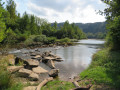
(7) The IGN map is incorrect at this point: cross the bridge and follow the Lézert, which flows below, on your right. You will reach the confluence of the Andouquette and the Lézert.
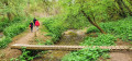
(8) A stone ford makes it easier to cross the Andouquette. The path, which is clearly visible on the ground, moves more or less away from the Lézert before rejoining it slightly further down. Look for an inverted Fork in the road.
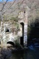
(9) Keep well to the right to reach the bridge and the ruins of the Labastide Vassals Mill.
(10) After the mill ruins, head uphill towards a second inverted Y-junction.
(11) Take a hairpin bend to the right to climb up to the ruins of Labastide Vassals Castle. This path resembles a Roman road.
(12) The ruins, which are currently being restored, are protected; continue climbing. Further up, the road gives way to a wide dirt track winding through the woodland. Keep to the right at every junction. You’ll emerge at a lovely pond.
(13) Walk along the left-hand side of the pond. The path winds its way through the grass before joining the road. Turn right and head towards the Calvary crossroads. Then turn left to return to the church car park (S/E).

 Visorando Member

 Moderate