Explore the forest from the Haguenau riding club

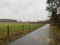
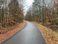
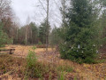
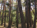
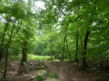
A pleasant walk on the outskirts of Haguenau that will allow you to discover different aspects of the forest, which is charming and changes with each season.

Details

n°18092443
Creation:
Last update:
Last review:
  • Walking
    Activity: Walking
  • ↔
    Distance: 5.60 mi
  • ◔
    Average duration: 2h 35 
  • ▲
    Difficulty: Easy

  • ⚐
    Back to start: Yes
  • ↗
    Ascent: + 20 ft
  • ↘
    Descent: - 20 ft

  • ▲
    Highest point: 499 ft
  • ▼
    Lowest point: 476 ft
  • ⚐ Country: France
  • ⚐ City: Haguenau (67500)
  • ⚑
    Start/End: N 48.81846° / E 7.813899°
  • ❏
    IGN map(s): Ref. 3814ET
  • Hour-by-hour weather

Photos

Description of the walk

Start at the Haguenau riding club, Route de Schirrhein, on the outskirts of Haguenau; there are parking spaces along the road.

(S/E) Take the sandy forest track opposite the riding club, which starts off diagonally for a few metres; continue for about 500 m, then take thethird track on the right and head towards a four-way junction.

(1) Turn left and, 200 m further on, follow the track to the right until you reach the next crossroads.

(2) Turn left, cross over a small stream and take the next track on the right. Continue straight on until you reach thesecond four-way junction at the ‘military ground’ sign. Turn left and join the Route de Soufflenheim (D 1063).

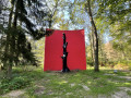
(3) Cross the road and take the track opposite. Carry on straight ahead, passing through a birch forest that is mysterious in winter and refreshing in spring. Cross the Route de Krummstein, then continue for about 300 metres until you reach the path marked with a Red Cross.

(4) Turn sharply left, following the Red Cross markings, and join the tarmac road.

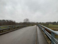
(5) Follow it to the right, cross the bridge over the D1063 (Haguenau bypass) and turn left at the next junction to reach the sawmill on Route de Soufflenheim.

(6) Continue to the right towards the entrance to Haguenau, then turn left onto Rue des Fougères, then left again onto Rue de la Loutre.

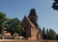
(7) Carry on to the right along Rue de la Taupe, continue along Rue du Gui and turn left onto Rue de l’Église Saint-Joseph. At the end of the road, turn left onto Route de Schirrhein and head for the riding club (S/E).


Waypoints

  1. S/E : mi 0 - alt. 479 ft - Equestrian club
  2. 1 : mi 0.59 - alt. 479 ft - Four-way junction; turn left
  3. 2 : mi 0.99 - alt. 479 ft - Junction: turn left
  4. 3 : mi 1.99 - alt. 486 ft - Route de Soufflenheim, straight ahead
  5. 4 : mi 2.81 - alt. 492 ft - Path on the left
  6. 5 : mi 3.17 - alt. 495 ft - Tarmac road, on the right
  7. 6 : mi 4.62 - alt. 495 ft - Sawmill, on the left
  8. 7 : mi 5.1 - alt. 482 ft - Rue de la Taupe, on the right
  9. S/E : mi 5.6 - alt. 479 ft - Arrival at the riding club

Notes

From (S/E) to (1), the path is very sandy, typical of the region.

From (1) to (2), the vegetation is quite different from the first section; it’s relatively muddy in wet weather, but you can easily avoid the puddles on the path.

This walk is very easy to follow using the app’s GPS, so that’s how I’d advise you to follow it.
The section through the forest is sometimes used as a hunting ground during the open season.

Reviews and comments

3.8 / 5
Based on 2 reviews

Reliability of the description
4 / 5
Ease of following the route
3.5 / 5
Route interest
4 / 5
User 28602804

Overall rating : 4 / 5

Date of your route : Mar 31, 2026
Reliability of the description : ★★★★☆ Good
Ease of following the route : ★★★☆☆ Average
Route interest : ★★★★★ Very good
Very busy route : Yes

A lovely route, but the description between points (2) and (3) is incomplete. At the sign for the military base, turn left as indicated, then take the last path on the right before the D1063, and then a path on the left before crossing the main road.

Machine-translated

Vava67500
Vava67500

Overall rating : 3.7 / 5

Date of your route : May 17, 2025
Reliability of the description : ★★★★☆ Good
Ease of following the route : ★★★★☆ Good
Route interest : ★★★☆☆ Average
Very busy route : No

The route is very sandy at the start, making it difficult to cycle on.
The end of the route is disappointing; once out of the forest, you wind your way through the neighbourhoods of Haguenau (Sew Usocome)

Machine-translated

Other walks in the area

For more walks, use our search engine .

The GPS track and description are the property of this route's author. Please do not copy them without permission.