In the Haguenau Forest, from Hundshof to Forlenweg

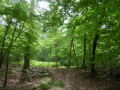
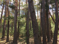
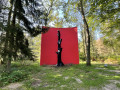
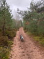
This is the largest undivided forest in France. It boasts the diversity of an ‘exception’ forest – a label awarded by the ONF to around fifteen forests in France – with a varied flora. It is teeming with mushrooms in season.
There is a small nature reserve along this route.

Details

2918259
Creation:
Last update:
Last review:
  • Walking
    Activity: Walking
  • ↔
    Distance: 9.85 mi
  • ◔
    Average duration: 4h 40 
  • ▲
    Difficulty: Moderate

  • ⚐
    Back to start: Yes
  • ↗
    Ascent: + 128 ft
  • ↘
    Descent: - 125 ft

  • ▲
    Highest point: 627 ft
  • ▼
    Lowest point: 499 ft
  • ⚐ Country: France
  • ⚐ City: Haguenau (67500)
  • ⚑
    Start/End: N 48.838585° / E 7.780023°
  • ❏
    IGN map(s): Ref. 3814ET
  • Hour-by-hour weather

Photos

Description of the walk

Access to the start: From Haguenau, take the D27 towards Morsbronn-les-Bains and Woerth. After crossing the D1063, then the railway line, turn left immediately at the forester’s lodge. Park at the end of the street next to the Hundshof wash house.

Marked with Yellow Discs throughout the route.
Map of the foresttrails (with plot numbers) (Haguenau Tourist Office)

(S/E) From the wash house, take the path towards Eschbach (marked with a Blue Ring). Turn right at the next junction.

(1) Turn left between plots 1061 and 1081.

(2) Take thesecond path on the right between plots 1082 and 1083.

(3) Turn left onto the track between plots 1143 and 1168.

(4) Take the next track on the right.

(5) Then take the next one on the right again.

(6) Turn left onto the next track.

(7) Turn left at the next track (sign for plot 1190 on the right).

(8) Turn right when you reach the road (forest ranger’s house opposite).

(9) Turn left onto Rue des Roses.

(10) Turn left at the end of the street onto Rue de la Forêt. Walk past the football pitch and carry on straight ahead until you reach the forest.

(11) Take the path on the left. Turn right when you reach the track, then turn right onto Route Forestière de Metzeleck.

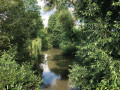
(12) Turn left onto a barely visible path, then take the left-hand fork. You’ll come to a stream flowing through a hollow. Cross the bridge. The markers on either side of the ditch are difficult to see, especially when the trees are in leaf. Continue straight on and cross two paths.

(13) Turn left at the end of plot 1123, then take the next path on the right.

(14) Take the next, barely visible path on the left. Cross a stream over a makeshift bridge. Continue along a barely visible path veering slightly to the right. Cross the Eschbach road and continue along the path opposite.

(15) Take an old path on the right, lined with trees. Cross a small nature reserve dotted with pools and streams. Turn left at the next path.

(16) At the next junction, take the path opposite, passing through plots 1064, 1063, 1032 and 1061. Continue along this path until you reach the path running between plots 1061 and 106,

(2) Turn right.

(1) Turn right onto the path, then left onto the path leading to the wash house and the car park (S/E).

Waypoints

  1. S/E : mi 0 - alt. 499 ft - Car park at the Hundshof wash house.
  2. 1 : mi 0.72 - alt. 541 ft - Take the path on the left.
  3. 2 : mi 1.18 - alt. 551 ft - Path on the right.
  4. 3 : mi 2.44 - alt. 548 ft - Take the path on the left.
  5. 4 : mi 2.66 - alt. 554 ft - Path on the right.
  6. 5 : mi 3.03 - alt. 551 ft - Path on the right.
  7. 6 : mi 3.21 - alt. 548 ft - Take the path on the left.
  8. 7 : mi 3.49 - alt. 558 ft - Take the path on the left.
  9. 8 : mi 3.9 - alt. 561 ft - Former Esbach forest keeper’s house.
  10. 9 : mi 4.39 - alt. 594 ft - Rue des Roses;
  11. 10 : mi 4.81 - alt. 620 ft - Turn left at the fork.
  12. 11 : mi 5.24 - alt. 564 ft - Path on the left.
  13. 12 : mi 5.74 - alt. 561 ft - Turn left at the fork.
  14. 13 : mi 6.58 - alt. 577 ft - Take the path on the left.
  15. 14 : mi 6.97 - alt. 554 ft - Turn left at the fork.
  16. 15 : mi 7.59 - alt. 554 ft - Tree-lined path on the right.
  17. 16 : mi 8.16 - alt. 531 ft - Path opposite.
  18. S/E : mi 9.85 - alt. 502 ft - Car park at the Hundshof wash house.

Notes

To find your way around the Haguenau Forest, it is a good idea to obtain a map from the Haguenau Tourist Office, on Place de la Gare, showing the plot numbers displayed at the crossroads. These are not shown on the IGN map. It is best to follow the GPX track.

Some paths can be very muddy.
There are no water points along the route.
Shelter is available under the canopy at the Eschbach football pitch.
(7) Picnic area at the entrance to the forest after Eschbach.

Reviews and comments

4.1 / 5
Based on 4 reviews

Reliability of the description
4.5 / 5
Ease of following the route
4 / 5
Route interest
3.8 / 5
richard-jean-marie
richard-jean-marie

Overall rating : 3.7 / 5

Date of your route : Nov 21, 2022
Reliability of the description : ★★★★☆ Good
Ease of following the route : ★★★★☆ Good
Route interest : ★★★☆☆ Average
Very busy route : No

An easy hike in fair weather; the Visorando GPS was very useful to us,

however, we didn’t find the nature reserve section particularly interesting

Machine-translated

HENRY Florence
HENRY Florence

Overall rating : 4.7 / 5

Date of your route : Jul 29, 2020
Reliability of the description : ★★★★★ Very good
Ease of following the route : ★★★★☆ Good
Route interest : ★★★★★ Very good
Very busy route : No

A lovely walk that showcases the diversity and richness of the Haguenau Forest

Machine-translated

henri57
henri57 ★

Hello,

Thank you for your comment.

As regards signposting, neither Visorando nor the authors are responsible for it. It is often included in the descriptions when present on the ground, but it may disappear, so you should rely on the description and the map instead.

The “Route on map” feature is not intended to assess the signposting, but rather to check that the route as shown on the map matches the actual terrain.
Happy walking

See you soon

Machine-translated

goettle
goettle

Overall rating : 3.3 / 5

Date of your route : Jun 21, 2020
Reliability of the description : ★★★★☆ Good
Ease of following the route : ★★★☆☆ Average
Route interest : ★★★☆☆ Average
Very busy route : No

There are a few missing road signs along the route++

Machine-translated

Other walks in the area

For more walks, use our search engine .

The GPS track and description are the property of this route's author. Please do not copy them without permission.