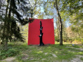
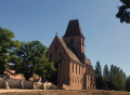
In the forest west of Haguenau

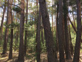
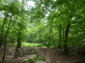
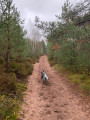
A very pleasant walk set in the woods to the west of Haguenau. The sandy ground makes it suitable for all weather conditions. In summer, most of the route is shaded. It is suitable for Nordic walking, running or even mountain biking.

Details

n°28868148
Creation:
Last update:
Last review:
  • Walking
    Activity: Walking
  • ↔
    Distance: 5.60 mi
  • ◔
    Average duration: 2h 35 
  • ▲
    Difficulty: Easy

  • ⚐
    Back to start: Yes
  • ↗
    Ascent: + 39 ft
  • ↘
    Descent: - 39 ft

  • ▲
    Highest point: 558 ft
  • ▼
    Lowest point: 502 ft
  • ⚐ Country: France
  • ⚐ City: Haguenau (67500)
  • ⚑
    Start/End: N 48.809101° / E 7.768786°
  • Accessible from the train station Gare de SCHWEIGHOUSE EG. PROTESTANTE.
  • ❏
    IGN map(s): Ref. 3715ET, 3814ET, 3815E
  • Hour-by-hour weather

Description of the walk

The start and finish are located at the car park at the edge of the forest entrance, opposite 22 Chemin des Friches in Haguenau.

(S/E) From the car park, with your back to the road, ignore the track slanting off to the left (the return route); take the track on the right, heading west, which runs alongside the field and then enters the forest, leading to the fence just before the D1063 (the four-lane Haguenau Western Bypass). Turn left and follow the uphill path to the wildlife footbridge.

(1) Cross the footbridge and turn right. Take the track that descends alongside the D1063. When you reach the high-voltage power lines, take the track on the left at the bottom of the descent and follow it through the woodland, staying on the main track (on the right). You’ll arrive at a crossroads where there is a small wooden bench.

(2) Continue to the right towards the cemetery.

(3) Walk past the cemetery and enter the residential area by taking the tarmac road (Rue des Menuisiers). Walk alongside the blocks of flats until you reach the electricity substation (large concrete block).

(4) Take the small path on the left and follow it to the D85 road near the Peugeot garage/Total petrol station.

(5) Cross the D85 carefully and turn left onto the path leading up into the forest. After about 200 m, turn 90° to the right and stay on the main track straight ahead until you reach the junction with a wide path. Take this path on the right and follow it straight on until you reach a wide right-hand bend, just after which you’ll find a junction of tracks. Head up to the left to reach the start of the fitness trail.

(6) Set off on the route, passing a community beehive. After about 150 m, you’ll reach a junction.

(7) At the three-way junction, continue uphill on the track to the right until you reach the next junction of tracks.

(8) Turn right, then immediately left onto the track suitable for vehicles. At the next junction, turn left, then quickly take thefirst right and follow the path straight on to reach a track junction (located about fifty metres from the microlight airfield).

(9) Turn left twice and follow the sports route tothe second junction. Turn right towards the east and walk straight on until you reach the D85. Cross the D85 with care and continue along the track opposite, keeping in the same direction for about 400 m.

(10) Turn right at the second track, pass under the high-voltage power lines and continue to the four-lane road (D1063). Turn left and follow the four-lane road to the wildlife footbridge. Cross the footbridge used on the way there.

(1) Turn left, then immediately turn right and continue straight on through the forest towards the east. Keep going in the same direction until you reach the Chemin des Friches, then turn left into the car park (S/E).

Waypoints

  1. S/E : mi 0 - alt. 518 ft - Chemin des Friches car park – Haguenau
  2. 1 : mi 0.81 - alt. 545 ft - Wildlife crossing
  3. 2 : mi 1.44 - alt. 509 ft - Small wooden bench
  4. 3 : mi 1.66 - alt. 502 ft - Cemetery
  5. 4 : mi 1.71 - alt. 502 ft - Concrete electricity transformer
  6. 5 : mi 1.89 - alt. 505 ft - Total petrol station
  7. 6 : mi 2.57 - alt. 512 ft - Start of the fitness route
  8. 7 : mi 2.66 - alt. 531 ft - Three-way junction
  9. 8 : mi 2.86 - alt. 551 ft - Vehicle-accessible track
  10. 9 : mi 3.27 - alt. 551 ft - Junction next to the microlight club
  11. 10 : mi 4.16 - alt. 545 ft - Junction in the woods
  12. S/E : mi 5.6 - alt. 518 ft - Chemin des Friches car park

Reviews and comments

3.4 / 5
Based on 3 reviews

Reliability of the description
3.3 / 5
Ease of following the route
3.7 / 5
Route interest
3.3 / 5
akrieger
akrieger
• Edited:

Overall rating : 2.3 / 5

Date of your route : Mar 31, 2025
Reliability of the description : ★★☆☆☆ Disappointing
Ease of following the route : ★★★☆☆ Average
Route interest : ★★☆☆☆ Disappointing
Very busy route : No

The route runs alongside the D1063 far too often (once on the way there, once on the way back); the sight and sound of the cars are not at all pleasant. The route description isn’t very clear at junctions; luckily, I’d downloaded the app onto my phone, so I was able to correct my route. Basically, we follow the fitness trail for much of the walk. It’s a walk suitable for children, but it isn’t particularly interesting for hikers.

Machine-translated

bvetel
bvetel

Overall rating : 4 / 5

Date of your route : Jun 19, 2023
Reliability of the description : ★★★★☆ Good
Ease of following the route : ★★★★☆ Good
Route interest : ★★★★☆ Good
Very busy route : No

It’s all well and good, but it’s no match for the mountains

Machine-translated

Elektro
Elektro

Overall rating : 4 / 5

Date of your route : Feb 09, 2023
Reliability of the description : ★★★★☆ Good
Ease of following the route : ★★★★☆ Good
Route interest : ★★★★☆ Good
Very busy route : No

All clear

Machine-translated

Other walks in the area

For more walks, use our search engine .

The GPS track and description are the property of this route's author. Please do not copy them without permission.