From Vaucresson to Chaville through the Fausses Reposes Forest

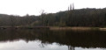
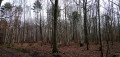
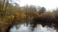
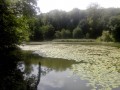
A walk from station to station, mainly through the pleasant Fausses Reposes State Forest. The Ville-d’Avray ponds, home to numerous birds, offer a lovely break halfway along the route.

This walk is part of a multi-day hike: Through the forests of western Paris

Details

68385419
Creation:
Last update:
Last review:
  • Walking
    Activity: Walking
  • ↔
    Distance: 6.14 mi
  • ◔
    Average duration: 3h 05 
  • ▲
    Difficulty: Moderate

  • ⚐
    Back to start: No
  • ↗
    Ascent: + 279 ft
  • ↘
    Descent: - 358 ft

  • ▲
    Highest point: 577 ft
  • ▼
    Lowest point: 367 ft
  • ⚐ Country: France
  • ⚐ City: Vaucresson (92420)
  • ⚑
    Start: N 48.836903° / E 2.15234°
  • ⚑
    End: N 48.812086° / E 2.187852°
  • ❏
    IGN map(s): Ref. 2214ET, 2314OT
  • Hour-by-hour weather

Photos

Description of the walk

Starting point and access: Vaucresson station.
- Transilien – Line L, on the section between Paris-Saint-Lazare and Saint-Nom-la-Bretèche.
Take the Place Charles de Gaulle exit on platform A, the platform for trains travelling from Saint-Nom to Paris (if arriving from the opposite direction on platform B, use the underpass).

Red and white + yellow markings

(S) With your back to the station, turn right and take Rue Allouard. When the street bends left, carry straight on into a narrow lane. At the end, climb a flight of steps and, on the landing, take the stairs on the left. Cross the D182 at the pedestrian crossing, then follow Avenue des Terrasses on the other side and head uphill (with lovely houses on either side).

Red and white markings

(1) At No. 12, carry on straight ahead (ignore a yellow arrow directing you down a flight of steps on the left). At the end of the street, turn right onto Avenue du Bois. At the end, turn left. At the traffic lights, cross a motorway slip road in two stages, then take the bridge over the A13. Then cross the other motorway slip road in two stages.

(2) Immediately turn left onto a path between two fences, with the motorway on your left and a golf course on your right. At the corner of the second fence, turn right and follow a ditch on your left. On your right, follow the golf course fence until you reach its end. Then carry on straight ahead, due east, and ignore all turn-offs on the left.

Yellow markings

(3) At the Carrefour des Ormes (plot no. 40), turn right onto a well-maintained, compacted track.

No markings

At the next junction (Carrefour du Haras), turn left. At the end of the track, go through a forest gate, turn right and follow the property wall on your left. Then take the first track on the right (forest gate).

Yellow markings

(4) At the crossroads (plot no. 50), take the second left, i.e. the stabilised track taken previously. At the next junction, turn right and follow thePR®4(twoPR® trails split here). At the next junction, go straight on. Pass through a forest gate, leave a small car park on your right and come out onto a road.

Markings: Green Owl on a white background

(5) Cross the road, take the path opposite and walk alongside a small car park on your right. Immediately ignore a path leading down to the left and continue on level ground along a small gravel track. At the first junction, go straight on. At the next junction (plots nos. 77 and 73), go straight on again (ignore a yellow arrow indicating a left turn). At the Fork in the road shortly afterwards, keep left. Stay on the signposted path until you reach a roundabout on the right (pass the roundabout a short distance away; ignore the paths leading to it).

Red and yellow markings

(6) Then take a path on the left that leads downhill.

Yellow markings (rare)

At the first junction (plot no. 79), follow thePR®48to the left. At the junction between plots no. 74 and no. 78, and at the junction between plots no. 74 and no. 75, go straight on (east).

No markings

(7) At the junction on the corner of plot no. 71, turn right. Pass through a forest gate at the foot of a building.

Yellow signposting

Cross the D985 at the pedestrian crossing and continue straight ahead along Route de Jardy. Pass through a forest gate and continue along a path. Carry on straight ahead until you reach a large junction.

Red and yellow + yellow markings

(8) Take the second left, between plot no. 93 (on the left) and no. 112 (on the right). Note a pond on the right.

Red and yellow markings

At the first junction (plot no. 93), turn left and head gently uphill. At the next junction, go straight on and follow a birch copse on your right. At the following junction, continue straight on and ignore a path branching off to the left.

(9) At the junction, turn left and head down a gentle slope. At the junction at the bottom, turn right.

(10) Take the first path on the left and walk alongside the first pond on your right. Cross a stream, turn right and continue alongside the pond. At the end, turn right and take the embankment separating the two ponds. On the other side, take the first path on the left and walk alongside the second pond on your left. Shortly before the end of the pond, climb a path on the right (the path is closed due to works until June 2025). You’ll come out onto a wide path; follow it to the left and you’ll immediately reach a crossroads.

Red and white + yellow markings

(11) Then turn right, go through a forest gate and head uphill. At the junction at the top, go straight on. At the next junction, go straight on again (pass a yellow marker on your left).

Yellow markings

(12) At the next crossroads (plot no. 133), take the second path on the right. At the next junction (plot no. 131), continue straight on (west).

Horseshoe markings

(13) At the crossroads, turn sharply left and head down a fairly steep slope. At the next junction, take the wide path on the left, heading due east. Head slightly uphill until you reach a crossroads.

Red and white + yellow markings

(14) Then veer right, heading slightly downhill. At the end of the path, cross Rue du Coteau and follow Rue Carnot against the flow of traffic. You will soon come to Chaville Rive Droite station on your left (E).

To get back home:
- Transilien – Line L, towards La Défense and Paris-Saint-Lazare or Versailles Rive Droite.
- Transilien – Line U, towards La Défense or Versailles-Chantiers and La Verrière.

Waypoints

  1. S : mi 0 - alt. 466 ft - Gare de Vaucresson
  2. 1 : mi 0.32 - alt. 535 ft - Junction – Avenue des Terrasses
  3. 2 : mi 0.57 - alt. 574 ft - Start of the trail
  4. 3 : mi 1.18 - alt. 545 ft - Carrefour des Ormes
  5. 4 : mi 1.78 - alt. 561 ft - Crossroads
  6. 5 : mi 2.12 - alt. 568 ft - Carrefour de l'Étoile Royale
  7. 6 : mi 2.86 - alt. 574 ft - Carrefour de la Porte Verte
  8. 7 : mi 3.48 - alt. 440 ft - Junction
  9. 8 : mi 3.85 - alt. 446 ft - Carrefour des Bassins
  10. 9 : mi 4.22 - alt. 512 ft - Junction
  11. 10 : mi 4.51 - alt. 400 ft - Junction - Étangs de Ville-d'Avray
  12. 11 : mi 4.97 - alt. 397 ft - Crossroads - Étangs de Ville-d'Avray
  13. 12 : mi 5.33 - alt. 502 ft - Carrefour de la Barrière Neuve
  14. 13 : mi 5.62 - alt. 495 ft - Carrefour des Relais
  15. 14 : mi 5.98 - alt. 413 ft - Crossroads
  16. E : mi 6.14 - alt. 371 ft - Gare de Chaville Rive Droite

Notes

Train timetables: see the Transilien website.

For motorists
Park in the car park at Vaucresson station. Once in Chaville, take a train towards Paris Saint-Lazare (line L) or La Défense (line U). Get off two stops later, at Saint-Cloud. Then take a train towards Saint-Nom-la-Bretèche (line L) and get off two stops later, at Vaucresson.

Hiking boots are recommended. In wet weather, there are muddy sections between (2) and (3).

No water points identified along the route. Bar-restaurant near Vaucresson station (S/E).

A detailed map is useful (at the very least, the one accompanying this description).

Warning
Walkers should be aware that, on the section near the A13 motorway, around the point (2), the heavy traffic in the area is certainly audible.

Walk undertaken by the author on 12 January 2025.

Worth a visit

A pleasant walk through the Fausses Reposes Forest.

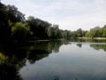
Ville d’Avray ponds, between (10) and (11).

Always be cautious and plan ahead when you're outdoors. Visorando and the author of this route cannot be held responsible for any accidents occurring on this route.

The GR® and PR® markings are the intellectual property of the Fédération Française de Randonnée Pédestre.

Reviews and comments

4.6 / 5
Based on 3 reviews

Reliability of the description
4.7 / 5
Ease of following the route
5 / 5
Route interest
4 / 5
Françoise. L
Françoise. L

Overall rating : 4.7 / 5

Date of your route : Jan 21, 2026
Reliability of the description : ★★★★☆ Good
Ease of following the route : ★★★★★ Very good
Route interest : ★★★★★ Very good
Very busy route : No

A pleasant, varied route through a forest that I already know quite well and really enjoy. I got lost between points 6 and 7. I turned right too soon, thinking I was at point 7, as plot no. 71 already appears at the crossroads before the crossroads at point 7. I must have been distracted.
The ponds have been "roughly" cleaned up. Before, they were largely covered with reeds or similar vegetation. Lots of small shrubs have been cut down... In my opinion, for the wildlife and birds... it can't be great! But thank you for this lovely walk.

Machine-translated

1950bba
1950bba

Overall rating : 4.3 / 5

Date of your route : Mar 24, 2025
Reliability of the description : ★★★★★ Very good
Ease of following the route : ★★★★★ Very good
Route interest : ★★★☆☆ Average
Very busy route : No

An easy and pleasant walk (especially in summer, I imagine).
Best avoided after it’s rained.

Machine-translated

cylcuz
cylcuz

Overall rating : 4.7 / 5

Date of your route : Feb 07, 2025
Reliability of the description : ★★★★★ Very good
Ease of following the route : ★★★★★ Very good
Route interest : ★★★★☆ Good
Very busy route : No

I followed the route from 1 to 14 (which is not something I usually do). The directions are just right – neither too long nor too short. I hesitated a bit at point 6 trying to find the path between plots 74 and 75; I carried on straight ahead instead of turning. It wasn’t really a problem, though, as at the next junction you can see the gate at the foot of the building given as a landmark.
I did this walk in early February 2025; the ground was quite muddy, especially on the narrow path that skirts the golf course at the start – I had to hold onto the fence to keep my feet dry as I walked alongside it. Further on, I had to veer off into the undergrowth to avoid the puddles and muddy ruts.
Overall, the walk is interesting and makes good use of this fairly small woodland, with a zigzagging route. I couldn’t have done it better myself! It’s a shame it’s cut through by several roads, and the traffic noise disturbs the tranquillity of the place.
Highlight: the Marnes-la-Coquette ponds area. Marnes Park looks interesting; I wonder if it’s open to the public.
The forest is fairly quiet on a Monday in February; it must be much busier at the weekend during the warmer months.

Machine-translated

Other walks in the area

For more walks, use our search engine .

The GPS track and description are the property of this route's author. Please do not copy them without permission.