Country:

 City:




No signposting
(S) Leave the Port Sable campsite and head right onto the Chemin de Toulassais. Turn left onto the one-way Chemin de Bel Air and continue until you reach the Chemin du Petit Mousse, where you’ll find yourself facing Quiberon Bay on theGR® 34.
Red and white signposting forthe GR®34
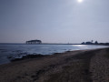
(1) Head right to follow the coastline. Pass Port Navalo Beach, which faces the ocean and acts as a sentinel at the entrance to the Gulf of Morbihan. Once past the lifeguard station, continue along the Chemin de la Corniche. Carry on until you reach the viewpoint.
(2) Carry on along the Chemin de la Corniche. You can see the Port Navalo Lighthouse on your right. Walk on to the jetty.
(3) Turn right (south-east) onto Rue du Général de Gaulle, driving against the one-way flow. Continue along this street until you reach the restaurant La Grande Cale.
(4) Turn left onto Rue de l’Armor, going against the one-way flow. At the junction, carry straight on along Rue de la Douane and continue to the south-western end of Port-Lenn Beach.
(5) Turn left onto Boulevard de Bilgroix to follow the coastline along Port-Lenn Beach and round the bay of Port-Navalo. Continue to House No. 35, located just before the junction.
No signposting
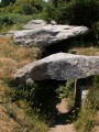
(6) At the barrier, temporarily leave theGR®34signposting to take the coastal path on the left and continue to the Bilgroix Dolmen; then, turning left, carry on to Pointe de Bilgroix, where you can admire the Statue of Saint Anne.
(7) From the headland, retrace your steps back to the Bilgroix Dolmen. Carry on straight ahead along Boulevard de Bilgroix until you reach the small house at No. 2, with blue shutters.
Red and white markings forthe GR®34
(8) Turn left (north-north-west) onto Rue du Dolmen. At the Fork in the road, keep right onto Rue du Dolmen and carry on to the first junction. Turn left (west) to reach Tréno Beach.
(9) Follow the path, which now heads north-east, running alongside Tréno Beach. At the far end of the beach, head up to the right to find Rue du Port Douar, then walk a few metres until the road widens. On the left is a small gate marking the entrance to the coastal path.
(10) Follow the coastal path to reach Pointe du Monténo, which overlooks the confluence of the gulf and the River Auray – a marine landscape of superb grandeur. Walk round the headland and continue on to Plage des Fontaines.
(11) Walk along the beach and carry on to Pointe de Penbert, where the view stretches out over Île Longue, the nearest island to the north, as well as the islands of Er Lannic and Gavrinis.
(12) Head south and continue along the coast until you reach the junction with Rue de la Palisse.
(13) Turn left (north-east) and carry on along Rue de la Palisse. Continue along the coast to Pointe de la Palisse.
(14) Follow the path that hugs the coastline closely before reaching Pointe de Kerners, where you can see the nearby islands of Île-aux-Moines, Creïzic, Berder, Île de la Jument and Hent Tenn.
(15) Carry on along Anse de Kerners. Walk past the Bilouris campsite before skirting the village of Kerners on your right. Carry on until you reach a wooden footbridge at the junction with Rue de la Vierge at the far end of Kerners Beach. (Feel free to take a detour via Rue des Vierges to explore the hamlet’s beautiful traditional houses).
(16) Walk along Kermers Beach and Anse de Kemers to reach Pointe de Saint-Nicolas.
(17) Continue south to the Pen Castel sea wall. Cross the structure to reach the Moulin de Pen-Castel, a splendid medieval tide mill. After visiting the site, continue for a few hundred metres to return to the car park and your car (E).
 Visorando Member

 Easy