Country:
 City:
City:


Park at the car park by Pornic railway station.
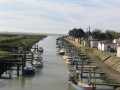
(S) Start the walk heading west towards the old harbour. Walk along the southern side of the harbour and carry on straight ahead, following the harbour and the Anse aux Lapins.
(1) You’ll leave Anse aux Lapins behind. Take the small path on the right that runs alongside the road, then carry on straight ahead along the seafront. Pass the Pointe de Gourmalon. Continue along the coastal path to reach Plage de la Source.
(2) You can either walk along the beach or go through the thalassotherapy centre, then rejoin the coastal path 100 metres further on. Continue along the path that runs alongside the sea towards La Joselière beach.
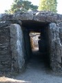
(3) On your left, you can see the Joselière burial mound. Carry on straight ahead along the path that runs alongside the sea towards the Fontaine aux Bretons. At Plage aux Bretons, carry on straight ahead towards Plage de la Boutinardière.
(4) Turn left onto the Chemin des Versannes for 40 metres, then turn right. Head towards the Crève-Cœur housing estate. Continue straight on for 200 metres, then turn right for 30 metres, then left for 60 metres. Head to the right to reach the seafront. Stay on the coastal path.
(5) A landslide on the cliff means we have to take the inland route (at low tide in good weather, it is possible to walk along the coast). Turn left onto Rue du Docteur Richelot for 200 m, then turn right onto Route de Pornic. After 200 m, turn right into the park. Leave the park via Avenue Edgar Maxence, then turn right to rejoin Route de Pornic for 200 m. Turn right onto Rue du Gagne Petit, then at the end of the street, continue straight on along the small path.
(6) Leave theGR®8and turn right into the narrow lane flanked by two walls, which leads down to the large Plage de la Bernerie. Follow the beach and go round the reservoir on either the right or the left.
(7) You can usually continue along the beach, but at spring tides and at high tide, you’ll have to go through the town. In this case, take Rue du Château d’eau, then turn right onto Rue des Carrés, then go straight on along Avenue du Docteur Marmottan, turn right onto Passage des Rosiers, left onto Avenue des Quatre Jumelles, then right to rejoin the coastal path.
(8) Follow the coastal path straight on to Plage du Pré Vincent in Les Moutiers-en-Retz, then continue straight on for 6 km to the entrance to Port du Collet, a small pass.
(9) In spring and summer, you can watch the birds in the marshes from the observation point.
(10) Turn left towards Port du Collet. The car park is 300 metres away. I’d recommend walking a further 300 metres to enjoy a view of Port du Collet from the footbridge spanning the River Le Falleron (E).

 Visorando Member
 Easy
Easy