Country:
 City:
City:


Car park at the Lakas Public Gardens.
Yellow signposting
(S/E) At the far end of the car park, turn left onto the Chemin des Lakas, then follow the Rue de l’Église. At the roundabout by the town hall, turn right onto the Rue des Ajoncs and follow this road out of La-Plaine-sur-Mer. Pass the ‘Partageons la route’ sign and you’ll arrive at a place called La Fendoire.
Off the marked route
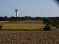
(1) Turn right onto the wide, carriageable track, Chemin du Héqueux. Continue straight on along this track for about 1 km; it turns to a gravel surface just before a property marked by an American flag. You’ll reach a road (with a view, on the right, of the water tower, which will serve as our landmark throughout this route).
Yellow signposting
(2) Cross the road and take the grassy path opposite, Chemin de la Maison Briand, and follow it to the next road.
(3) Follow this road to the left, passing a caravan winter storage shed on the left, and begin the descent towards the large ‘La Tabardière’ campsite.
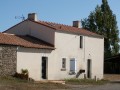
(4) Shortly after the farm on the left, turn right onto Chemin de la Génière, which winds its way through the fields and leads to a small road. Note a beautifully renovated building on the right. Follow this road for a few metres.
(5) Turn left onto the Chemin de la Breuvat, then left again onto the Chemin de la Juliennais, which runs alongside a private poplar grove. Join a road, cross it, and after a bend, turn right onto the Chemin Touche Neuve.
(6) You’ll reach the Croix Jean Lehours, where a picnic area with tables awaits walkers. Continue left onto Chemin du Pas Tharon.
(7) You’ll come to a signpost indicating a shortcut (not tried). Head down opposite towards a small stream, then start a gentle climb.
(8) At the next junction, turn right towards the hamlet of La Briandière (make sure you spot the markings on the electricity pole, as the layout of the terrain might tempt you to carry on straight ahead).
Cross the hamlet of La Briandière, follow the small road which turns left and reach the hamlet of La Haute Briandière.
No signposting.
(9) Continue straight on along the small road despite the crossed-out Yellow Cross, pass a joiner’s and carpenter’s workshop and, at the next bend, turn right onto Chemin de Moquechien. Pass some private caravan sites on the left and reach a small road.
Yellow markings
Follow the yellow markings again, pass through the hamlet of La Roctière and follow the small road known as La Dolotière.
(10) At the ‘Stop 150m’ sign bearing the markings, turn left and head up Chemin de la Hache, a hard-packed clay track.
After a right-hand bend followed by a left-hand bend, the track takes the name ‘La Frenelle’, after the hamlet. Also follow the mountain bike signpost no. 1. After this hamlet, the track becomes gravel.
(11) When you reach a signpost common to both routes, continue straight on along the white track to reach Rue des Ajoncs.
Turn right and follow the route taken on the way out to reach the car park at the Jardin public des Lakas (S/E).


 Visorando Member

 Easy
Easy