


 Country:
 City:


Start from the Pichauris car park, at the junction of the D908 and the D46a.
(S/E) Follow the path eastwards, running alongside the D46a.
(1) When you reach a hairpin bend in the road, cross it carefully and take the path opposite, which follows a stream; due to recent rain, you’ll have to wade through it a little. Most of the time, however, the stream is dry.
(2) After 500 m, turn left onto an uphill path. Continue northwards until you reach a track.
(3) Turn right under a power line and follow the track northwards for 200 m.
(4) Take a path on the left and walk 200 m through the olive groves.
(5) Veer to the left and you’ll come across two wells with typically Provençal names (Romu and Antonin). Continue along the path northwards for 500 m, ignoring any paths branching off to the right or left.
(6) When you reach a track, turn right, then left after 50 m onto the path that veers slightly north-north-east, and continue for 600 m. Then carry on straight ahead towards the north-east, ignoring the many paths branching off to the right and left.
(7) When you reach the Route des Termes (D 908), cross carefully and take the ascending track opposite. Continue along this for 2 km in a north-westerly direction until you reach the entrance to L’Ortolan.
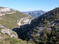
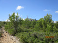
(8) Take a path on the left which runs alongside a property. This marks the start of the climb up to Mont Julien. You’ll reach a junction of several tracks with a fire lookout post on the right; take the well-marked path on the left which climbs southwards. Gradually, the cliffs of Mont Julien come into view in the distance.
(9) You’ll reach a small pass after climbing over a few rocks. The summit comes into view to the south and a final short climb takes you up to it, where you can enjoy the 360° view.
To the north, Sainte Victoire; to the west, the Chaîne de l’Étoile and the Bay of Marseille; to the east, Sainte Baume and the cliffs of Mont Aurélien, amongst others.
Head back down southwards along a stony path to join the track running alongside the Ratier; follow it to the left for 300 m until you reach a sharp bend to the left.
(10) Take the path opposite, which descends southwards for 500 m. Pass under a high-voltage power line (elevation 455) and start the climb; after 300 m, turn left towards the south-east.
After 600 m, join a track that leads back to the Route des Termes.
Head southwards, keeping the power line directly below you, and turn left at the next hairpin bend on the track.
(11) When you reach the road, cross it carefully and head down to the right, a few metres higher up, into the dry riverbed of the Jarret. Follow this for 700 m to return to the car park (S/E).



 Visorando Member




 Difficult

