Country:
 City:
City:


From Plan-de-Cuques, take the D908 towards Peypin. Turn right onto the D46A at the Auberge de Pichauris. Park in the car park for the park, signposted by a sign.
(S/E) Go through the large park entrance gate. Continue straight on along the shepherds’ path, marked by signposts, and pass the Fontaine Muriel.
(1) Turn left onto the path leading uphill through the forest. You’ll reach the Puits de Gérard, then an electric fence. Go through a small gate and turn right. You’ll come to a picnic area; walk past it and turn right (yellow-red-yellow markings).
(2) Cut across to the left into a meadow that slopes upwards to join a path which first turns left then right in a hairpin bend. You’ll reach Puits de Jean Noël. A few metres before the well, head up to the left, walk past an old house and reach a green gate. Turn right.
After about 150 m, you’ll see the Puits de Téo on your left. At a crossroads, turn left. Pass between a few houses and a ranch, then come out onto a tarmac road. Turn right towards fire hydrant no. 474. Head down the road.
(3) Turn right onto thefirst path, marked Yellow-Red-Yellow. At a T-junction, turn left.
(4) At the next junction, take the path straight ahead which winds downwards, still marked yellow-red-yellow. This path runs alongside the road before rejoining it. Turn right onto the road.
(5) After about thirty metres, turn right onto the path, then immediately left, still following the yellow-red-yellow markings. The path climbs steadily and moves away from the road.
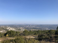
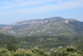
(6) Turn left towards an old fire tank. Carry straight on along the track whilst admiring the magnificent view to your left.
(7) Turn right (at an iron plate on the ground) onto the path which climbs steeply and joins the DFCI track leading to Mont des Marseillais. Turn left onto the track and look out for a signpost.
(8) At the signpost, turn right towards the Puits de l’Aroumi. Keep to the left and follow the Sentier des Tourdres, marked in yellow. You’ll come to a crossroads.
(9) Turn right, then immediately left (elevation 492). The climb is steep with rocky sections to negotiate but levels out quickly.
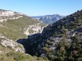
(10) At a fork in the road, keep left, keeping the Garlaban in sight. The path then runs alongside the Grand Vallon. The scenery is magnificent. At the end of the valley, admire the Baume Plate on the left (sign on a stone), pass by a large cairn, then head into the woodland. There are a few large boulders to negotiate, but the climb is relatively easy. You’ll reach a signpost.
(11) Turn left towards the Puits de l’Aroumi. Then turn right at the next signpost. The markings are yellow, sometimes blue. The path climbs steeply and becomes difficult due to scree. The path then levels out to reach an open area, the Puits de l’Aroumi. Head west again along the DFCI track.
(12) Take the path heading westwards in the middle of the track’s first bend. Keep to the right; the path is not obvious but joins the DFCI track further up. Turn left onto the track, then a few metres further on, do not follow the main DFCI track but keep to the right.
The track passes by a stone hut, then descends gradually through the undergrowth, with steps made of logs. There’s a lovely view of Marseille and the Étoile massif. Pass through the Barre Coupée gap, descend the numerous rock steps known as the ‘escalier du Goï’ (the lame man’s staircase) and arrive at a DFCI track.
(13) Turn left onto the track. Walk down to a signpost.
(14) Turn right and head down towards the valley. The path winds in numerous hairpin bends. Keep to the left.
(15) Join a wider track and turn left. Look out for the ruins of Ners Castle high up, but do not try to take any paths on the left as they lead into the bushes.
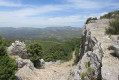
(16) Directly beneath a high-voltage power line, turn left through a gap in the bushes, marked by a cairn (sometimes missing – if so, use your GPS). Quickly pass afirst wall, then climb the hill to the castle ruins. Then turn back to rejoin the track.
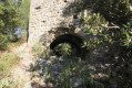
(16) Turn left, then keep right at thefirst junction of tracks. You’ll reach fire tank no. 524. Keep to the left. Cross a small stone bridge, continue to the left and arrive at a junction you passed on the way out.
(1) Turn left and head back to the car park (S/E).


 Visorando Member
 Moderate