Country:
 City:
City:


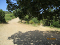
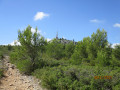
Park in the car park at the Pichauris Departmental Park.
No signposting
(S/E) Leave the car park and follow the D64A to the right until you reach the first hairpin bend, where there is a small lay-by. Leave the road and take a path on the left after passing through a forest gate. You will come to a junction marked by a mountain bike signpost. Turn left at a 90° angle and head up the hillside until you reach a cross-country track. Turn right and you’ll soon reach another junction.
Signposting: Yellow PR® + Yellow and Red GRP
(1) Continue straight ahead. At the next junction (electric pylon on the right), keep to the left and continue for about a hundred metres.
No signposting
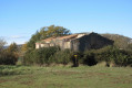
Leave the dual signposting by turning left. Walk alongside a dry meadow dotted with a few olive trees, then keep to the right to reach the ruined buildings of La Bastidonne. Cross the meadow and emerge onto the Chemin de la Verrerie at a forest gate. Turn left, then keep left at the next junction to reach a large open area with scattered pine trees.
PR® Yellow + GRP Yellow and Red markings
(2) Head to the right, walk for about fifteen metres, then turn right again onto a narrow path. Ignore a path coming from the left, then another on the right, and continue in the same direction until you come out onto a track.
No signposting
Take this track to the right and you’ll reach a three-way junction where an inscription painted on a rock on the ground marks the boundary of the commune of Allauch.
(3) Turn off to the left. Go through a forest gate as you reach the first houses of La Rouvière and follow a concrete track leading to the D64a. Turn left, pass the cemetery, then leave the road and turn right onto a steeply ascending path which quickly leads to a junction.
Signposted: PR® Yellow + GRP Yellow and Red
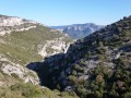
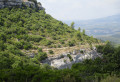
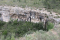
(4) Walk about ten metres to the left, then turn right as indicated by the dual signposting. The path winds through two hairpin bends before heading south, skirting the cliffs of the slender peak of La Cride on your left, eventually emerging onto a forest track. Follow this track to the left, negotiate two hairpin bends and walk for about a hundred metres to reach a small pass (sign: fire station).
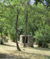
(5) Go straight on and, at the next junction, turn right. Follow the wide path, which winds several times, passes two stone huts situated below on the left and continues straight on, leaving cistern no. 305 on the right. Continue uphill until you reach a three-way junction at the ruins of a small stone building.
(6) Carry on straight ahead, slightly to the right, uphill.
No signposting
At the first bend, leave the track you have been following and turn left onto a narrower path. Keep to the right about fifty metres further on and continue until you come to a small water reservoir with an electricity pylon on the left.
(7) Leave the track and head right towards a path that is difficult to spot for the first few tens of metres. This narrow, stony and sometimes obstructed path leads to the Col du Marseillais.
Markings: Yellow PR® + Yellow and Red GRP
(8) Turn right, following, amongst other things, the sign for Mont du Marseillais 30 mins. Walk for about 200 m, then leave the track for a narrow path that starts climbing to the left and rejoins the track further up. Turn left until you reach the next signpost.
No signposting
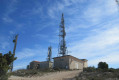
(9) Turn left, then immediately right towards the small rocky ridge leading to Mont du Marseillais. After a fairly steep climb, reach a junction and turn right to cross the ridge at its narrowest point. You’ll come out at a huge cairn; head off to the left to reach the summit facilities.
PR® yellow + GRP yellow and red signposting
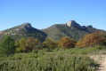
(10) Take a moment to enjoy the exceptional 360° view, then leave Mont du Marseillais via the track leading up to it. Walk to a three-way junction.
(11) Take the left-hand fork, which climbs gently.
No signposting
(12) Turn right onto a path that serves as a shortcut and joins the double signposting further on.
PR® yellow signposting + GRP yellow and red
Carry on straight ahead. When you reach the junction with a hunting blind opposite, turn right towards cistern no. 525, situated near a large crossroads where numerous tracks and paths intersect, and where a majestic oak tree stands.
(13) Take the path opposite, slightly to the right, taking care not to be tempted by the track leading uphill on the left. Continue straight on at the first junction (signpost), make a long traverse along the hillside and head straight on to the next junction, maintaining the same direction.
No signposting
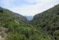
(14) Ignore the signposting heading off to the left and turn right onto the path at the bottom of the valley.
PR® Yellow + GRP Yellow and Red signposting
Rejoin the signposting you left earlier, follow it to a wide track, then head right downhill. When you reach a large meadow, turn left, then left again to reach the Pichauris farm.
No signposting
(15) Turn left onto the dirt track which leads directly to the car park at the Pichauris Departmental Park (S/E).

 Visorando Member


 Difficult