Country:

 City:
City:


Park at the far end of the village, opposite the newly restored village hall.
Then follow the Gagne route to (7), the trail (in reverse) from (7) to (9), then the Yellow route from (9) to (S/E).
(S/E) Set off towards the church, then, before reaching it, head down the road to the left to cross the Ruisseau de Montusclat. Leave the sandy track on your right and head back up the road opposite towards the houses.
Yellow markings
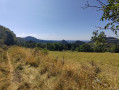
(1) At the end of the road, turn right onto a track that climbs through meadows. As it enters the forest, continue along this track, which winds once to the left then once to the right.
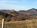
Carry on climbing, leave the forest, come to a grassy clearing and reach a cross at the pass, a tourist information point (view of Mont Mézenc) and a road.
(2) In the distance to the right, you can see a cluster of crosses known as the Croix de l’Étoile. Continue straight on along the road which descends towards the hamlet of Pouzol Vieux. After about 200 m, leave the road to the left, following the yellow markings. Join a small road on the right, then leave it again to the right, following the yellow markings. Pass in front of a hermit’s cottage.
Join the road and carry on straight ahead; you’ll very quickly reach the end of the hamlet. The road turns into a track that crosses meadows before heading down into the forest.
You’ll come to a 90° right-hand bend and immediately spot a vaguely passable track on your left.
No signposting
(3) Take this track, which descends gently before reaching a flat section. On your right, you’ll see an old forest track that descends steeply. Take this overgrown track, which winds down in three hairpin bends and ends in the middle of the forest.
(4) You can see another track about twenty metres below. Rather than heading straight down to it (the ground is steep and slippery), follow a faint path straight ahead which winds once to join the track below.
Follow this track to the left, which descends gently, overlooking the deeply incised Ruisseau de Montusclat.
The track turns into a path, then a narrow trail, and finally opens out into a meadow.
(5) Walk down the meadow, following the course of the stream, to reach the confluence with the Gagne. Ford the stream just before the confluence, near a bridge – which is unfortunately of no use as it lies downstream of the confluence.
This brings you to a stony track, which you take to the right to climb back up onto the plateau. You will then reach a junction of tracks.
(6) Leave the main track and take a track on the right which climbs quite steeply and leads to the edge of a meadow. Follow the track to the left, which curves in a semicircle, emerges onto the plateau through the meadows and reaches a road next to a cross.
Cross the road and head up a stony, fairly steep track. You’ll reach a three-way junction at the edge of the woods.
Trail markings
(7) Ignore the track heading uphill to the left and take the path straight ahead, which climbs gently (if you look back, you’ll see you’re on a trail, which you’ll follow in the opposite direction until (9)). You’ll reach another three-way junction.
(8) Ignore the right-hand branch, which follows the contour line, and head steeply uphill to the left. Reach the ridge and follow the path, the traces of which are fairly clearly visible. The path crosses over to the other side of the ridge and joins a track suitable for vehicles. Take this track to the right, leave the forest and reach a pass in the middle of the meadows. Continue straight on and you’ll come to a three-way junction after about a hundred metres.
Yellow markings
(9) Take the right-hand fork, which overlooks the valley offering fine views, and joins a road.
Cross this road and head down a damp path which joins a wide track. Pass close to the cemetery and head down towards the church. In front of the church, take the road running alongside it on the left, pass the town hall and return to the starting point (S/E).

 Visorando Member
 Easy
Easy 
 Difficult