Gagne slopes via Bigorre

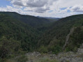
This short, fairly challenging walk crosses the deep, wild Gagne gorges twice.
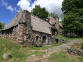
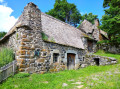
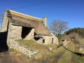
It also passes through Bigorre, a beautiful village with thatched-roof houses on the edge of the plateau.
Please note: a wading crossing is compulsory!

Details

3373970
Creation:
Last update:
Last review:
  • Walking
    Activity: Walking
  • ↔
    Distance: 6.28 mi
  • ◔
    Average duration: 4h 25 
  • ▲
    Difficulty: Difficult

  • ⚐
    Back to start: Yes
  • ↗
    Ascent: + 1,726 ft
  • ↘
    Descent: - 1,739 ft

  • ▲
    Highest point: 3,717 ft
  • ▼
    Lowest point: 2,697 ft

Photos

Description of the walk

Park in the centre of the hamlet of La Pradette Haute, on the flat area overlooking the Gagne valley.

(S/E) Set off due south, towards the Gagne Gorges, and immediately take the left-hand track at the three-way junction. The track is tarmac-surfaced as far as the last house. About 200 m past this house, another track joins from the left and the descent begins.

(1) You will reach the valley floor and cross a bridge at the confluence of the Gagne and the Ruisseau de Montusclat.
The path climbs to the right and begins the ascent in hairpin bends. You’ll come to a junction with a very steep path and another that climbs only slightly.

(2) Ignore the steep path and take the flat path, which soon winds to the right; leave a path ahead of you that descends and joins the top of the steep path.
Gradually emerge from the forest and climb up through the meadows, along a path that widens into a track, to reach the hamlet of Bigorre and the road.

(3) Take the road on the right and take the opportunity to admire the many thatched cottages.
Leave the hamlet and, after about 300 metres, you’ll come to a track branching off to the right which descends into the valley.

(4) Leave the road and follow this sandy track to the right, which descends gently to a three-way junction.

(5) Take the path on the left which descends into the small valley, veering to the left. The path climbs back up through the woods and joins a wide track.

(6) Take this track on the right, which descends steadily. Head uphill along the track, which then follows a contour line. You will then reach a junction with a path leading down to the right.

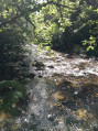
(7) Take this path, which very quickly makes a hairpin bend to the right and begins a steep descent amongst the rocks. This brings you to the bottom of the valley, at a ford.

(8) Cross the ford (the stones are quite flat and won’t hurt your feet!) and join a path that runs along the right bank of the Gagne.
Take this path on the right; it offers plenty of places to rest by the river. After about 500 metres, the path begins to wind its way uphill. This will take you to a large open area marking the end of the road coming from La Pradette.

(9) Follow this road to the right as it leaves the gorges and leads to Pradette Haute (S/E).

Waypoints

  1. S/E : mi 0 - alt. 3,478 ft - La Pradette Haute
  2. 1 : mi 1.05 - alt. 3,015 ft - Bridge - Gagne (rivière)
  3. 2 : mi 1.36 - alt. 3,314 ft - Turn right at the fork
  4. 3 : mi 2.11 - alt. 3,714 ft - The hamlet of Bigorre
  5. 4 : mi 2.53 - alt. 3,681 ft - Track to the right, hairpin bend
  6. 5 : mi 2.84 - alt. 3,432 ft - Three-Way Junction
  7. 6 : mi 3.26 - alt. 3,392 ft - Trail
  8. 7 : mi 4.23 - alt. 3,196 ft - End of the trail
  9. 8 : mi 4.68 - alt. 2,697 ft - Fording
  10. 9 : mi 5.57 - alt. 3,136 ft - Route
  11. S/E : mi 6.28 - alt. 3,478 ft - La Pradette Haute

Notes

Sturdy footwear is essential (steep descents over rocky terrain).
Be prepared for the river crossing at (9): it’s refreshing in summer, but wading barefoot across the Gagne in winter isn’t exactly pleasant!
Actual duration without breaks: 3 hours 15 minutes.

Worth a visit

To find out more about Bigorre, visit the website.
You can also visit theeco-museum.

Reviews and comments

4.1 / 5
Based on 3 reviews

Reliability of the description
4.7 / 5
Ease of following the route
3.7 / 5
Route interest
4 / 5
User 23487417

Overall rating : 4 / 5

Date of your route : Aug 31, 2026
Reliability of the description : ★★★★☆ Good
Ease of following the route : ★★★☆☆ Average
Route interest : ★★★★★ Very good
Very busy route : No

It’s a tricky path to find after Bigorre, as the woodcutters have piled up a heap of branches at the start of the track

Machine-translated

dominique duperret
dominique duperret

Overall rating : 3.7 / 5

Date of your route : Sep 16, 2024
Reliability of the description : ★★★★★ Very good
Ease of following the route : ★★★☆☆ Average
Route interest : ★★★☆☆ Average
Very busy route : No

No signposts.
Forestry work with fallen trees blocking the path.
A very difficult stretch.

Machine-translated

PA12
PA12

Overall rating : 4.7 / 5

Date of your route : Aug 03, 2022
Reliability of the description : ★★★★★ Very good
Ease of following the route : ★★★★★ Very good
Route interest : ★★★★☆ Good
Very busy route : No

A route mainly through woodland, which is very pleasant in hot weather, though there are a few sections with panoramic views. We set off from the car park at the Bigorre Ecomuseum – a good choice, as the descent to the ford (which we crossed without any problems in August) and the subsequent climb up the Pradette are a bit monotonous, so we ended with the most interesting and varied part of the route.
The ‘Difficult’ rating is an overestimate; the only difficulty is that the paths are often stony (good footwear is strongly recommended).
Please note at point 7 that the entrance to the path is blocked by tree trunks and branches, so you’ll need to go round them for a few metres.
The circular route took just under three and a half hours, not including breaks.
Thank you!

Machine-translated

Other walks in the area

For more walks, use our search engine .

The GPS track and description are the property of this route's author. Please do not copy them without permission.