Near the Loire Gorges at Beauzac

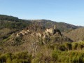
A route of no great difficulty, offering a beautiful view of the Loire and the Pont de Lignon viaduct.

Details

n°46676245
Creation:
Last update:
Last review:
  • Walking
    Activity: Walking
  • ↔
    Distance: 7.05 mi
  • ◔
    Average duration: 4h 00 
  • ▲
    Difficulty: Moderate

  • ⚐
    Back to start: Yes
  • ↗
    Ascent: + 886 ft
  • ↘
    Descent: - 906 ft

  • ▲
    Highest point: 2,073 ft
  • ▼
    Lowest point: 1,716 ft

Description of the walk

Parking at the hamlet of Les Vivas near Beauzac, in the car park near the restaurant ‘La Vielle Ferme’.

(S/E) Head south-east along Rue de la Charreyre to join the D42.

(1) At the junction, cross carefully and take Route des Cotes straight ahead until the first right-hand turn-off.

Follow the red-and-white markings forthe GR® de Pays des Gorges de la Loire (GR®) until you reach (10).

(2) At Côte 603, theGR® turns sharply (90°) to the right, descending into the forest above the Gorges de la Loire. Walk 100 metres past the houses on Côte Méanne.

(3) Turn left onto the path that climbs and stay on this path on the right until Côte 612, where it turns 90° to the right. Continue to the entrance to the hamlet known as Côte Chaude.

(4) Turn right onto the tarmac road for 50 metres, then, at the bend, go straight on along the path that descends to the 550-metre contour line.

(5) Turn left to join the road below. Cross this departmental road with care and take the small path opposite, which descends steeply towards the hamlet of Le Riou and leads onto a tarmac road.

(6) After the pond and the house on the left, leave the road and take the path on the left which climbs into the woods. At a junction, continue climbing by turning left, then at the path junction turn right to reach the hamlet of Le Plat.

(7) After passing the mobile phone mast on your right, take in the view of the Loire Gorges, the Pont Salomon viaduct and the Monts du Velay. Then carry on straight ahead and, at the Chanteduc road, continue straight on until you reach the large farm at Chanteduc.

(8) Near the large farm, leave the tarmac road and turn left, then carry on straight ahead all the way to La Groslière (rubbish bins). Take the tarmac road on the right.
Please note: in La Groslière, veer slightly to the right, then immediately take the path on the left. You’ll reach a crossroads.

(9) Follow the tarmac road which passes above the Peyragrosse farm. Continue along the left-hand-most road for 100 m. When the road turns at a right angle, take the path on the left and you’ll reach an industrial estate.

(10) Leave theGR® and take the path on the left which runs alongside the industrial estate for 100 m.
Leave the tarmac road and follow the path to the left, marked with yellow signposts, to the hamlet of Chevalier.

(11) Turn right twice, walk past the sports grounds and come out onto a road near a wayside cross.

(12) Turn left, then right, and head straight on towards Les Ollières; you’ll reach a ‘Stop’ sign near ‘Valprivas espaces verts’.

(13) Turn right onto Rue Pinatons, then left onto Rue du Verdoyer to join the D42.

(14) Cross the road with care and continue straight ahead to join the Route des Vivats; keep going straight on until you reach the hamlet of Les Vivas (signposted for the car park) (S/E).

Waypoints

  1. S/E : mi 0 - alt. 1,962 ft - Car park at the hamlet of Les Vivas
  2. 1 : mi 0.23 - alt. 1,939 ft - D42 junction
  3. 2 : mi 0.74 - alt. 1,978 ft - Junction. Elevation 603
  4. 3 : mi 1.15 - alt. 1,798 ft - Junction after the Côte Méanne
  5. 4 : mi 2.21 - alt. 1,916 ft - Crossroads. Côte Chaude
  6. 5 : mi 2.5 - alt. 1,818 ft - Junction. Altitude 550
  7. 6 : mi 2.71 - alt. 1,716 ft - Le Riou
  8. 7 : mi 3.17 - alt. 2,011 ft - Le Plat, mobile phone mast, viewpoint over the Loire (river)
  9. 8 : mi 3.48 - alt. 2,073 ft - Chanteduc Farmhouse
  10. 9 : mi 4.24 - alt. 1,870 ft - Route to Ferme de Peyragrosse
  11. 10 : mi 4.79 - alt. 1,778 ft - Factories, industrial estate
  12. 11 : mi 5.26 - alt. 1,936 ft - A place called Chevalier
  13. 12 : mi 6.04 - alt. 1,831 ft - Road junction
  14. 13 : mi 6.22 - alt. 1,860 ft - Les Ollières, ‘Valprivas Espaces Verts’
  15. 14 : mi 6.39 - alt. 1,824 ft - D42 junction
  16. S/E : mi 7.05 - alt. 1,962 ft - Car park at the hamlet of Les Vivas

Worth a visit

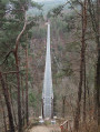
Nearby, 12 km away by car, is the Himalayan footbridge in the Gorges du Lignon.
Car park at Maubourg Castle near Saint-Maurice de Lignon. The walk to the start is 3.7 km with an elevation gain of 184 m. Return via the same route, with a slightly steep climb.

Always be cautious and plan ahead when you're outdoors. Visorando and the author of this route cannot be held responsible for any accidents occurring on this route.

The GR® and PR® markings are the intellectual property of the Fédération Française de Randonnée Pédestre.

Reviews and comments

4.2 / 5
Based on 2 reviews

Reliability of the description
4.5 / 5
Ease of following the route
4.5 / 5
Route interest
3.5 / 5
HmJm50
HmJm50

Overall rating : 4.3 / 5

Date of your route : Mar 17, 2026
Reliability of the description : ★★★★★ Very good
Ease of following the route : ★★★★★ Very good
Route interest : ★★★☆☆ Average
Very busy route : No

A short, easy walk.

Machine-translated

kibler georges
kibler georges

Overall rating : 4 / 5

Date of your route : Feb 03, 2026
Reliability of the description : ★★★★☆ Good
Ease of following the route : ★★★★☆ Good
Route interest : ★★★★☆ Good
Very busy route : No

Machine-translated

Alain_42
Alain_42

I don’t understand what the problem is – three-quarters of the route follows the GR, so it’s signposted.
As for the route description, we’re limited in the number of points we can include – it’s a shame you didn’t come back to the site to tell me exactly where the problem lies.
Alain

Machine-translated

Alain_42
Alain_42

Hello, I’m sorry if you’ve had any difficulties.
Where exactly did you encounter problems so that I can try to sort it out?
Did you print out the route map?
It’s much more convenient to use the Visorando app on your smartphone to follow a walk.

Machine-translated

Nathalye
Nathalye
• Edited:

The directions didn’t let us complete the walk as it was described… so we had to improvise! Thanks, Google Maps 😁
Perhaps the route description isn’t quite clear enough… or maybe we’re just really hopeless 🤔
That said, it’s a lovely spot and the wildlife is full of surprises 🤣

Machine-translated

Other walks in the area

For more walks, use our search engine .

The GPS track and description are the property of this route's author. Please do not copy them without permission.