From Marigny to Grand Mauduit via the GR®36

A pleasant walk through the countryside around Marigny, taking in the northern edge of the Chizé Forest. This route offers a chance to get close to nature away from major roads, with varied scenery. It’s a place where you might spot roe deer or birds.

Details

3245491
Creation:
Last update:
Last review:
  • Walking
    Activity: Walking
  • ↔
    Distance: 6.78 mi
  • ◔
    Average duration: 3h 15 
  • ▲
    Difficulty: Moderate

  • ⚐
    Back to start: Yes
  • ↗
    Ascent: + 108 ft
  • ↘
    Descent: - 108 ft

  • ▲
    Highest point: 279 ft
  • ▼
    Lowest point: 151 ft

Photos

Description of the walk

(S/E) Leave the car park by heading towards the far end of the Place du Centre, where the car park is located, heading south-west. Continue along the Chemin de Saint-Sévenin and you’ll see a well in front of a house on the right-hand side.
Go straight on at the junction with Rue de la Morinne, heading towards the campsite: a lovely farm with livestock buildings on the right.

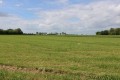
(1) Further on, turn right onto the track, leaving the road leading to the campsite: lovely views to the north over the surrounding countryside. Carry on straight ahead until you reach the first small copse.

(2) Turn onto the farm track on the right, which winds between the Fief Clervaux on the left and the Fief Poitevin on the right. Continue to the D101 road. Turn left and follow the road carefully to the junction with the Grand Mauduit road.

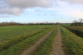
(3) Take the path opposite, which heads south after a slight bend to the left. The path, lined with a hedge on your left, eventually reaches a T-junction. Take the path to the right through open fields towards the hamlet of Sèche-Bec on the north side of the path, and you’ll reach another junction.

(4) From this point, the route follows theGR®36(marked in white and red).
Turn left and carefully follow the road for about sixty metres. At the bend to the right, turn left onto a path that follows the edge of the Chizé woods in the section known as l’Aile du Bois.

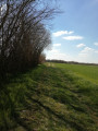
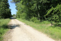
(5) Further on, the path joins forest road no. 11. Turn left to take this forest road northwards. At the end of a long straight stretch, pass through the barrier restricting motor vehicle access to the forest. The path turns left and, at the edge of the woodland, veers sharply to the right. The path runs along the edge of the woodland, with cultivated fields on the left-hand side beyond the trees.

After about two hundred and fifty metres, turn right onto a path that leads directly to the junction between the Route du Grand Mauduit and the road leading to the Carrefour de la Grande Borne. Alternatively, carry on straight ahead until you reach the road and turn right to follow it. The route leaves theGR®36at this point.

(6) Turn right and carefully follow the D101 road heading east. Walk to Grand Mauduit along the grassy verge on the right-hand side of the road. Walk through Grand Mauduit to the junction with the Route des Essards on the right.

(7) Continue along the D101, which takes a first turn left then right towards Péré-en-Forêt. As you leave the hamlet, just as the road takes a right-angle bend to the right, carry on straight ahead down a sloping track. At the next Y-junction, take the track on the right, which is almost level.

(8) Further on, the track joins a north-south farm track. Follow it northwards, turning left to join the D102 road (elevation 66). Turn right and carefully follow the D102 road until you reach the junction with another road on the left.

(9) Turn left onto the small road leading to isolated livestock buildings in the countryside. On reaching it, continue straight on along the track that follows on from the road and join the small road leading to the hamlet of Le Portail. Turn right for about thirty metres before turning left onto the small road leading to the hamlet of La Clervaudière. Pass the hamlet on your right and continue until you reach a right-angled bend in the road to the right.

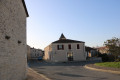
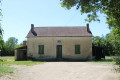
(10) Turn left onto a farm track heading west, north of ‘Terre de Jules’. Further on, the track joins the D101 road. Turn left and follow the D101 carefully as far as Marigny. Pass the cemetery on your left. Pass the junction with the Route de Péré on your left and, immediately afterwards, turn into the Place du Centre on the left-hand side. Before reaching the car park, take a look at the beautiful house on the right-hand side of the square, where Yves Rabault, the Poitevin bard and singer-songwriter, once lived (S/E).

Waypoints

  1. S/E : mi 0 - alt. 171 ft - Place du Centre car park
  2. 1 : mi 0.39 - alt. 177 ft - Junction
  3. 2 : mi 0.81 - alt. 230 ft - Junction with a farm track
  4. 3 : mi 1.46 - alt. 266 ft - D101 junction
  5. 4 : mi 2.1 - alt. 223 ft - Road to Sèche-Bec
  6. 5 : mi 2.71 - alt. 243 ft - Forest track No. 11
  7. 6 : mi 3.25 - alt. 256 ft - Crossroads
  8. 7 : mi 3.86 - alt. 276 ft - Crossroads in the centre of Grand Mauduit
  9. 8 : mi 4.39 - alt. 230 ft - Junction with the farm track
  10. 9 : mi 4.9 - alt. 197 ft - Crossroads before La Pommeraie
  11. 10 : mi 5.75 - alt. 161 ft - Junction of road and footpath after La Clervaudière
  12. S/E : mi 6.78 - alt. 171 ft - Place du Centre car park

Notes

The car park is located on Place du Centre in Marigny. At the far end of the car park on the right, at the back of a small grassy area, there are toilets. There are other car parks in the village (opposite the cemetery, next to it, and near the village hall).

This walk across varied terrain requires sturdy footwear.

This route is partially signposted as it follows sections of the GR®36 and the GR®36 diversion, marked in red and white. It follows the GR®36 almost exactly from (S/E) to (2) and from (4) to (7). Nevertheless, it is advisable to follow the instructions in this description and on the map, whilst also paying attention to the surrounding landscape. Distance measurements from the starting point, or even the GPS coordinates of waypoints (including the start), can also help walkers find their way.

Alternative route: for those wishing to take a shorter route, you can continue straight on at (2) to reach, after approximately 300 metres, the junction where the path crosses a small road. Take the road on the left and you will reach the point (6) just over 100 metres further on. In this case, the route is 8 km long.

There are toilets about one hundred metres past the car park on the right (at the start of the route).

Walk completed by the author on 27/02/2022. A very quiet route, even on a Sunday afternoon.

Worth a visit

Marigny
In the 12th century, the area under vine increased at the expense of wheat. Food shortages occurred at the slightest climatic disturbance.
From the 15th to the 16th century. It is said that François I, who owned a kennel at Rimbault for hunting with hounds in the Forest of Chizé, enjoyed local wines such as those from Marigny. He favoured grape varieties such as Folle Blanche for white wine and Balzac for red wine.
In the 18th century, the intensification of crop and cereal farming made way for the planting of vineyards.
During the Empire, the vineyards – which accounted for 12 per cent of arable land – provided the commune’s main source of income. Certain names of fiefdoms evoke the presence of vineyards, such as Plantis, Les Vignes Franches, Le Vigneau, Les Vieilles Vignes, the Fief de Beauregard, the Fief des Dames, etc. The vineyard area increased from 360 ha to 700 ha by 1875 (over a period of fifty years).
In 1881, the vines were infected and withered away, leading to the disappearance of almost all the vineyards. This was accompanied by a massive exodus of the population.
In 1889, the first dairy in the Deux-Sèvres department was founded in Beauvoir. This prompted all the farmers to build up their own herds. In 1896, new families settled on the land that had become available. They came from Gâtine and the Vendée.

The Church of Saint-Jean-Baptiste
The site has been inhabited for a long time, as evidenced by the megaliths and nine Merovingian tombs discovered in 1883. Between 936 and 954, Marigny (Marniacus) was the administrative centre of a Carolingian district, known as a ‘viguerie’. The church is thought to have been built by the monks of the Abbey of Saint-Jean-de-Montierneuf in Poitiers towards the end of the 11th century. It is dedicated to the same saint as the abbey, John the Evangelist.
It was confirmed as belonging to the abbey by Pope Adrian IV in 1157. The priory church remained under the jurisdiction of Montierneuf until the Revolution. The priory buildings adjoined the church. Damaged during the Wars of Religion, the church underwent major restoration in 1715.
During the Revolution, it was put up for sale as national property and acquired in 1793 by Jacques-Claude Jard-Panvilliers. It was used as a saltpetre store. When the purchaser offered to sell it back to the local council for 1,600 francs, the council refused. He then had the paving removed and the vaults, as well as the south and west walls, demolished in 1801.
In 1813, a new town council took office and decided to rebuild the church. Mr de La Rochebrochard donated stones from the former castle at Fors for this purpose.
Source: the municipality’s official website

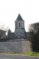
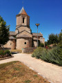
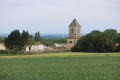
The landscaping of the surrounding area allows visitors to admire the beauty of the central bay and the semi-circular apse, flanked by the semi-circular apsidioles of the transept, all covered with slate. The whole is dominated by the massive, elongated bell tower. The bell tower, situated above the square section of the transept, dates only from 1854. Given its imposing octagonal base, it is likely that the original bell tower must have been more slender. A stone parapet enhances the appearance of the four-window square section that provides light for the belfry.
The spiral staircase leading up to the bell tower is situated at the junction of the nave and the right-hand arm of the transept. The bell tower covers the transept square with an octagonal dome resting on corbels. The four arches of the transept’s square section are built in the basket-handle style. The pillars are adorned with large capitals, each of which is well worth admiring in turn. On each arm of the barrel-vaulted transept there is a semicircular apsidal niche.
The chancel comprises a single straight bay with a barrel vault and an apse with a cul-de-four vault, lit by an oculus. This part of the church was listed as a historic monument on 8 April 1909.

The Chizé State Forest
A remnant of a prehistoric forest, it covers approximately 3,435 ha and forms part of a larger area, the Aulnay-Chizé forest complex.
An open forest
Crossed by the GR®36, the GR® de Pays de la Sylve d’Argenson, the Chizé Forest welcomes many visitors, including walkers, cyclists, schoolchildren and scientists.
Remarkable wildlife
Designated as a Natura 2000 site, the forest is home to 31 species of mammals, 6 species of reptiles, 8 species of amphibians, 78 species of birds and over 530 species of butterflies!
The dominant broad-leaved trees
The Chizé Forest is unique in that it consists mainly of beech trees. Having been affected by the storm of 1999, it is now the subject of in-depth observations and studies into the resilience of the tree in the context of climate change.
There are also numerous oaks, notably the ‘Emperor’s Oak’, which is around 250 years old and stands 27 metres tall, as well as the ‘Papinot Oak’, which will provide shelter for your picnic break.

A forest, a legend: the seven oaks of Chizé
Legend has it that Melusine, the fairy of Poitou, whilst flying over the Forest of Chizé, was desperate to find a water source to bathe her serpent’s tail. She thus caused an oak tree with seven trunks to spring from seven acorns, at the centre of which a natural basin filled with water. Today, it is known as Melusine’s Bath.

Organisations based at the Chizé site:
The CNRS laboratory (on the site of a former military camp, active from 1952 to 1967, which housed 4,000 American military personnel and French civilians);
Ifrée (on the CNRS site), whose aim is to promote greater public involvement through environmental education;
Zoodyssée (established in 2009; an air quality monitoring station operated by ATMO Poitou-Charentes helps to better understand the links between air quality and forest ecology).
Source: website

Yves Rabault, the Poitevin singer-songwriter (1910–1990)
The origins of ‘Quand tu m’fais d’la sauce aux lumas’
Yves Rabault was born at 12 Chemin de Saint-Séverin, in Marigny, a small rural village on the edge of the Chizé Forest. Born into a family of farmers, he was nicknamed the ‘Poitevin bard’ in the 1930s. His *Histouères et chantuseries*, published in 1982 with a foreword by Léon Zitrone, is a collection of his complete works, including the famous ‘Sauce aux Lumas’, written in 1940 to the tune of Vincent Scotto’s “Quand on s’aime bien tous les deux”, an idea that came to him in 1934 whilst he was performing in Paris at the Caveau de la République, the Lapin Agile, the Théâtre des Deux Ânes, the Coucou and La Lune Rousse; a song that would take France by storm!
He remarried in 1965 to Simone Suzange, a pianist and accompanist who was a star of the Parisian cabarets and who founded a dance and music school in Marigny. He then took over the management of Productions Paris Variétés, founded by his wife; in 1973, he received the Georges Chepfer Prize, awarded to the best poet-songwriter writing in the local dialect that year. After a lively career, he now rests in Marigny Cemetery.

What is a ‘luma’ in Poitou?
Known as ‘luma’ (*) in Poitou and Aunis, ‘bavou’ in Deux-Sèvres and ‘cagouille ’ (**) in the Charentes, it is the petit-gris, a snail measuring 30 to 40 mm and weighing 6 to 18 g, for which the French centres of snail farming are Cavaillon, in the Vaucluse, and Charente-Maritime; with Poitou-Charentes remaining the leading producer, even though this gastropod is ill-suited to farming and is therefore only farmed on a small scale.
(*) From the Latin ‘limax’, meaning slug or snail.
(**) From the Latin ‘cuculle’, meaning hood or cap.
For further information and source (excerpts):

Always be cautious and plan ahead when you're outdoors. Visorando and the author of this route cannot be held responsible for any accidents occurring on this route.

The GR® and PR® markings are the intellectual property of the Fédération Française de Randonnée Pédestre.

Reviews and comments

4.7 / 5
Based on 3 reviews

Reliability of the description
5 / 5
Ease of following the route
5 / 5
Route interest
4 / 5
Patricia RIMBAULT
Patricia RIMBAULT

Overall rating : 5 / 5

Date of your route : Jul 30, 2026
Reliability of the description : ★★★★★ Very good
Ease of following the route : ★★★★★ Very good
Route interest : ★★★★★ Very good
Very busy route : Yes

A pleasant route, with plenty of paths and woodland. Not much tarmac.

Machine-translated

Vincen
Vincen

Overall rating : 4.3 / 5

Date of your route : Feb 22, 2026
Reliability of the description : ★★★★★ Very good
Ease of following the route : ★★★★★ Very good
Route interest : ★★★☆☆ Average
Very busy route : No

Hike completed without any problems using GPS and with dry feet, even though many paths are flooded at this time of year.
Halfway along the route, at Le Grand Maudit, there is a picnic table where you can take a break.

Machine-translated

Other walks in the area

For more walks, use our search engine .

The GPS track and description are the property of this route's author. Please do not copy them without permission.