From Laguépie to Najac via the Gorges de l’Aveyron

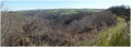
A wild and magnificent walk along the River Aveyron to the splendid medieval village of Najac, dominated by its royal fortress. A route from station to station, directly accessible by TER from Toulouse.

Details

n°65101328
Creation:
Last update:
Last review:
  • Walking
    Activity: Walking
  • ↔
    Distance: 10.12 mi
  • ◔
    Average duration: 6h 10 
  • ▲
    Difficulty: Moderate

  • ⚐
    Back to start: No
  • ↗
    Ascent: + 1,719 ft
  • ↘
    Descent: - 1,552 ft

  • ▲
    Highest point: 1,319 ft
  • ▼
    Lowest point: 489 ft

Photos

Description of the walk

Start at Laguépie station.

GR® white-and-red markings

(S) Turn left as you leave the station, then head straight down to the right at the hairpin bend to join the GR®63. Pass under the road bridge. Continue along this flat path, which runs gently alongside the River Aveyron. Pass under a railway bridge for the first time and then continue through the forest, along the riverbanks. The path becomes wilder and damper below a cliff dominated by the hamlet of La Baussanière. Pass under another railway bridge.

(1) The path leaves the banks of the Aveyron, suddenly gaining altitude, up to the hamlet of Mergieux. Then descend slightly through the forest before climbing again into a small, damp valley, alongside a stream. Cross the stream and emerge at La Gasquie.

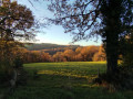
(2) Take the tarmac road on the left, heading uphill through the pastures. At the junction, turn right and walk through the hamlet of Le Bastit. Just as you leave the hamlet, veer slightly off the path to the right to reach an open field, offering a splendid view of the village of Najac.

(3) Resume the route by turning right and look out for a small, barely visible path on the left just after the hairpin bend to the right.

(4) Follow this path (small GR®36 sign) and continue downhill through the forest (blue arrows painted on the stones mark the path), emerging behind a house and joining a tarmac road running alongside the River Aveyron.

(5) Turn left onto this road, then turn right at the junction.

(6) Cross the magnificent Saint-Blaise Bridge over the River Aveyron. Continue up the road, then leave it at the bend, heading towards the sewage treatment works. Then turn left straight away onto the old Roman road, which climbs until it joins a road (D39) at a three-way junction with a wayside cross.

(7) Cross the D39, turn left onto Rue de la Pause, and climb up to the Church of Saint John the Evangelist.

(8) Carry on straight ahead, skirting the church on the left, then take the small path on the left which leads up to the fortress (open to visitors).

(9) Then head down to the village’s main street and continue through the village until you reach Place du Faubourg.

(10) Cross the square, then turn left behind the hotel to take Rue de l’Hiversenq on the left, which leads downhill. Continue down this street until you come to a small path that veers right into the forest.

(11) Follow it until you reach a bridge over the Aveyron.

(12) Cross the bridge, turn right as you come off it and head towards Najac railway station (E).

Waypoints

  1. S : mi 0 - alt. 512 ft - Gare de Laguépie
  2. 1 : mi 3.76 - alt. 554 ft - Second railway bridge - Aveyron (rivière)
  3. 2 : mi 5.81 - alt. 1,250 ft - La Gasquie
  4. 3 : mi 6.9 - alt. 1,171 ft - Field, viewpoint
  5. 4 : mi 7.13 - alt. 1,125 ft - Trail abandonment
  6. 5 : mi 7.59 - alt. 633 ft - Turn left onto the road
  7. 6 : mi 7.93 - alt. 627 ft - Saint-Blaise Bridge
  8. 7 : mi 8.28 - alt. 837 ft - Three-Way Junction
  9. 8 : mi 8.47 - alt. 988 ft - Church of Saint John the Evangelist
  10. 9 : mi 8.66 - alt. 1,132 ft - Fortress
  11. 10 : mi 9.09 - alt. 1,122 ft - Place du Faubourg
  12. 11 : mi 9.47 - alt. 1,066 ft - Path on the right
  13. 12 : mi 9.86 - alt. 656 ft - Bridge over the Aveyron
  14. E : mi 10.12 - alt. 673 ft - Gare de Najac

Notes

The entire walk is signposted GR®36. If in doubt, always follow the red and white markings.

It is best to wear good walking shoes, as the GR® can be quite damp and rugged in places.

The walk starts at Laguépie railway station and ends at Najac railway station. The route is easily and quickly accessible by TER from Toulouse.

Worth a visit

Detailed map of Najac and history of the village: here.

Always be cautious and plan ahead when you're outdoors. Visorando and the author of this route cannot be held responsible for any accidents occurring on this route.

The GR® and PR® markings are the intellectual property of the Fédération Française de Randonnée Pédestre.

Reviews and comments

4.7 / 5
Based on 1 review

Reliability of the description
5 / 5
Ease of following the route
5 / 5
Route interest
4 / 5
Francis961
Francis961

Overall rating : 4.7 / 5

Date of your route : Dec 29, 2025
Reliability of the description : ★★★★★ Very good
Ease of following the route : ★★★★★ Very good
Route interest : ★★★★☆ Good
Very busy route : No

A beautiful hike, the view of Najac is definitely worth the detour! The trail is well marked and the explanations are clear.
Be sure to wear good shoes, as the ground becomes muddy after Mergieux.

The only downside: two dogs block the Rue du Roc du Pont leading to the station (and there's no way around them). We had to be very determined to get past them despite their aggressive barking, but they don't actually attack.

Machine-translated

Other walks in the area

For more walks, use our search engine .

The GPS track and description are the property of this route's author. Please do not copy them without permission.