From Pointe de la Fumée to Fort Énet

A short walk, which can only be done at low tide, takes you out to sea in an unusual setting.

Details

92159
Creation:
Last update:
Last review:
  • Walking
    Activity: Walking
  • ↔
    Distance: 2.47 mi
  • ◔
    Average duration: 1h 10 
  • ▲
    Difficulty: Easy

  • ⚐
    Back to start: Yes
  • ↗
    Ascent: + 16 ft
  • ↘
    Descent: - 16 ft

  • ▲
    Highest point: 13 ft
  • ▼
    Lowest point: -3 ft
  • ⚐ Country: France
  • ⚐ City: Fouras (17450)
  • ⚑
    Start/End: N 46.002796° / W 1.120799°
  • ❏
    IGN map(s): Ref. 1330OT, 1430OT
  • Hour-by-hour weather

Photos

Description of the walk

Parking is available at the (paid) car park at Pointe de la Fumée (the usual car park for taking the ferry to the Île d’Aix).

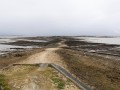
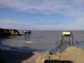
From the far end of the Pointe de la Fumée car park (starting point), Fort Énet is clearly visible offshore. Signs indicate traffic regulations and remind visitors to remain vigilant regarding the rising tide.

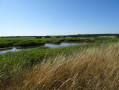
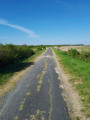
(S/E) Take the stony path leading towards the fort. Walk due west along this well-marked main path, ignoring the much less clearly marked paths branching off to the sides amongst the oyster beds.

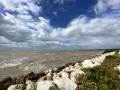
(1) Reach the islet on which Fort Énet stands (private property). Walking over the pebbles and small rocks, go round the fort to the left and continue westwards as far as the sea allows. The sense of isolation and vast open space is astonishing!

(2) Return via the same route as on the way out to the car park (S/E).

Waypoints

  1. S/E : mi 0 - alt. 13 ft - Pointe de la Fumée
  2. 1 : mi 1.02 - alt. -3 ft - Arrival at the foot of the - Fort Énet
  3. 2 : mi 1.24 - alt. -3 ft - Behind Fort Énet, facing the sea
  4. S/E : mi 2.47 - alt. 13 ft - Pointe de la Fumée

Notes

NB. This walk can only be undertaken at low tide. It is therefore essential to check the tide times for Fouras in advance.

When you’re on the way or on the Ilot du Fort Énet, a sure sign is when the oyster farmers start moving to get back to the shore. Please be aware that the oyster farmers travel by car, tractor or lorry: the time it takes them to reach the shore is therefore relatively short, so pedestrians would be well advised to plan ahead.

Needless to say, the oyster beds are not there for walkers to help themselves.

In summer, the car park at Pointe de la Fumée is often full: plan this walk for the mid-season, or arrive early in the morning.

This walk can be combined with another walk described on this website starting from Fouras: From Fouras to Fort La Pointe or The Carrelets of Anse de Fouras. You can choose to reach the starting point of either of these walks on foot or by car: in both cases, you must take the road leading to the Pointe de la Fumée car park in the opposite direction.

Walk completed by the author on 2 May 2014.

Worth a visit

From the islet of Fort Énet, there’s a 360° view of the coastline, the neighbouring islands and the sea. A lovely atmosphere! A beautiful and unique spot for a snack with friends.

It is possible to take a guided tour (for a fee) of Fort Énet. Information: tours of Fort Énet (dates and times subject to the tides).

Reviews and comments

4.5 / 5
Based on 9 reviews

Reliability of the description
4.9 / 5
Ease of following the route
4.8 / 5
Route interest
3.9 / 5
User 13142895

Overall rating : 5 / 5

Date of your route : Jun 05, 2026
Reliability of the description : ★★★★★ Very good
Ease of following the route : ★★★★★ Very good
Route interest : ★★★★★ Very good
Very busy route : No

That's fine, provided you keep an eye on the tide times, as mentioned.

Machine-translated

Vanoise73
Vanoise73

Overall rating : 4.7 / 5

Date of your route : Feb 17, 2025
Reliability of the description : ★★★★★ Very good
Ease of following the route : ★★★★★ Very good
Route interest : ★★★★☆ Good
Very busy route : No

A lovely walk in the spring sunshine
No difficulty

Machine-translated

deforge
deforge

Overall rating : 4.7 / 5

Date of your route : Mar 15, 2022
Reliability of the description : ★★★★★ Very good
Ease of following the route : ★★★★★ Very good
Route interest : ★★★★☆ Good
Very busy route : No

An interesting and unusual route through the oyster beds
To get the most out of it, set off half an hour to an hour before low tide
Meditate behind the fort in the middle of nowhere

Machine-translated

bblà
bblà

Overall rating : 3.7 / 5

Date of your route : Jul 28, 2020
Reliability of the description : ★★★★☆ Good
Ease of following the route : ★★★★☆ Good
Route interest : ★★★☆☆ Average
Very busy route : Yes

very well

Machine-translated

Josetteaubry
Josetteaubry

Overall rating : 5 / 5

Date of your route : Feb 14, 2020
Reliability of the description : ★★★★★ Very good
Ease of following the route : ★★★★★ Very good
Route interest : ★★★★★ Very good

A short, unusual route – it's nice to go well beyond the fort!

Machine-translated

Fabienne4454
Fabienne4454

Overall rating : 3.7 / 5

Date of your route : Oct 10, 2018
Reliability of the description : ★★★★★ Very good
Ease of following the route : ★★★★★ Very good
Route interest : ★☆☆☆☆ Very disappointing

With a low tidal coefficient, we won't get very far!

Machine-translated

RASSELET
RASSELET

Overall rating : 4.7 / 5

Date of your route : Sep 05, 2017
Reliability of the description : ★★★★★ Very good
Ease of following the route : ★★★★★ Very good
Route interest : ★★★★☆ Good

Very interesting visit to Fort Enet, superb views, interesting and enjoyable commentary from the guide, not to mention some previously unheard information.

Machine-translated

GERANITA
GERANITA

Overall rating : 4.7 / 5

Date of your route : Jun 25, 2015
Reliability of the description : ★★★★★ Very good
Ease of following the route : ★★★★☆ Good
Route interest : ★★★★★ Very good

Machine-translated

ggautier4
ggautier4

Overall rating : 4.7 / 5

Date of your route : Apr 18, 2015
Reliability of the description : ★★★★★ Very good
Ease of following the route : ★★★★★ Very good
Route interest : ★★★★☆ Good

Hiking among the oyster beds is very pleasant. The view from the other side of Fort Enet is breathtaking.

Machine-translated

Other walks in the area

For more walks, use our search engine .

The GPS track and description are the property of this route's author. Please do not copy them without permission.