From Notre-Heure to Les Montagnes

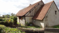
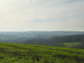
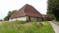
After setting off, take a quick look at the wash house. At the start of the Chemin des Borses on the right is a farmhouse typical of the region, complete with its own well. Walk back up to the site of the old castle. Along the way, you’ll discover some beautiful panoramic views of the valley, then of the hills of the Pays Fort. You’ll then head back down to La Notreure (or Notre-Heure) via the Femes des Bondonnières.

Details

n°18458359
Creation:
Last update:
Last review:
  • Walking
    Activity: Walking
  • ↔
    Distance: 5.57 mi
  • ◔
    Average duration: 2h 50 
  • ▲
    Difficulty: Easy

  • ⚐
    Back to start: Yes
  • ↗
    Ascent: + 269 ft
  • ↘
    Descent: - 246 ft

  • ▲
    Highest point: 830 ft
  • ▼
    Lowest point: 627 ft

Photos

Description of the walk

Start from the Place de l’Église in Cernoy-en-Berry.

(S/E) Walk down the Grande Rue, Route de Châtillon-sur-Loire.

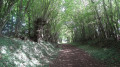
(1) After the small stone bridge, opposite the wash house, turn left then immediately right between the houses. Follow a shaded path for 1 km. You’ll reach the Colombier crossroads.

(2) Turn right straight away. Walk past the ruins of the Château de la Vaiserie and carry on until you reach the road.

(3) Turn right and walk carefully along the road for 1 km. The verge is wide; enjoy the view over the valley. Continue down the road

(4) After passing two farm driveways on the left further down, take a path between the hedges that winds sharply uphill to the left. Walk through the old Billotière farm. About 150 m further on, turn right onto the grassy path (a lovely view to the right).

(5) You’ll come to a road (another 180° view) and follow it to the left with care, facing oncoming traffic, for 300 m until you reach Chemin des Bonbonnières on the right.

(6) Follow this path, passing an old farmhouse, then a sheep farm which you’ll leave on your left. Carry on straight ahead, keeping the hedge on your right. Continue straight along this path for 700 metres. Then turn left and, 110 metres further on, turn right until you reach the road. (D153). Cross the road with care (there is no pedestrian crossing and visibility is poor). Head downhill opposite to the Notre-Heure ford.

(7) At the ford, turn right and continue for about 700 metres.

(8) Take the path leading uphill to the left and enjoy the lovely views of the village. Pass the old François farm on your left and join a road.

(9) Turn right and head downhill towards the village. You’ll come out onto the Grande Rue (D50); follow it to the right as far as the church

(S/E).

Waypoints

  1. S/E : mi 0 - alt. 630 ft - Église Saint-Martin (Cernoy-en-Berry)
  2. 1 : mi 0.16 - alt. 630 ft - Washing house
  3. 2 : mi 0.77 - alt. 659 ft - Colombier crossroads
  4. 3 : mi 0.97 - alt. 768 ft - D153
  5. 4 : mi 1.59 - alt. 709 ft - Start of the path
  6. 5 : mi 2.16 - alt. 801 ft - D50
  7. 6 : mi 2.67 - alt. 830 ft - Bellevue – Junction
  8. 7 : mi 4.14 - alt. 627 ft - Ford at the - Notreure (rivière)
  9. 8 : mi 4.58 - alt. 636 ft - Chemin de la Fontaine
  10. 9 : mi 5.02 - alt. 692 ft - Road junction. Towards the - Étang de la Ferrière (Cernoy-en-Berry)
  11. S/E : mi 5.57 - alt. 630 ft - Église Saint-Martin (Cernoy-en-Berry)

Notes

(8) Alternatively, you can go straight on past the Saint-Loup fountain to reach the village.

Reviews and comments

4.7 / 5
Based on 1 review

Reliability of the description
5 / 5
Ease of following the route
4 / 5
Route interest
5 / 5
Valeb
Valeb

Overall rating : 4.7 / 5

Date of your route : Jul 31, 2023
Reliability of the description : ★★★★★ Very good
Ease of following the route : ★★★★☆ Good
Route interest : ★★★★★ Very good
Very busy route : No

Take care at point 6: the village path runs to the right of the sheep farm’s yard, and the Labrador isn’t very friendly (though he won’t bite unless provoked). The path runs alongside the small pond and then past the agricultural equipment sheds. The house does indeed remain on your left. An extra yellow sign would be welcome, as you follow the B19 walk all the way, marked with yellow arrows.
A lovely walk apart from that unpleasant encounter with the dog.

Machine-translated

Other walks in the area

For more walks, use our search engine .

The GPS track and description are the property of this route's author. Please do not copy them without permission.