


 Country:

 City:
City:


By car from Saverne, on the D132 towards Lutzelbourg, just before the entrance to Stambach, turn left and cross the railway line. Continue along the forest road for 1.4 km to reach the Maisonnette de Pierres, where you can park during the day.
(S/E) Take the forest track to the left, following the ‘Red Saltire’ signposting towards the Haberacker Forest House.
(1) After 150 metres, leave the track and continue left, then right, following the ‘Red Saltire’ signposts. The slope is steep for about ten minutes, before levelling out considerably.
(2) After crossing the Schlossberg Forest Track, take the path on the right, still following the ‘Red Saltire’ signposts. The slope is gentle.
(3) You’ll reach a wide forest track, known as the Gibraltar track; follow it to the right for about fifteen minutes.
(4) Leave the forest track and turn left onto the path marked with a red saltire signpost.
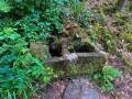
(5) After 30 metres, you’ll come to the Ottenad-Keller Fountain, the first point of interest on the walk. Continue up the gentle slope until you reach the wide Klappenfelsen Forest Track.
(6) Follow this track to the right for 250 metres towards the Haberacker Forest House.
(7) Turn diagonally left onto the path, which is still signposted with a Red Saltire.
(8) When you reach a wide track, take the path on the left towards the Krappenfels Pass, signposted with a Blue Ring.
(9) After 100 metres, turn left towards Ochsenstein Castle, following the Blue Rectangle markings, which you should follow until the end of the walk. The gradient increases but remains moderate.
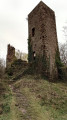
(10) You’ll reach Ochsenstein Castle, where you can stop for a while. Continue towards the Col du Krappenfels, following the Blue Rectangle markings. The path runs along the ridge and, just before the summit of the Schlossberg (a round sign on a tree to the right of the path), don’t hesitate to leave the path by turning left to reach a lovely viewpoint.
(11) Return to the path and continue leftwards towards the north. The path leaves the ridge and descends the left-hand slope of the Schlossberg to reach the Krappenfels Pass.
(13) At this wide crossroads, take the small path opposite, marked with a Blue Rectangle, which climbs towards the Krappenfels Rock. On the rock, walk about ten metres to the right and back to reach a bench.
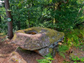
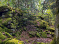
(14) A lovely view over the wooded hills and the Rocher de Dabo. Continue along the Wuestenberg Ridge Path. After a 20-minute walk, you’ll reach the remains of a pagan wall, and immediately afterwards, 20 metres to the left, the Pierre des Druides.
(15) Return to the path.
(16) Begin the descent down the eastern slope of the Wuestenberg, following a path still marked with Blue Rectangles.Pay close attention to changes in direction on the hairpin bends. After about forty minutes, you’ll arrive at the Jean-Louis Haemmerlin Fountain.
(17) Continue the descent to the Maisonnette de Pierres (S/E).
 Visorando Member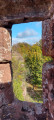

 Difficult
 Very difficult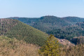
 Easy
Easy 
