The Peanut Circular in Stambach

An easy walk suitable for families. It’s a circular route with a short stretch through the heart of the forest.

Details

32976812
Creation:
Last update:
Last review:
  • Walking
    Activity: Walking
  • ↔
    Distance: 2.87 mi
  • ◔
    Average duration: 1h 40 
  • ▲
    Difficulty: Easy

  • ⚐
    Back to start: Yes
  • ↗
    Ascent: + 404 ft
  • ↘
    Descent: - 404 ft

  • ▲
    Highest point: 1,076 ft
  • ▼
    Lowest point: 673 ft

Description of the walk

Coming from Saverne, head towards Lutzelbourg (D132) until you reach the hamlet of Stambach. Then turn left onto the Baerembach forest road for 200 metres and park in the car park.

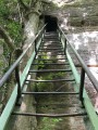
(S/E) With your back to the forest track, walk on for about twenty metres, then take the steps on the left leading to the path that runs alongside the road and the stream. Follow this path, which forms part of theGR®351.

(1) Carry on straight ahead until you reach the confluence of the two streams.

(2) Turn left, following the Langenthalbach, and walk for about 400 m.

(3) Turn left through the forest to join a path higher up. Follow it, turning left at the fork, and continue straight on until you reach a crossroads.

(4) Turn left and rejoin the path you took at the start.

(1) Turn right and retrace your steps along the route you took on the way there to return to the car park (S/E).

Waypoints

  1. S/E : mi 0 - alt. 673 ft - Car park
  2. 1 : mi 0.58 - alt. 755 ft - Crossroads of the circular loop
  3. 2 : mi 1.07 - alt. 810 ft - Confluent
  4. 3 : mi 1.33 - alt. 971 ft - Turn left
  5. 4 : mi 2.11 - alt. 899 ft - Crossroads
  6. S/E : mi 2.87 - alt. 673 ft - Car park

Notes

On the way there, you’ll find a stone shelter with a bench.

Worth a visit

There are several lovely streams nearby.

Always be cautious and plan ahead when you're outdoors. Visorando and the author of this route cannot be held responsible for any accidents occurring on this route.

The GR® and PR® markings are the intellectual property of the Fédération Française de Randonnée Pédestre.

Reviews and comments

3.6 / 5
Based on 4 reviews

Reliability of the description
3.5 / 5
Ease of following the route
3.3 / 5
Route interest
4 / 5
ChGrand
ChGrand

Overall rating : 2.7 / 5

Date of your route : Oct 19, 2025
Reliability of the description : ★★★☆☆ Average
Ease of following the route : ★★☆☆☆ Disappointing
Route interest : ★★★☆☆ Average
Very busy route : No

Everything was going well until point 3, where you turn to go back down. There, you are faced with a parish-specific to Brittany, parish-specific to Brittany, very steep climb in the forest, and it's not even a path anymore, so we gave up and turned back! This section is really tricky!
otherwise, the walk along the Baerenbach stream is very pleasant.

Machine-translated

Dom19
Dom19

Overall rating : 4.3 / 5

Date of your route : Jun 23, 2024
Reliability of the description : ★★★★☆ Good
Ease of following the route : ★★★★☆ Good
Route interest : ★★★★★ Very good
Very busy route : No

Interesting route but not up to date between point 3 and point 4 (logging work). Hence the tricky section if you follow the route. It would even become medium grade. But eventually you find your way back and all's well that ends well.

Machine-translated

LarissaB
LarissaB

Overall rating : 3 / 5

Date of your route : May 13, 2024
Reliability of the description : ★★★☆☆ Average
Ease of following the route : ★★★☆☆ Average
Route interest : Not used / Not applicable
Very busy route : No

We didn't manage to follow the route. I felt there was a lack of detail to help us find our way around the multitude of paths. That said, the area is very pretty with its streams.

Machine-translated

Martine Feg
Martine Feg

Overall rating : 4 / 5

Date of your route : Sep 08, 2023
Reliability of the description : ★★★★☆ Good
Ease of following the route : ★★★★☆ Good
Route interest : ★★★★☆ Good
Very busy route : No

pleasant walk in the forest, especially when the weather is hot nice path
but from "3" onwards, on the way up, there was forestry work and trees on the path
we turned back

Machine-translated

Other walks in the area

For more walks, use our search engine .

The GPS track and description are the property of this route's author. Please do not copy them without permission.