From the Penthièvre Isthmus to the Port Blanc Arch

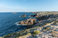
Walk along the coastal paths on the western side of the Quiberon Peninsula.

Details

4828835
Creation:
Last update:
Last review:
  • Walking
    Activity: Walking
  • ↔
    Distance: 5.80 mi
  • ◔
    Average duration: 2h 45 
  • ▲
    Difficulty: Moderate

  • ⚐
    Back to start: Yes
  • ↗
    Ascent: + 128 ft
  • ↘
    Descent: - 131 ft

  • ▲
    Highest point: 72 ft
  • ▼
    Lowest point: 7 ft

Description of the walk

Park in the Isthmus car park, on the left after the bar when coming from Plouharnel.

(S/E) At the far end of the car park, take the pedestrian crossing and follow the path between Fort Penthièvre and the railway line.
When you reach the level crossing, turn right towards the fort, then veer left to join the coastal path. Fort Penthièvre is still in active military use.

(1) Head left towards the beach and continue along the coastal path.

(2) Walk past Île Tilic, where a Celtic necropolis comprising 27 graves has been uncovered. The island is accessible at low tide. Continue straight on until you reach the small, sheltered harbour at Portivy.

(3) Return to the coastal path towards Fozo Beach.

(4) Walk along this beach, turn right onto the Route du Fozo, then rejoin the coastal path.

(5) Turn right to walk round the burial mound and reach Pointe de Beg en Aud.

(6) Continue round the burial mound and return to the junction.

(5) Take the path on the right to Pointe du Percho.

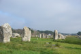
(7) Continue along the coast, passing close to the Port Blanc dolmens.

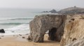
(8) Walk along the beach to the Port Blanc arch.

(9) Turn back.

(8) Turn right towards the Port Blanc Beach car park. Cross the car park, cross the coastal road and carry straight on along Rue de Beg en Aud.

(10) Look out for the small path on the left between the gardens to rejoin the outbound route after crossing the Route du Fozo.

(4) Follow the outbound route in the opposite direction to return to the car park (S/E).

Waypoints

  1. S/E : mi 0 - alt. 20 ft - Isthme car park - Gare de L'Isthme
  2. 1 : mi 0.38 - alt. 69 ft - Coastal path - Fort de Penthièvre
  3. 2 : mi 1.14 - alt. 26 ft - Thinic Island
  4. 3 : mi 1.45 - alt. 13 ft - Portivy Harbour
  5. 4 : mi 1.69 - alt. 30 ft - Foso Beach – junction of the circular loop
  6. 5 : mi 2.1 - alt. 43 ft - Beg en Aud junction
  7. 6 : mi 2.32 - alt. 49 ft - Tumulus de Beg en Aud
  8. 7 : mi 2.96 - alt. 69 ft - Pointe de Percho
  9. 8 : mi 3.2 - alt. 36 ft - Port Blanc Arch
  10. 9 : mi 3.45 - alt. 72 ft - Port-Blanc Arch
  11. 10 : mi 4 - alt. 33 ft - Path to the left
  12. S/E : mi 5.8 - alt. 20 ft - Isthme car park - Gare de L'Isthme

Notes

Red and white markings.

You can start the route at Portivy (3).

Worth a visit

(1) Fort Penthièvre was built in 1747 with funding from the Duke of Penthièvre. It has been listed as a historic monument since 1933 and is now used as a commando training centre; only the outdoor areas are accessible.

(2) Tilic Island was once an archaeological site. Excavations there uncovered a necropolis in which each body was found in a foetal position with few grave goods.

(3) Portivy Harbour is the only harbour on the Côte Sauvage. It is a 20th-century fishing harbour. Visitors can see the Chapel of Notre-Dame de Lotivy and the Lotivy Fountain

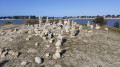
(6) The Beg en Aud Tumulus is 50 metres long and 5 metres high: it may be a Scandinavian tomb and served as a defensive embankment for the inhabitants of the headland.

Reviews and comments

4.5 / 5
Based on 2 reviews

Reliability of the description
4.5 / 5
Ease of following the route
4.5 / 5
Route interest
4.5 / 5
Bernes29
Bernes29

Overall rating : 4 / 5

Date of your route : Sep 12, 2025
Reliability of the description : ★★★★☆ Good
Ease of following the route : ★★★★☆ Good
Route interest : ★★★★☆ Good
Very busy route : No

Pleasant scenery
Easy hike

Machine-translated

D
D

Overall rating : 5 / 5

Date of your route : Mar 28, 2021
Reliability of the description : ★★★★★ Very good
Ease of following the route : ★★★★★ Very good
Route interest : ★★★★★ Very good
Very busy route : Yes

.

Machine-translated

Other walks in the area

For more walks, use our search engine .

The GPS track and description are the property of this route's author. Please do not copy them without permission.