Country:

 City:
City:


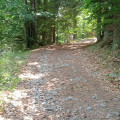
Drive past the Écomusée and park on the way down, before the bridge over the Trévezel, on the right, or, after the bridge, along the road.
The start is opposite the Térondel campsite. Yellow markings throughout.
(S/E) Take the path that winds its way across the road opposite the campsite. It is marked in yellow and the ‘Taillade’ signpost indicates ‘Col de Faubel 3.3 km’.
Winding gently along until you reach the water tower on the right.
(1) Keep to the left and continue along the Serre Long, which crosses the Ruisseau les Tauriers via a small bridge.
(2) At the fork in the road, turn right (the return route will come from the left).
(3) Continue uphill.
(4) Enter the Cévennes National Park and keep dogs on a lead. Continue to the next Fork in the road.
(5) Keep to the left and continue along the main path to the Col de Faubel, 1,285 m.
(6) Turn back.
(3) Take the right-hand branch and complete the descent to the bridge (S/E).

 Association / Club / Walk leader
 Moderate
 Visorando Member