


 Country:
 City:


Starting point and access: Guérard – La Celle-sur-Morin station.
- Transilien – Line P, on the section between Paris-Est and Coulommiers.
Take the only exit (single track).
Purple signposting
(S/E) On leaving the station, turn right, cross a small square and turn right onto a one-way street. At the T-junction, turn right and cross the bridge over the railway line. When the road bends to the right, cross it and climb a flight of steps. At the top, cross a road and continue along the path opposite.
(1) Turn immediately right at the corner of a wall (two branches of the PR® route split here) and follow a grassy path. After passing a shed on the right-hand side, continue along the tarmac road and cross the Grande Cour on the right-hand side.
(2) At the T-junction, first turn left then right onto Rue d’En Haut (signposted further on). At the Stop sign, go straight on and continue along Rue des Courbes. Turn right then left along this street and cross through the hamlet. Continue along a small road that slopes gently downwards.
Red and white + red and yellow + yellow + green markings
(3) Just before a small railway bridge, turn left between two railings and follow a shaded path running parallel to the railway line. Further on, move away from the railway line, ignore two faint paths branching off to the left, then turn right with the path. Continue along a track bordered by a fence on the right-hand side. Then head south. At a junction, go straight on, leave the woodland and walk alongside a field on your left. Enter the woodland again and walk on for a few dozen metres.
(4) Take the first path on the right and head downhill, skirting a meadow on your left. Cross the D20 with care and continue along the grassy path opposite. Cross a minor, less-busy road and follow the small road straight ahead to quickly reach the foot of a railway bridge.
No signposting
(5) Pass under the railway bridge (ignore the arrows indicating a left turn) and continue downhill along the small road. At a three-way junction, turn right onto Rue de la Fontaine. Pass Rue de la Ferme on your left and walk through a housing estate. At the junction, turn left onto Route de Tigeaux (D20). Shortly afterwards, turn left onto the (stony) Chemin de Villecoupée. Take the first path on the right and walk past the cemetery on your left.
(6) Cross the D20 carefully and follow Rue Jacob straight ahead. At the end, turn right. Shortly afterwards, take a first turn left then right to join a path reserved for pedestrians and cyclists. Pass a car park on your right and continue along a track between the houses. Cross a road and head up a grassy path, keeping the castle park wall on your right. After a zigzag formed by large boulders, you’ll reach a T-junction.
(7) Then head down a steep, stony path.
Red and white + red and yellow + yellow + mauve + green markings
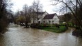
(8) At the bottom, turn sharply left onto the Chemin des Moulins and leave the Moulin de Prémol on your right. Turn right along the path to cross the Grand Morin via a footbridge. On the other side, go straight on into a woodland and pass under a medium-voltage power line.
Red and white + red and yellow + yellow markings
(9) At the crossroads, take the first path on the left, Rue de Prémol. At the Fork in the road shortly afterwards, veer left, leave the woodland, pass under the power line again and walk alongside a fenced meadow on your left. Continue along the edge of the woodland, then enter the woodland. Reach the Grand Morin and walk alongside it on your left.
(10) At the end of the path, cross a small road and first turn left then right onto the Chemin du Bord de l’Eau (gravel track). After the last house, continue along a dirt track and enter a woodland. Further on, leave the woodland, turn right with the path and continue between the fields.
Green signposting (rare)
(11) You’ll come out onto a small road; follow it to the left, slightly downhill. Pass the Rézy farm, go past a series of boulders and cross a bridge over the Grand Morin. On the other side, go straight on. Cross the D20 at the entrance to Tigeaux and continue straight ahead onto Rue des Meuniers.
(12) Take the first left, the Chemin de Fort à Faire, and head uphill. Turn left immediately onto the (grassy) Chemin du Grimpel. Pass a metal chicane and follow a path between hedges and garden fences. After a left-hand bend, you’ll reach a T-junction.
(13) Turn right here, pass house number 9 and continue along a footpath. Wind your way through the woodland and ignore a path on the right blocked by a wooden pole. Shortly afterwards, veer left and head down a steep slope. You’ll arrive at the bottom, at the foot of the war memorial and Tigeaux church.
(14) Then follow the D20 to the right for about 300 m, keeping to the wide pavement on the left.
(15) Just before a bus stop, turn right to cross the road at the pedestrian crossing and head up a one-way street.
Yellow signposting
(16) At the junction, cross the road and take the Chemin de Saint-Fiacre opposite. After No. 16bis, continue along a gravel track. After No. 18, continue along a stony path running alongside a field.
(17) At a crossroads, carry on straight ahead along a dirt track and enter a woodland. Walk due south. At the junction (elevation 87), carry on straight ahead. Leave the woodland, head downhill, cross a stream and climb slightly.
Red and white + red and yellow + yellow + mauve markings
(18) At the junction, take a stony path to the left. Pass a small shed on the right. Come out onto a small road and follow it to the right.
Markings: Red and Yellow + Blue + Mauve + Green
(19) Ignore a path branching off to the left and continue along the road. Pass under a railway viaduct, then note an old lime kiln on the left-hand side.
(20) Shortly afterwards, turn right, pass a hairpin bend and enter a woodland along a dirt track. After crossing a stream, the track widens. At a junction, carry straight on and follow a large meadow on your left at a distance. Pass a second chicane, walk past a small building on your left and continue below the station car park on your right. At the end, turn right twice to reach Mortcerf station (E).
To get back home:
- Transilien – Line P, towards Paris-Est (immediate access) or Coulommiers (take the footbridge).
 Visorando Member





 Association / Club / Walk leader

