Country:

 City:
City:


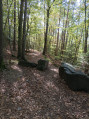
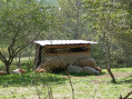
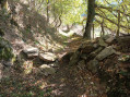
The car park is located at the bottom of the village, at the start of Route de Bordeaux, opposite the garden centre.
(S/E) Leave the car park on your left, heading towards the junction, and take Route du Col until you reach the entrance to the housing estate on the left. Take Chemin des Gardes and follow it to the end.
Turn right, ignore the Chemin du Crozet which appears immediately on your right, and stay on the Chemin des Fayes until number 915.
(1) Then take the path on the right. About 40 metres further on, take the grassy path on your right for about 700 metres; this path is somewhat sheltered, descending gently at first and more steeply through the forest. Continue to the junction with a larger dirt track.
Keep going straight on until the next junction
(2) Head up the exposed stony path to the left and continue to the crossroads.
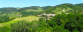
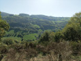
(3) Take the grassy path on your right, towards Montfort. This path offers lovely unobstructed views on both sides. At the end of the path (about 500 m), go down the stony path on the left to the T-junction in Montfort.
(4) Turn right and, at the end of the tarmac road, take the path on the right that runs alongside the greenhouse. Follow the grassy path straight ahead. At the next fork, ignore the flat path on the right and take the stony path with roots on the left. You will reach a T-junction.
(5) Stop descending, ignore the path on the right with a rock in front of it and take the ‘Sentier Pollinier Sentinelle’ path right at the far left. Pass between the three large rocks blocking the way for vehicles. You will see the remains of aqueducts marked out by stakes and string. You will come to a fork.
(6) Continue along the path on the right, which is a bit overgrown, with fallen trees to climb over. This part of the forest has a mysterious feel to it.
(7) Turn left, climb a little and veer left again. Follow the barbed wire fence and climb this rather steep path.
(8) At the junction marked by a signpost indicating an altitude of 710 m, head down to the right along the grassy path, which is easy despite a few rocks. You will see sheep and donkeys on your right. This path leads you to a road that descends (elevation 622 m). Cross the busy road with care to take the road opposite towards Chemin de l’Orjolle, then Haut de l’Orjolle at a crossroads, at elevation 615 m.
(9) Turn right and, at the right-hand bend at elevation 660, continue straight ahead along the path until you reach a Y-junction.
(10) Turn sharply right onto the path signposted ‘Croix Trouilloux 1.8 km’, which starts with a concrete kerb. Then follow the path to the left marked with the letter D. Follow the fence. At the manhole, take the path to the right, then climb up to the left over the large stones. Follow the arrow pointing right on the post. Once you reach the road, follow it for 90 m.
(11) Turn completely onto the path on the left and follow it for about 900 m. After a steeper climb, you will reach the cross-cut leading to the path below.
(12) Take the path on the left, in a hollow, descending between trees, the first of which on the right is marked with a red ‘10’. The path has a few stones and roots. Follow it down for several dozen metres until you see a fence; head towards it and follow it, climbing back up towards Duerne. Walk along this fence towards the village. Once on the road, head down to the left towards the car park (S/E).



 Visorando Member
 Easy
Easy 
 Difficult