Country:
 City:
City:


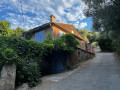
The route starts from the Camoins-les-Bains cemetery, located on Chemin du Maupas, where parking spaces are available.
(S/E) Follow this road to the end. Take the PR® path, which starts behind a small gate, and walk uphill for 150 m.
(1) Turn left and continue uphill. You’ll come out onto a track; carry on straight ahead until you reach a right-hand bend.
(2) Turn left onto a path that curves to the left and leads to a junction.
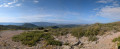
(3) Head left to reach a viewpoint overlooking Camoins.
(4) Return to the crossroads.
(3) Follow the track straight ahead up to the three-way junction.
(5) Carry on to the right; you’ll soon come out onto another track and turn right towards a private property.
(6) Take a well-signposted path on the left which climbs up the Vallon de Marcellin and leads to the Ferme d’Angèle. Continue straight on to reach the Col d’Aubignane.
(7) Take the path opposite, signposted “Baume du Plantier”, and walk for about 200 m.
(8) Turn right and head up the Vallon de Passe-Temps.
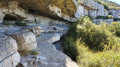
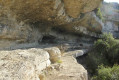
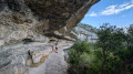
(9) At the junction, continue climbing to the right, following the sign for “Baume du Plantier”, until you reach the cave. Explore this cave, which is actually just a horizontal crevice – a lovely spot for a picnic in summer.
(10) Walk back a short way and climb up above the crevice, following the blue markings: you’ll need to use your hands. Once you reach the plateau, head down the track on the right.
(11) Leave this track and follow the path opposite, which serves as a shortcut by cutting across several hairpin bends. You’ll reach the Col d’Aubignagne.
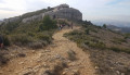
(7) Head straight down the main track towards Camoins, keeping the Barres Rocheuses du Saint-Esprit on your left. Follow this winding track for just under two kilometres.
(12) Head down the path on the right to rejoin the route you took on the way up.
(5) Carry on straight ahead.
(3) Pass the viewpoint on your right – which you’d already admired on the way up – and follow the outbound route in the opposite direction to the left to return to the car park near the cemetery (S/E).
 Visorando Member
 Easy
Easy 
 Difficult
  Association / Club / Walk leader