Le Garlaban via the Vallon des Piches in the footsteps of Marcel Pagnol

This is an exciting hike that combines the appeal of hiking with cultural interest. Throughout the circuit, you will discover the locations where Marcel Pagnol's works were filmed.
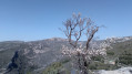
In addition, at the top of Garlaban, the view is breathtaking, with a 360° panorama of Marseille, the Mediterranean Sea and the beginning of the Côte d'Azur, as well as the surrounding landscape, including La Sainte-Victoire and the Sainte-Baume mountain range.

Details

n°4165878
Creation:
Last update:
Last review:
  • Walking
    Activity: Walking
  • ↔
    Distance: 7.70 mi
  • ◔
    Average duration: 5h 05 
  • ▲
    Difficulty: Moderate

  • ⚐
    Back to start: Yes
  • ↗
    Ascent: + 1,798 ft
  • ↘
    Descent: - 1,788 ft

  • ▲
    Highest point: 2,326 ft
  • ▼
    Lowest point: 906 ft

Photos

Description of the walk

(S/E) From the Puits de Raimu car park, take the road heading north towards Garlaban. After about 150 m, you will come to a T-junction. Turn left onto Chemin de la Font de Mai.

(1) Just after the crossroads, ignore the Puits de Raimu trail on your left and continue straight ahead. Pass in front of the Mas de Massacan (Ugolin's house in the film "Manon des Sources"). The road becomes a track that leads to a barrier. Go through it and head towards the Col d'Aubignane.

(2) At the crossroads just before the pass, leave the path on the left that leads to the Ferme d'Angèle, keep to the right and reach the Col d'Aubignane.

(3) Head towards Garlaban as indicated on the large triangular stone on the ground. Climb up the steepest path, avoiding the switchbacks used by mountain bikes.

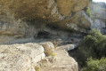
(4) On the climb, you will arrive at the rock carvings (around 80 in 2020, many of which are related to the work of Marcel Pagnol). Don't hesitate to take a detour along a small path on the left which leads to another group of carvings.
Return to the track and, when you reach a wide bend to the left near the Col de Garlaban, take the small path on the right.

(5) Take this path up to the summit and the Croix du Garlaban.

(6) Descend by the same route to the Col de Garlaban.

(5) From the pass, take thefirst track on the left of the one you took on the way up. This parallel track descends westwards into the Vallon des Piches.

(7) At the Pas Garrigue crossroads, continue downhill to the left. The path turns south-west and reaches a fork.

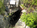
(8) Take the path on the left that leads to the Manon cave (or Baume du Plantier) featured in the film "Manon des Sources".

(9) Retrace your steps back to the crossroads.

(8) Back on the trail, continue downhill to the Col d'Aubignane.

(3) Find the path you took on the way there and descend to the crossroads with the Chemin de la Ferme d'Angèle.

(2) Follow the signs for Ferme d'Angèle on the right (ruins of the farm from the film "Angèle").
Continue along the Pierre Tchernia path, which leads to the rocky outcrops of Saint-Esprit, where the film "Regain" was shot. The arch represents the entrance to the village of Aubignane in the film. Pass under the arch and continue along the path that leads to the Croix de la Barre du Saint-Esprit and back.

(10) Retrace your steps along the Tchernia path and then at the crossroads at the start of the Ferme Angèle path.

(2) Return to the trail you started on and follow it back to the car park.

(1) Before returning to the car park, turn right onto the small path that leads to the Puits de Raimu (reconstruction). Continue along this same path to return to the car park (S/E).

Waypoints

  1. S/E : mi 0 - alt. 909 ft - Puits de Raimu car park
  2. 1 : mi 0.09 - alt. 909 ft - Chemin de la Font de Mai - Puits de Raimu
  3. 2 : mi 0.94 - alt. 1,047 ft - Keep to the right
  4. 3 : mi 1.01 - alt. 1,089 ft - Col d'Aubignane
  5. 4 : mi 2.1 - alt. 1,923 ft - Engraving site
  6. 5 : mi 2.77 - alt. 2,064 ft - Col de Garlaban (628m)
  7. 6 : mi 3.01 - alt. 2,326 ft - Croix du Garlaban - Garlaban
  8. 7 : mi 3.7 - alt. 1,795 ft - Pas Garrigue
  9. 8 : mi 4.29 - alt. 1,506 ft - Manon's Cave Trail
  10. 9 : mi 4.37 - alt. 1,585 ft - Grotte du Plantier ou Grotte de Manon
  11. 10 : mi 6.02 - alt. 1,243 ft - Cross of the Barre du Saint-Esprit
  12. S/E : mi 7.7 - alt. 909 ft - Puits de Raimu car park

Reviews and comments

4.7 / 5
Based on 44 reviews

Reliability of the description
4.7 / 5
Ease of following the route
4.7 / 5
Route interest
4.8 / 5
Fontenotte
Fontenotte

Overall rating : 4.7 / 5

Date of your route : Oct 22, 2026
Reliability of the description : ★★★★★ Very good
Ease of following the route : ★★★★☆ Good
Route interest : ★★★★★ Very good
Very busy route : No

All right. You just need to make sure you find the start of the route after coming down from Garlaban

Machine-translated

Patricia LeC.
Patricia LeC.

Actually, that was a bit of a slip-up on my part!

Machine-translated

bececoste
bececoste

Hello Patricia Le C.
Your comment does not relate to this walk; it refers instead to this one: “Mont Puget via the Aiguille Guillemin, returning via Cap Gros”.

Machine-translated

Patricia LeC.
Patricia LeC.

Overall rating : 5 / 5

Date of your route : Oct 19, 2026
Reliability of the description : ★★★★★ Very good
Ease of following the route : ★★★★★ Very good
Route interest : ★★★★★ Very good
Very busy route : No

A magnificent route to the highest point of the Calanques of Marseille.
The Aiguille Guillemin ridge walk is very pleasant, but you do have to lift your knees at times, which requires a bit of stamina. No vertigo and a sublime view over the Calanques of Morgiou and Sormiou!
The descent after the Col de la Candelle is a bit tricky; take care as it can be slippery.
For me, this is the most beautiful route to Mont Puget and the one to choose in this direction.

Machine-translated

P. Dollé
P. Dollé

Overall rating : 4.7 / 5

Date of your route : Oct 04, 2026
Reliability of the description : ★★★★★ Very good
Ease of following the route : ★★★★★ Very good
Route interest : ★★★★☆ Good
Very busy route : Yes

What’s more, we had the pleasure of meeting the artist behind the engravings; he’s a fascinating man.

Machine-translated

Claje
Claje

Overall rating : 5 / 5

Date of your route : Apr 13, 2026
Reliability of the description : ★★★★★ Very good
Ease of following the route : ★★★★★ Very good
Route interest : ★★★★★ Very good
Very busy route : Yes

A superb hike
Magnificent scenery
Very clear instructions
However, I found it difficult up to Garlaban

Machine-translated

Webfou
Webfou

Overall rating : 4.7 / 5

Date of your route : Jan 06, 2026
Reliability of the description : ★★★★☆ Good
Ease of following the route : ★★★★★ Very good
Route interest : ★★★★★ Very good
Very busy route : Yes

A beautiful hike, but it's longer than stated in the description.
The engravings are beautiful.
It's a shame about the weather at the cross, we couldn't see anything because of the mist.

Machine-translated

bernard coulomb
bernard coulomb

Overall rating : 5 / 5

Date of your route : Dec 13, 2025
Reliability of the description : Not used / Not applicable
Ease of following the route : ★★★★★ Very good
Route interest : ★★★★★ Very good
Very busy route : No

While the hike takes place in a stunning setting of wooded hills and ravines, discovering these dozens of engravings adds a touch of magic to the outing. A truly selfless act, the artist's generosity shines through in this work, which is personal yet resolutely attached to this recent part of Provençal culture. It is truly a magnificent gift that we enjoyed for a long time.
It reminds us of another hike, north of Toulon, where numerous rocks are engraved with ants, alone or in groups.

Machine-translated

FM83
FM83

Overall rating : 4.3 / 5

Date of your route : Dec 11, 2025
Reliability of the description : ★★★★☆ Good
Ease of following the route : ★★★★☆ Good
Route interest : ★★★★★ Very good
Very busy route : Yes

A very pleasant route with superb views.

Machine-translated

Narnar83
Narnar83

Overall rating : 4.7 / 5

Date of your route : Nov 11, 2025
Reliability of the description : ★★★★★ Very good
Ease of following the route : ★★★★★ Very good
Route interest : ★★★★☆ Good
Very busy route : Yes

A wonderful discovery concerning these engraved rocks. There were lots of people there on 11/11, the car park quickly filled up, we had to drive back down a little, arriving a little late from Toulon.

Machine-translated

User 4298750

Overall rating : 4.3 / 5

Date of your route : Oct 06, 2025
Reliability of the description : ★★★★☆ Good
Ease of following the route : ★★★★☆ Good
Route interest : ★★★★★ Very good
Very busy route : No

Everything was perfect. However, on the ground, the route is not well marked

Machine-translated

User 26056145

Overall rating : 2.7 / 5

Date of your route : Jun 16, 2025
Reliability of the description : ★★☆☆☆ Disappointing
Ease of following the route : ★★☆☆☆ Disappointing
Route interest : ★★★★☆ Good
Very busy route : No

The route is poorly signposted in its second section, after Angele's farm

Machine-translated

User 19928475

Overall rating : 5 / 5

Date of your route : Jun 08, 2025
Reliability of the description : ★★★★★ Very good
Ease of following the route : ★★★★★ Very good
Route interest : ★★★★★ Very good
Very busy route : No

A magnificent walk with majestic views of Marseille Bay and the Aubagne region (from Cap Canaille to the Lure mountain!) at the summit.
Please note that there is very little shade, so it is best to go very early in the morning or outside the hot season.
Good shoes are necessary as there are some very rocky sections.
Do not do the route in reverse as the return is much more pleasant going downhill than uphill.

Please note that a complaint has been lodged against the organisers because Emmanuelle Béart (young) was not present in Manon's cave.

Machine-translated

SDR83
SDR83

Overall rating : 5 / 5

Date of your route : May 18, 2025
Reliability of the description : ★★★★★ Very good
Ease of following the route : ★★★★★ Very good
Route interest : ★★★★★ Very good
Very busy route : Yes

A beautiful hike to do before the hot season, given the terrain, the stunning scenery and the lack of any particular difficulties. I highly recommend it!

Machine-translated

54olivier
54olivier

Overall rating : 5 / 5

Date of your route : May 10, 2025
Reliability of the description : ★★★★★ Very good
Ease of following the route : ★★★★★ Very good
Route interest : ★★★★★ Very good
Very busy route : Yes

Hello,
Very beautiful hike, with ideal weather for climbing. Compared to the original itinerary, we prefer to do the loop starting with the path that leads to the Manon cave (or Baume du Plantier) in the film "Manon des Sources" and then climb up the Vallon des Piches via the Pas Garrigue to reach the Garlaban with its 360° panorama. We had a wonderful encounter with Mr. Louis Douard, a remarkable author and storyteller who is passionate about local history and traditions. He is a fountain of knowledge about Giono, Pagnol and the films based on their stories: "Jofroi", "Angèle", "Regain" and "La Femme du boulanger".

Machine-translated

Other walks in the area

For more walks, use our search engine .

The GPS track and description are the property of this route's author. Please do not copy them without permission.