Country:
 City:
City:



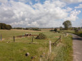
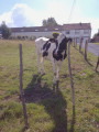
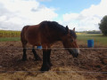
Park in the supermarket car park (though you can set off from any car park in Soignies and then join the route).
(S/E) From the indicated car park, head south, keeping to the left, until you reach Rue de la Senne, which you should follow to the right. Then, take Ruelle de l’Enfer on the right. When you reach Chaussée d’Enghien, turn left and then immediately right onto Chemin des Manettes.
(1) At the Chemin de l’Épinois, turn left, then take the first right onto the Chemin des Chevaux, which you should follow until you reach the Chemin du Tour. Head down this road to the left.
(2) Turn right onto the Chemin du Spodio to leave the town, and continue for about 1.4 km until you reach a junction with a road.
(3) Cross the road and head straight on for 300 metres until you reach a junction with another road (which does not appear on the maps due to the scale used).
(4) At the junction, cross the N524 and carry on straight ahead for about 1 km, until you reach the foot of the quarry.
(5) Continue straight ahead for approximately 1.3 km (Chaussée Notre-Dame de Louvigny), following the base of the quarry mound.
(6) Turn right and follow the track for just over 750 metres.
(7) At the end, turn right onto the road and follow it to the junction.
(8) Turn left, heading north, and continue to the first junction.
(9) Turn right and carry on to L’Ardoisier.
(10) Cross the N57 road and carry on straight ahead for about 500 metres.
(11) As you leave the hamlet, turn right and carry on to the junction.
(12) Turn left and continue for just over 300 metres.
(13) Turn right onto the road.
(14) Turn left onto Chemin d’Hubeaumel and follow it to the junction after the stream.
(15) Turn right, staying on Chemin d'Hubeaumel, and follow it for just under 200 metres.
(16) At the junction, turn left, staying on Chemin d’Hubeaumel, and continue to the N55.
(17) After crossing the road, carry on straight ahead for about 250 metres.
(18) Turn right, heading south, and continue for about 1.5 km, passing under the N57.
(19) In Biamont, turn left towards the Tour Saint-Vincent and follow the Chemin de la Couture to the end.
(20) Turn right and head down Chemin de la Guelenne to the car park at the supermarket (S/E).
 Visorando Member
 Difficult
 Easy
Easy 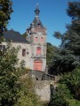

 Tourist office