From church to church, from Pélissanne to Salon-de-Provence

An easy walk from the church in Pélissane to Saint-Michel in Salon-de-Provence. The route passes several times along the Craponne Canals, the Pélissanne branch. As you climb the Coste, there’s a lovely view of Sainte-Victoire and the Pilon du Roi, the Salon-de-Provence airbase, with a section featuring fossilised shells. In the Valdegon, discover the terraced fields dating from the late 19th and early 20th centuries, below the Auberge de Sainte-Croix. After passing the Canal de Provence, the walk ends with a stroll through the town centre, taking in Salon-de-Provence Town Hall and the statue honouring Craponne, a benefactor of the Salon region.

Details

n°70013777
Creation:
Last update:
Last review:
  • Walking
    Activity: Walking
  • ↔
    Distance: 4.40 mi
  • ◔
    Average duration: 2h 15 
  • ▲
    Difficulty: Easy

  • ⚐
    Back to start: No
  • ↗
    Ascent: + 299 ft
  • ↘
    Descent: - 289 ft

  • ▲
    Highest point: 551 ft
  • ▼
    Lowest point: 259 ft
  • ⚐ Country: France
  • ⚐ City: Pélissanne (13330)
  • ⚑
    Start: N 43.629762° / E 5.148878°
  • ⚑
    End: N 43.640344° / E 5.098033°
  • ❏
    IGN map(s): Ref. 3143OT
  • Hour-by-hour weather

Description of the walk

Start from the car park beside the Touloubre, Place du Lavoir, Rue des Passadouires.

(S) With your back to the square, turn left onto the one-way street. At the end of Rue des Passadouires, cross the road and go under the archway opposite. Immediately afterwards, turn right (Rue de la Liberté), ignore the first right, and take the next right. Walk past the church until you reach its forecourt.

(1) Turn left and walk a few metres; with your back to the church, take Rue Foch, to the north-east of the square. Turn left at the first street (Chemin de la Petite Brulière), then right at the first street, Chemin de Saint-Pierre. Follow this road, go round a roundabout, and you’ll reach the oil mill at No. 445.

(2) Just past the mill, there is a car park from which you can see, at the far end by the gate, a system of three branches of the Canal de Craponne (Pélissanne branch). Carry on along Chemin de Saint-Pierre, then turn left onto Vieux Chemin de Lambesc à Salon. Before the small bridge crossing the canal, keep to the right onto Chemin de la Coste and, at the next fork, take the path on the right to begin the gentle climb up La Coste.

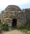
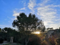
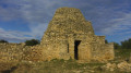
(3) Before the lovely countryside on the left, note the numerous fossilised shells (do not pick them up!). A lovely view of Sainte-Victoire, at the Salon air base, stretching past Sainte-Baume and the Pilon du Roi. Then pass the rocky outcrop by following the path to the right. Take in the terraces and shelters. Join a wider stony path, follow it to the left, then, after about a hundred metres, turn right onto the small path heading north. Soon after, turn left, heading north-west, and climb up to the viewpoint.

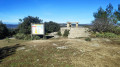
(4) A lovely view over Valdegon with its olive trees, terraces, an old well and, above, the Auberge de Sainte Croix. Then continue downhill and, at the bottom of the slope, turn left onto the path. Leave Valdegon, following the valley floor. At the three-way junction, keep to the right and head for the next junction (GR® Marseille Provence Métropole), running alongside the Coste.

(5) Beautiful panoramic view to the south. Turn right and follow the main track. After passing the remains of a quarry, join the tarmac road.

(6) Follow it to the right (Rue de la Coustelade) and enter the village. Walk past the care home on your right and arrive at a junction at the entrance to Salon-de-Provence.

(7) Carry on to the right (Route de Pélissane), cross the bridge over the motorway, then the one over the Canal de Provence. Head towards the town centre along Avenue du Maréchal Leclerc.

(8) At the roundabout, and again at the next one, carry on straight ahead until you reach the end of Avenue Roger Donnadieu. Cross the road and continue straight ahead towards Collège Viala Lacoste (Avenue Gaston Cabrier). Follow Rue Auguste Moutin until you reach Place de l’Hôtel de Ville, with its fountain dedicated to Craponne.

(9) Opposite the Town Hall, turn right, then pass under the medieval gateway featuring the Black Madonna on Rue Bourg Neuf, and head towards Saint-Michel Church, situated in the magnificent historic centre (E). 

Waypoints

  1. S : mi 0 - alt. 262 ft - Place du Lavoir, Rue des Passadouires - Touloubre (fleuve)
  2. 1 : mi 0.15 - alt. 269 ft - Church
  3. 2 : mi 0.69 - alt. 305 ft - Moulin des Costes
  4. 3 : mi 1.31 - alt. 387 ft - Fossils and beautiful views
  5. 4 : mi 1.84 - alt. 541 ft - A glimpse into the inner world of the Valdegon
  6. 5 : mi 2.37 - alt. 404 ft - Junction
  7. 6 : mi 2.95 - alt. 371 ft - Tarmac road
  8. 7 : mi 3.18 - alt. 381 ft - Crossroads
  9. 8 : mi 3.81 - alt. 341 ft - Roundabout
  10. 9 : mi 4.3 - alt. 269 ft - Town Hall Square
  11. E : mi 4.4 - alt. 262 ft - Saint-Michel Church - Gare de Salon

Notes

(S) Car parks are also available further east, towards the Post Office and the Stade de la Prouvenque, or just past the start point, immediately north of the Moulin des Costes.

(E) You can return from Salon-de-Provence by bus, with easy payment via the Métropole’s transport app. Libébus routes 4 and 8 are at the bottom of the list in the app. Please note: no services run on Sunday afternoons.

(8) You can turn left onto Rue André Marie Ampère to join the fitness trail for a short detour under the pine trees (tree-top adventure course).

(9) A fountain in honour of Craponne, whose network of canals enabled the creation of the Crau Verte, a treasure of the Salon region. Adam de Craponne, the man from Salon who diverted the River Durance.

Remember to take water with you (there are no water points once you’ve left Pélissanne), but all shops are available at the start of the walk.

Access to the woodland areas is restricted from mid-June to mid-September.

Worth a visit

Always be cautious and plan ahead when you're outdoors. Visorando and the author of this route cannot be held responsible for any accidents occurring on this route.

The GR® and PR® markings are the intellectual property of the Fédération Française de Randonnée Pédestre.

Reviews and comments

5 / 5
Based on 1 review

Reliability of the description
5 / 5
Ease of following the route
5 / 5
Route interest
5 / 5
ojeannot
ojeannot

Overall rating : 5 / 5

Date of your route : Mar 16, 2025
Reliability of the description : ★★★★★ Very good
Ease of following the route : ★★★★★ Very good
Route interest : ★★★★★ Very good
Very busy route : No

A lovely walk – it’s just a bit of a shame that it ends alongside a local road, but there’s no other way round it.

Just a quick note regarding the practical information: on Sunday mornings, there’s also bus route no. 7 (Salon Etang Cote Bleu, formerly Libébus) which runs between Salon and Pélissanne.

Machine-translated

Other walks in the area

For more walks, use our search engine .

The GPS track and description are the property of this route's author. Please do not copy them without permission.