Country:

 City:


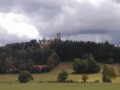
The walk starts from the car park situated below the medieval site in the village of Apcher.
(S/E) From the car park, head south-east along the road towards Prunières. At the fountain, keep left at the junction and continue out of the village.
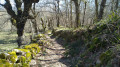
(1) Once past the last house on your right, take the path on the right which winds its way through the pastures. Ignore the successive paths on either side and continue until you reach a crossroads.
(2) Then turn left, following the yellowPR® signposts. The path descends to join a tarmac road.
(3) Follow this road to the right. Ignore the first path on the left, then the road leading to Fermus.
(4) 100 m further on, leave this road and take the wide track on the left instead. Continue in this direction towards the hamlet of Les Cayres.
(5) Before reaching the houses, beneath the high-voltage power line, leave this track and turn left. A grassy path for a few metres joins a stony track that runs alongside the high-voltage pylons (GTMC link signposted). This track, which is very rutted in places, leads downhill to the Cayres bridge, a very popular spot in summer for fishing and picnics.
(6) Cross the footbridge and head back up to the left along the single track.
(7) At the end of the track, continue straight ahead along the small tarmac road. Pass through the hamlet of Grazières-Menoux, then stay on this quiet road until you reach the next hamlet, Grazières-Mages.
(8) At the entrance to the hamlet, take the ford across a small stream and head for the signpost near theGR®65, which is none other than the Way of St James (S/E).

 Visorando Member
 Moderate