The hillsides of Pamiers and the banks of the Ariège

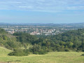
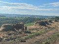
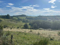
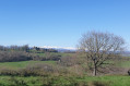
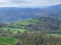
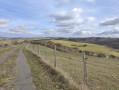
A very beautiful walk, despite the route being quite close to Pamiers town centre. You’ll soon find yourself out in the countryside, joining paths at the edge of the woods before heading deeper in. You then reach, via a lovely climb, a commanding view in both directions: a view of Pamiers and its surroundings, and then a view across the Piedmont towards the Pyrenees. Quite simply marvellous.

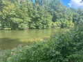
The route runs mainly along clean, unobstructed paths (bare earth without stones, which can be slippery in wet weather: two walking poles are therefore highly recommended). The sections on road (except at the end, where you must be very careful as it’s a very fast-flowing road with no pavement near the campsite) are almost like footpaths, so narrow are they and serving only a few isolated farms. All in all, a lovely discovery, as the route also runs alongside the Ariège, whose banks have recently been redeveloped.

Details

62822445
Creation:
Last update:
Last review:
  • Walking
    Activity: Walking
  • ↔
    Distance: 6.85 mi
  • ◔
    Average duration: 3h 40 
  • ▲
    Difficulty: Moderate

  • ⚐
    Back to start: Yes
  • ↗
    Ascent: + 591 ft
  • ↘
    Descent: - 594 ft

  • ▲
    Highest point: 1,371 ft
  • ▼
    Lowest point: 860 ft
  • ⚐ Country: France
  • ⚐ City: Pamiers (09100)
  • ⚑
    Start/End: N 43.122363° / E 1.604407°
  • ❏
    IGN map(s): Ref. 2146O
  • Hour-by-hour weather

Photos

Description of the walk

The starting point is in a large, well-maintained and shaded car park near the Salle du Jeu de Mail in Pamiers, along the D119.

(S/E) Follow Avenue du Jeu de Mail (D119) westwards, then turn right onto the large metal bridge (dating from 1895) which crosses the Ariège.

(1) As you come off the bridge, turn left, following the river. At a fork in the road, turn left. At the next junction, take a path on the left and follow the Ariège. Enter a wood and, further on, reach a fork in the road.

(2) Then veer left. You’ll come back to the Ariège and follow it on your left until you reach a junction just past an electricity substation.

(3) Then turn right at the hairpin bend. Follow a small road (Chemin du Rigail) through a residential area, ignoring all the side streets on the left.

(4) At the end of the residential area, turn left onto a steep, narrow path that climbs (the path is signposted as closed to motor vehicles). You can’t go wrong on this path, which climbs steeply and continuously (the old path shown on the IGN map is blocked by a ‘no entry’ sign). Carry on, heading west-north-west, to the highest point of the walk (at 416 m), and enjoy the view of Pamiers to your right.

(5) Continue along the path, which descends gently and remains very well marked, until it joins a tarmac road (electricity pylon on the right).

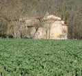
(6) Follow the road to the right, passing at the foot of the pylon. Continue along this small tarmac road for about 2 km and enjoy the beautiful view on your right (the Pyrenean foothills). This quiet little road passes through the hamlet of Puchauriol (a farm and an old building).

(7) As you come out of the left-hand bend, there is a wooden hiking sign pointing towards Pamiers: leave the road and take a path leading off to the right. This path, which descends, leads to a very large clearing.

(8) Then, at the far end on the right, take a clearly visible path that winds through the forest. It descends until it joins the D119.

(9) Cross the road carefully and continue straight ahead along a wide, well-maintained path. Pass under a high-voltage power line, rejoin the Arière stream and follow it on your left. Then walk between the stream and the D119. Next, turn off the road.

(10) At a blue pumping station, take a path leading off to the right. Join the D119 and follow it to the left, taking care (keep well to the left). Walk past the municipal campsite.

(1) Cross the metal bridge over the Ariège again, continue along the D119, and you’ll soon reach the starting point at the Salle du Jeu de Mail car park (S/E).

Waypoints

  1. S/E : mi 0 - alt. 896 ft - Car park: Salle du Jeu de Mail, Pamiers
  2. 1 : mi 0.19 - alt. 902 ft - Junction of the circular loop. Bridge over the - Ariège (rivière)
  3. 2 : mi 0.67 - alt. 1,020 ft - Fork in the road
  4. 3 : mi 1.37 - alt. 922 ft - Junction – Electrical substation
  5. 4 : mi 1.8 - alt. 915 ft - Start of the trail
  6. 5 : mi 2.3 - alt. 1,371 ft - Highest point of the walk
  7. 6 : mi 2.48 - alt. 1,332 ft - Pylon
  8. 7 : mi 3.95 - alt. 1,243 ft - Start of the forest track
  9. 8 : mi 4.36 - alt. 1,102 ft - Clearing
  10. 9 : mi 5.19 - alt. 863 ft - Crossing the D119
  11. 10 : mi 6.25 - alt. 876 ft - Blue pumping station
  12. S/E : mi 6.85 - alt. 896 ft - Car park: Salle du Jeu de Mail, Pamiers

Notes

Bring walking poles and bear in mind the 180 m elevation gain, which takes place over a good kilometre.

A high-visibility jacket may be useful to make yourself clearly visible to oncoming motorists on the fast road on the way back (take care over 500 metres!).

Reviews and comments

3.9 / 5
Based on 3 reviews

Reliability of the description
4.3 / 5
Ease of following the route
3.7 / 5
Route interest
3.7 / 5
User 19127319
• Edited:

Overall rating : 4 / 5

Date of your route : Jun 13, 2026
Reliability of the description : ★★★★☆ Good
Ease of following the route : ★★★★☆ Good
Route interest : ★★★★☆ Good
Very busy route : No

A really lovely walk – best avoided after a spell of rain.
Magnificent, unobstructed views and a pleasant walk through the woodland

Machine-translated

User 25460525

Overall rating : 4.3 / 5

Date of your route : Jun 15, 2026
Reliability of the description : ★★★★★ Very good
Ease of following the route : ★★★★☆ Good
Route interest : ★★★★☆ Good
Very busy route : No

A superb hike with views of Pamiers.
Best done in the morning in summer, with a section through the woods alongside the Ariège

Machine-translated

Est_
Est_

At point 10, on arrival, to avoid taking the county road, there is a path called ‘Le Chemin Derrière le Camping’. This runs alongside the Ariège … passing behind the campsite

Machine-translated

Latra
Latra

Overall rating : 3.3 / 5

Date of your route : Mar 02, 2025
Reliability of the description : ★★★★☆ Good
Ease of following the route : ★★★☆☆ Average
Route interest : ★★★☆☆ Average
Very busy route : No

At point two, you are directed onto a path that is impassable because it is muddy and littered with fallen trees; it should have been mentioned that you have to climb a slope. At point 10, there is no need to take the D119; simply continue along the path beside the Ariège, which leads directly to the metal bridge.

Machine-translated

Other walks in the area

For more walks, use our search engine .

The GPS track and description are the property of this route's author. Please do not copy them without permission.