The Water Trail in Saint-Amadou

A short circular route around Saint-Amadou with a focus on water.

Details

38336976
Creation:
Last update:
Last review:
  • Walking
    Activity: Walking
  • ↔
    Distance: 4.87 mi
  • ◔
    Average duration: 2h 25 
  • ▲
    Difficulty: Easy

  • ⚐
    Back to start: Yes
  • ↗
    Ascent: + 210 ft
  • ↘
    Descent: - 240 ft

  • ▲
    Highest point: 1,060 ft
  • ▼
    Lowest point: 863 ft

Description of the walk

The walk starts at the Saint-Amadou wash house, in the centre of the village. There is a car park right next to it.
Several walking routes are marked on a large sign next to the washhouse.

(S/E) Start by keeping the wash house on your left and walking down along the road. Then follow the ‘Dragonflies’ signposts (small signs featuring dragonflies).

(1) Turn left at the first dragonfly sign and you’ll find yourself with vegetable gardens on your right. The dragonfly signs don’t keep you on the path but lead you on a short detour to the left to see an old water channel. At the end of the small path, take the steps – this isn’t signposted – but at the top of the steps, be sure to turn left to stay on the ‘Libellules’ path. You’ll then rejoin the road to Ludiès and turn left to take some small steps leading up to a wide footpath. You must turn left at the top of these steps. After walking straight on for about 250 metres and passing a farm, you’ll reach a junction.

(2) Turn right, then immediately left to head back towards the woods. After the last house, continue along the clearly marked path which runs alongside meadows and fields, first turn right then left, and arrives at a hamlet called Le Py.

(3) You then walk through the small hamlet from one end to the other, whilst continuing to follow the signs featuring dragonflies. The path is dotted with educational panels. You come to a road which you follow to the right. After walking alongside the fields on your left, you reach a crossroads

(4) Turn left onto the road, then immediately afterwards turn right onto the small dirt track.
You then stay on this path, which, further on, runs slightly higher than the road to your right, until you reach the wash house in the small village of Fond Communal.

(5) The wash house is situated very slightly below the road; there is also a water reservoir further down. To continue along the path without cutting across the fields, you must then head back up to the road and follow the first path on the left.

(6) Further on, the path turns left. At the junction, turn right until you reach the next crossroads.

(7) Carry on straight on to Saint-Amadou; small signs featuring dragonflies are still visible.

(8) Turn left in Saint-Amadou and head back up towards the wash house (S/E).

Waypoints

  1. S/E : mi 0 - alt. 912 ft - Saint-Amadou washhouse
  2. 1 : mi 0.17 - alt. 879 ft - Walk through the vegetable gardens
  3. 2 : mi 0.57 - alt. 932 ft - Junction, turn right
  4. 3 : mi 1.26 - alt. 988 ft - Le Py hamlet
  5. 4 : mi 2.15 - alt. 955 ft - At the junction, turn left then right
  6. 5 : mi 3.15 - alt. 889 ft - Ancien L’avoir. Near the - Hers (rivière) à finaliser
  7. 6 : mi 3.78 - alt. 866 ft - Turn left
  8. 7 : mi 4.15 - alt. 873 ft - Straight ahead through the fields
  9. 8 : mi 4.77 - alt. 869 ft - Junction, turn left
  10. S/E : mi 4.87 - alt. 906 ft - Saint-Amadou washhouse

Notes

At the start of the route, next to the wash house, there is a public fountain with drinking water.
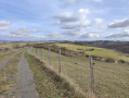
The route mainly follows woodland paths and small tracks, though a short section does run along a road.

Worth a visit

This walk is great fun. Throughout the route, you’ll find information about the Water Trail and its significance through the ages.

Reviews and comments

4.7 / 5
Based on 3 reviews

Reliability of the description
5 / 5
Ease of following the route
4.7 / 5
Route interest
4.3 / 5
jpv1950
jpv1950

Overall rating : 5 / 5

Date of your route : Aug 18, 2026
Reliability of the description : ★★★★★ Very good
Ease of following the route : ★★★★★ Very good
Route interest : ★★★★★ Very good
Very busy route : No

As described; the coolness of the streams is very pleasant during this hot spell

Machine-translated

RFC31500
RFC31500

Overall rating : 4.7 / 5

Date of your route : Sep 20, 2024
Reliability of the description : ★★★★★ Very good
Ease of following the route : ★★★★★ Very good
Route interest : ★★★★☆ Good
Very busy route : No

It was a good idea to create a route based on the theme of water, with plenty of information boards. It is also featured in the August–September 2024 issue of the magazine *L’Ariègeois*.
We went on this walk in rather unfavourable weather. The rain also decided to play its part in our exploration of the theme; the cloud cover meant we could only catch glimpses of the Pyrenees range from time to time.
One downside to note: the section between points 4 and 5 is on the D40. Whilst we were there, we encountered a lot of cars driving quite fast. It’s a real shame because, apart from that, the route is a pleasure to follow! The dragonflies also invite us to take a short detour, after point 5, to visit the pumping station on the River Hers.

Machine-translated

Fredemazeres
Fredemazeres

Overall rating : 4.3 / 5

Date of your route : Dec 04, 2023
Reliability of the description : ★★★★★ Very good
Ease of following the route : ★★★★☆ Good
Route interest : ★★★★☆ Good
Very busy route : No

A lovely walk, good paths...

Machine-translated

Other walks in the area

For more walks, use our search engine .

The GPS track and description are the property of this route's author. Please do not copy them without permission.