The Sillon de Bretagne circular at La Colle (Cordemais)

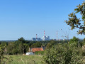
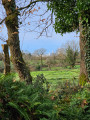
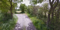
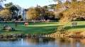
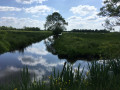
To begin with, this walk offers a unique view of the Cordemais power station. The walk then climbs higher and, thanks to a succession of sections along roads or on paths of varying degrees of wildness, offers numerous panoramic views of the countryside.

Details

39487110
Creation:
Last update:
Last review:
  • Walking
    Activity: Walking
  • ↔
    Distance: 7.60 mi
  • ◔
    Average duration: 3h 50 
  • ▲
    Difficulty: Moderate

  • ⚐
    Back to start: Yes
  • ↗
    Ascent: + 348 ft
  • ↘
    Descent: - 351 ft

  • ▲
    Highest point: 292 ft
  • ▼
    Lowest point: 66 ft
  • ⚐ Country: France
  • ⚐ City: Cordemais (44360)
  • ⚑
    Start/End: N 47.300984° / W 1.822849°
  • ❏
    IGN map(s): Ref. 1122SB, 1222SB, 1223SB
  • Hour-by-hour weather

Photos

Description of the walk

Park at La Colle car park.

GR®3+PR® Yellow

(S/E) From the car park, follow theGR®3(marked in white and red) alongside a local route (marked in yellow) for nearly 2 km. Cross three small roads, then the D49 (with care). You will then pass a junction signposted ‘Le Haut Gast’, marked with a cross, and finally arrive at a crossroads.

Unmarked

(1) Carry on straight ahead until you come to a small road, which you take to the left. Almost immediately, you will find, on your right, a junction where two paths meet: one, straight ahead, markedGR®3, and the other, at a right angle to the right, unmarked.

(2) Take this path, which climbs steeply. Continue to a small road.

(3) Follow this road straight ahead. Pass through La Borderie, La Gâtais and La Jannais-des-Montagnes. Shortly after this hamlet, you’ll find a path entrance on the right.

(4) Follow this path, which takes a wide bend to the right, then a right-angled bend to the left, before joining a path coming from the left. Turn right onto this new path until you reach a road.

(5) Turn right onto this road. Walk through La Close Neuve until you reach a path entrance on the left, just past a beautiful house.

(6) Follow this track and pass the Mâtais straight ahead to reach a road.

Yellow markings

(7) Turn left onto this road to reach Haute Moissonnais. Continue until you reach a path entrance on the left, marked with a cross.

(8) Take this path leading to Les Perrouchais. It makes a sharp turn to the right, then joins the D19. Cross the road carefully and continue along the path opposite. Carry on until you reach a path coming from the left.

(9) Turn right onto this path, then left at the first Fork in the road. The path takes a wide bend to the right and leads you to a road.

(10) Turn left onto this road to head towards La Gentais. At the entrance to the hamlet, turn right onto the first track you come to. Then take the track on the left as the road curves to the right. A short straight stretch leads you to a road.

(11) Take this road on the right. Just before La Violais, you’ll find a path entrance on the left.

(12) Turn left onto this track. After a fairly sharp right-hand bend, the track descends for some distance to a right-angled left-hand bend. The track then climbs back up to a road.

(13) Turn right onto this road, heading towards La Primaudière. Continue until you reach a road on the right

GR®3

(14) Follow this road, which turns into a path. After crossing a stream, you’ll reach a Fork in the road.

(15) Take the path on the left and immediately cross a ford. The path begins to descend quite steeply and leads you to a footbridge over the stream. A fairly steep climb takes you back to La Colle, where you simply need to find your way back to the car park (S/E).


Waypoints

  1. S/E : mi 0 - alt. 138 ft - La Colle car park
  2. 1 : mi 1.2 - alt. 89 ft - Crossroads (start of alternative route)
  3. 2 : mi 1.38 - alt. 98 ft - Junction
  4. 3 : mi 1.78 - alt. 194 ft - Route (cross)
  5. 4 : mi 2.46 - alt. 236 ft - Path after Jannais des Montagnes
  6. 5 : mi 2.91 - alt. 266 ft - Road junction
  7. 6 : mi 3.11 - alt. 256 ft - Fork in the path
  8. 7 : mi 3.59 - alt. 253 ft - Junction with the yellow-marked route
  9. 8 : mi 3.96 - alt. 272 ft - La Haute Moissonnais
  10. 9 : mi 4.4 - alt. 289 ft - Crossroads
  11. 10 : mi 4.84 - alt. 272 ft - Road junction
  12. 11 : mi 5.24 - alt. 249 ft - Road junction
  13. 12 : mi 5.42 - alt. 236 ft - Fork in the path
  14. 13 : mi 6.51 - alt. 233 ft - Road junction
  15. 14 : mi 6.67 - alt. 207 ft - Route (GR°°®°°3)
  16. 15 : mi 7.26 - alt. 79 ft - Fork in the road
  17. S/E : mi 7.6 - alt. 138 ft - La Colle car park

Notes

  • La Colle car park

From Cordemais, head towards the Temple de Bretagne for 3 km. At the La Croix-Morzet crossroads, turn right onto the middle road and follow it for 1.5 km.

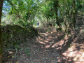
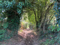
  • In wet weather, some sections may be muddy or slippery, particularly between points (12) and (13) or (14) and (15)

Please ensure you are suitably equipped.

Worth a visit

(1) Alternative route: you’ll find signposts to the right marked ‘Route du Sillon’. If you follow these signposts, you’ll take a shorter route with less tarmac. You’ll rejoin the suggested walk towards La Gâtais at point (7).

Always be cautious and plan ahead when you're outdoors. Visorando and the author of this route cannot be held responsible for any accidents occurring on this route.

The GR® and PR® markings are the intellectual property of the Fédération Française de Randonnée Pédestre.

Reviews and comments

4.5 / 5
Based on 2 reviews

Reliability of the description
4.5 / 5
Ease of following the route
4.5 / 5
Route interest
4.5 / 5
JEAN CLAUDE FOR*
JEAN CLAUDE FOR*

Overall rating : 4 / 5

Date of your route : Nov 24, 2025
Reliability of the description : ★★★★☆ Good
Ease of following the route : ★★★★☆ Good
Route interest : ★★★★☆ Good
Very busy route : No

smooth journey

Machine-translated

pip4422
pip4422

Overall rating : 5 / 5

Date of your route : Apr 23, 2024
Reliability of the description : ★★★★★ Very good
Ease of following the route : ★★★★★ Very good
Route interest : ★★★★★ Very good
Very busy route : No

A superb walk along the Sillon de Bretagne between the Loire Valley and the plateau, through pastures and wooded valleys.
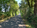
Lovely, easily walkable paths with very little tarmac. We only came across a group of walkers on the GR3.

Machine-translated

Other walks in the area

For more walks, use our search engine .

The GPS track and description are the property of this route's author. Please do not copy them without permission.