Country:
 City:


Canadian Memorial at Neuville-Saint-Vaast: walkers are asked to use the car park behind the trenches, on the D55 (Canadian Road).
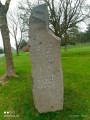
(S/E) On leaving the car park, turn right, then right again, and take the service road off the D55. Walk past the imposing Canadian memorial and the small Moroccan memorial and carry on straight ahead.
(2) Before you reach the stadium and the stables, cross the road very carefully and take the small path that runs alongside the stables on the left. Further on, you’ll pass a small Canadian cemetery.
(3) About fifty metres before the A26 bridge, take the path on the right to run alongside the motorway for about 1 km.
(4) Take the sharp right-hand bend in the path. Continue to the “Henri Barbusse – The Pimple” memorial.
(5) Turn left to head down towards Givenchy-en-Gohelle, which you’ll reach via Rue Pasteur.
(6) Turn left onto Rue Marcel Sembat, then left again onto Rue Montesquieu. Turn right straight away onto Rue Victor Hugo, which continues as a footpath.
(7) Go through the gate on the left (narrow footpath) and enter the Bois des Bruyères.
(8) At the junction, keep to the right, then keep right again about fifty metres further on, ignoring the path that branches off to the left. Continue along the grassy path, which quickly widens: there are sections with wooden duckboards and steps. Then turn right to leave the woods, go through a gate and enter Givenchy.
(9) Carry on to the right along Rue Léon Degréaux, then right again onto Rue Arthur Lamendin. At the next junction, before the bus stop, turn left down Rue Jean-Jacques Rousseau.
(10) Turn right onto Rue Jean Jaurès and cross the road. Pass a cul-de-sac and two carriage gates and, immediately afterwards, take the narrow alleyway on the left. Walk past the Jacques Prévert nursery school, come out onto Rue de l’Égalité and follow it to the right until you reach Rue de la République.
(11) Turn left, walk past the church, ignoring Rue Jules Ferry on your right. Take the next right onto Rue du 11 Novembre, walk down Rue Florent Evrard on the left, then, at the bottom, turn right onto Rue Pierre Curie, which leads up a path towards the memorial. Keep to the right, ignoring the path on the left.
(1) Cross the car park and enter the memorial park, which is on Canadian territory.
(12) Take a round trip to the monument: from the terrace, there is a lovely view over the mining basin and, on a clear day, as far as the Flanders Mountains.
(13) Return to the road that runs round the monument and follow it to the left.
(14) Take the small, winding path on the right to enter the State Forest. Follow the Route Forestière du Train de Loos, a route commemorating Canadian soldiers. Turn right before reaching the N17.
(15) Pass the access to the footbridge over the N17 on your left and continue straight on to rejoin the Canadian route. Follow the side lane to the starting car park (S/E).

 Visorando Member

 Easy

 Difficult
 Association / Club / Walk leader