


Refine your search for walks in Coo bassin inférieur
Coo bassin inférieur walks


 Over hill and dale around Trois-Ponts
 Visorando Member
 10.97 mi
 +1,683 ft
 -1,703 ft
 6h 30
6h 30
 Difficult
 Departure from Trois-Ponts (Province de Liège)
The surroundings of Trois-Ponts and Coo are mainly forested, with paths and trails running through coniferous and deciduous trees. The rugged terrain highlights the panoramic views of the Ardennes and promises a sometimes very challenging route. In the heart of nature, the route connects with the site of Coo and its lower lake before returning to Trois-Ponts, again mainly through the woods.
Walks near Coo bassin inférieur
Trois-Ponts - Vielsalm
 12.67 mi
+1,788 ft
-1,444 ft
7h 25
Difficult
Departure from Trois-Ponts (Province de Liège)
12.67 mi
+1,788 ft
-1,444 ft
7h 25
Difficult
Departure from Trois-Ponts (Province de Liège)
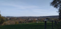
La Salm Valley, whose real name is Le Glain
This stage ofthe GRP®571leaves the Amblève Valley and heads up the slopes of the La Salm Valley, known as Le Glain. The route changes banks several times until it reaches Vielsalm in the Pays des Macralles.
Stoumont - Trois-Ponts
 12.22 mi
+2,034 ft
-2,290 ft
7h 25
Difficult
Departure from Stoumont (Province de Liège)
12.22 mi
+2,034 ft
-2,290 ft
7h 25
Difficult
Departure from Stoumont (Province de Liège)
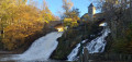
Amblève Valley
This stage ofthe GRP® 571 starts in Stoumont, passes in front of Froidcourt Castle and crosses the Amblève in Cheneux. The route then descends towards the Coo waterfall, crosses the river again and reaches Trois-Ponts via the Belvédère de Ster.
Vielsalm - Gouvy
 10.65 mi
+1,572 ft
-1,237 ft
6h 15
10.65 mi
+1,572 ft
-1,237 ft
6h 15
 Moderate
Departure from Vielsalm (Province de Luxembourg)
Moderate
Departure from Vielsalm (Province de Luxembourg)
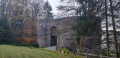
La Salm Valley, known as Le Glain
This stage ofthe GRP®571starts in Vielsalm in the Pays des Macralles, crosses the river at Salmchâteau and enters the Deux Ourthes Nature Park, heading towards the Ardennes plateau and Gouvy.
From Vielsalm station to Trois-Ponts station
11.33 mi
+1,440 ft
-1,765 ft
6h 30
Difficult
Departure from Vielsalm (Province de Luxembourg)
This Ardennes walk stretches across the heights of the left bank of the Salm. Set mainly in woodland, it offers magnificent views of the region. Relatively far from road traffic, it is a walk that rejuvenates body and mind through its tranquillity and the fresh air that is ever-present. The charming village of Goronne, the tranquillity of the Domaine de Farnières and the hamlet of Bergeval are much-loved stops along the way.
Remouchamps - Stoumont
 10.35 mi
+2,077 ft
-1,444 ft
6h 35
Moderate
Departure from Aywaille (Province de Liège)
10.35 mi
+2,077 ft
-1,444 ft
6h 35
Moderate
Departure from Aywaille (Province de Liège)
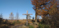
This stage ofthe GRP® 571 starts in Remouchamps, passes through Sedoz and Fonds de Quarreux close to the Amblève, follows the Chefna stream to the border of the Sources Nature Park and descends into the valley to finish in Stoumont.
Rodt Sank Vith – Losheimergraben
 16.19 mi
+994 ft
-459 ft
8h 20
16.19 mi
+994 ft
-459 ft
8h 20
 Very difficult
Departure from Sankt Vith (Province de Liège)
Very difficult
Departure from Sankt Vith (Province de Liège)
On this twenty-third stage, we’ll head to the German border – the easternmost point of my tour of Wallonia – as the village of Losheimergraben lies on the border. In reality, it isn’t really a village but rather a hamlet that’s ideal as a starting point for hikes or cross-country skiing trips. So you’ll have no trouble finding somewhere to stay there. The lowest point on the route is at an altitude of 500 m, and the highest at 682 m. We are therefore in the highest region of Belgium, to some extent. The first third of the day is spent in the countryside, and the rest in the woods.