


Refine your search for walks in Coll de la Descarga 1400m)
Coll de la Descarga 1400m) walks


 Torre de Batera from El Molinot
 Visorando Member
 10.63 mi
 +3,576 ft
 -3,563 ft
 7 hrs
7 hrs
 Very difficult
 Departure from Arles-sur-Tech (Pyrénées-Orientales)
A very beautiful hike offering access to the Batère Tower via a little-known path.Discover the Jacouty Station, the Dolmen, the Palet de Rotllan, the Coll Bufador, the Torre de Batera, the Coll de la Descarga and the Refuge des Vigourats.This hike is classified as very difficult because, although it is largely signposted, it requires a good sense of direction and observation skills during part of the ascent.
The Iron Trail – Pinosa and Batera Mines from Coll Palomeres
 10.24 mi
+2,507 ft
-2,546 ft
6h 55
10.24 mi
+2,507 ft
-2,546 ft
6h 55
 Difficult
Departure from La Bastide (Pyrénées-Orientales)
Difficult
Departure from La Bastide (Pyrénées-Orientales)
A lovely walk exploring the mining history of the Vallespir. A long railway line once ran here at an altitude of 1,200 metres.A good sense of direction and the GPX track may prove useful in some places: there are many crossroads and junctions. Allow around 7 hours to enjoy these surroundings.Please stay on the marked and safe paths.It’s easy to imagine what working conditions must have been like; winters weren’t always as mild as they are today.Some truly beautiful scenery.
Coll Palomeres to Puig de l’Estella via Menerots, Torre and Batera Mountain Hut
 10.06 mi
+2,707 ft
-2,684 ft
7h 00
Difficult
Departure from La Bastide (Pyrénées-Orientales)
10.06 mi
+2,707 ft
-2,684 ft
7h 00
Difficult
Departure from La Bastide (Pyrénées-Orientales)
The route consists of two circular loops. This hike can therefore be adapted as desired. However, it would be a shame not to complete the whole route. Discover an old railway line used for iron ore extraction at an altitude of 1,200 metres, former stations on this line, old iron mines, tunnels, a signal tower, a superb ridge, a summit, a mountain hut, and much more.
A good sense of direction and following the GPX track will be very useful.
Walks near Coll de la Descarga 1400m)
From the Batère Refuge to the Sant-Guillem Refuge
 10.44 mi
+3,346 ft
-3,898 ft
7h 45
Difficult
Departure from Corsavy (Pyrénées-Orientales)
10.44 mi
+3,346 ft
-3,898 ft
7h 45
Difficult
Departure from Corsavy (Pyrénées-Orientales)
Second stage of the clockwise Tour du Canigou in 8 days.A fairly long hike that starts with a descent.This route follows old paths connecting pastures and valleys.
Pic du Canigou - Los Masos at the Refuge des Cortalets
4.01 mi
+3,825 ft
-157 ft
5h 10
Difficult
Departure from Valmanya (Pyrénées-Orientales)
First stage of this two-day route around Pic du Canigou.
Refuge Sant Guillem - Chemin d'els Troncassers - Puig Sarraïns - La Llau
 9.33 mi
+1,847 ft
-3,104 ft
5h 55
9.33 mi
+1,847 ft
-3,104 ft
5h 55
 Average
Departure from Le Tech (Pyrénées-Orientales)
Average
Departure from Le Tech (Pyrénées-Orientales)
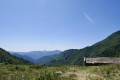
Second day of: Two days of discovery at the Sant Guillem Refuge, from the Sant Guillem Refuge.Between (8) and (12), a GPX track is strongly recommended or a very good sense of direction, despite the signposting and cairns being in very good condition. Observed at the end of July 2023.Coll de Serre Vernet via a magnificent balcony path in very good condition. The same applies to Puig dels Sarraïns.Return to the refuge via a beautiful path, then pleasant tracks through the woods.After a break at the refuge, return to the car park at La Llau via the usual route.
Sant Guillem to Prats-de-Mollo via Serre Vernet - Comella - Lloses - Miracle
9.45 mi
+1,775 ft
-3,609 ft
5h 55
Average
Departure from Le Tech (Pyrénées-Orientales)
Thissecond stage, almost entirely in the forest, is therefore possible in summer, setting off early.Discovery hike along marked paths, little or not used, requiring a sense of direction and the GPX track. Beautiful places to stop and enjoy the scenery.
The Sant Guillem refuge via the Coll de la Rua - La Soca - l'Estanyol
 9.23 mi
+3,323 ft
-2,041 ft
7h 10
Difficult
Departure from Le Tech (Pyrénées-Orientales)
9.23 mi
+3,323 ft
-2,041 ft
7h 10
Difficult
Departure from Le Tech (Pyrénées-Orientales)
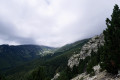
First day of: Two days exploring the Sant Guillem Refuge, including the ascent to the Sant Guillem Refuge.Do not underestimate this day. The estimated time is accurate.From the La Llau hikers’ car park, head up to the Coll de la Rua.Continue along a narrow grassy track to the shelter and the Font del Brigadier.Then climb up a very steep path to La Soca.Then head for the Coll de l’Estanyol.Further on, begin a lovely descent to the Sant Guillem Refuge.Vast landscapes on this first day of your exploratory hike.
⚠️ Warning: observed on 3 September 2026 => The track from Coll de la Rua (3) to the Abri del Brigader (4) has not been cleared. Following a series of storms, a large number of fir trees are completely blocking the track as soon as you enter the forest. => This section cannot be completed until further notice. This section from (3) can be adapted by using one of my walks: The Sant-Guillem Refuge via Coll de Rua – Cortal d’Allosat from La Llau
Cortalets – Fillols
 5.02 mi
+59 ft
-4,603 ft
2h 20
Average
Departure from Taurinya (Pyrénées-Orientales)
5.02 mi
+59 ft
-4,603 ft
2h 20
Average
Departure from Taurinya (Pyrénées-Orientales)
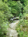
The fifth and final stage takes you to the village of Fillols.
Pic du Canigou - From the Cortalets Refuge to Los Masos
9.58 mi
+2,595 ft
-6,257 ft
6h 40
Difficult
Departure from Taurinya (Pyrénées-Orientales)
This is the continuation of the Pic du Canigou - Los Masos hike from the Refuge des Cortalets. It passes through the Crêtes du Barbet, the Portella de Vallmanya, the Brèche Durier, the Pic del Canigó, the Refuge des Cortalets and ends at Los Masos.
Pass through the chimney as the yellow markings have been erased - path closed (not recommended).
See practical information below.
From Cortalets to Mariailles via the Barbet ridges and the Moura hut
 9.11 mi
+3,209 ft
-4,692 ft
7h 00
Difficult
Departure from Taurinya (Pyrénées-Orientales)
9.11 mi
+3,209 ft
-4,692 ft
7h 00
Difficult
Departure from Taurinya (Pyrénées-Orientales)
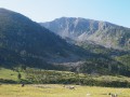
Variation of a mountain stage that is part of theGR®®36.This way of connecting the two refuges allows you to avoid the crowds. The path from the Cabane de Moura to Coll del Cavall Mort is quite challenging.Read practical information in case of bad weather.
Refuge des Cortalets - Refuge de Mariailles via Canigou
 8.50 mi
+2,425 ft
-3,832 ft
6h 00
Difficult
Departure from Taurinya (Pyrénées-Orientales)
8.50 mi
+2,425 ft
-3,832 ft
6h 00
Difficult
Departure from Taurinya (Pyrénées-Orientales)
This day is devoted to the ascent of Pic du Canigou from the Refuge des Cortalets, and the descent via the chimney to the Refuge Arago, then to Mariailles, the starting point of the hike.
Refuge des Cortalets - Casteil
 7.77 mi
+899 ft
-5,292 ft
4h 20
Difficult
Departure from Taurinya (Pyrénées-Orientales)
7.77 mi
+899 ft
-5,292 ft
4h 20
Difficult
Departure from Taurinya (Pyrénées-Orientales)
Third stage of the Three Days on the Canigou.A very pleasant return to the starting point of this three-day trek via old, little-used paths.This hike is classified as difficult as it involves a 1,650-metre descent, with a steep gradient over just over two kilometres. Allow at least five hours for the walk.