


 Country:

 City:
City:


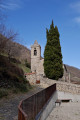
Coming from Perpignan, turn left at the Vinça reservoir and follow the road signs for Valmanya. Park on Carrer de la Terrera near the Roc de l'Ours stopover lodge. Please ensure you do not obstruct traffic. There is a new car park at the junction of the D13 and D13d (LIO bus stop).
The route is signposted, except between the GR®36 (2) and Cortal del Solà (3), where the markings are of different colours. A GPX track may be necessary for this route.
White and red markings of the GR®36, towards Baillestavy
(S/E) Head due north along the road, keeping the cemetery on your left. At the end of the road, continue along the path, passing a fountain and its water retention basin. After a ruined farmhouse on the left, you’ll soon reach a fork at the 875m mark. Ignore the yellow-marked path heading straight ahead.
(1) Continue climbing steeply to the left along the GR®36, which then heads due west across open ground at the edge of the forest. Enter the forest again, cross an electric fence and turn due north for a few metres.
Take care. Very soon, look out for a small rock on the left and an old wooden sign pointing to Baillestavy (do not follow this direction).
Off the marked trail
(2) Leave the GR®36 and head up to the left, into the forest, heading south-west, along a well-marked path. You’ll soon come out at a bend in a track by an electric fence; cross it between the two wooden posts.
Yellow markings
(3) Pass the ruins of the old Cortal de Solà on your right and continue along the track which climbs gently. Pass an underground fire-fighting tank (D.F.C.I.531) on your left, and eventually reach a sharp bend to the right of this track at an elevation of 1212 metres.
(4) Head up to the right, due north, along a steep path with a sharp gradient through a well-cleared grazing area (February 2022). You’ll reach a grassy area at the edge of the forest. A lovely, open spot.
(5) Take care. Head left, due west, climbing again. I have reinforced a few cairns.
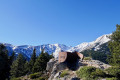
Pass through a recent steel gate. Very beautiful view. Continue climbing along a stony path. Return to the forest and follow the path, which is very well marked on the ground. The path turns north-west, remaining almost flat. This leads to a clearly marked fork in the forest at around 1,445 m. Three wooden signs fixed to the trees.
Yellow markings and old red and white markings for the GR®36 variant towards the Refuge des Cortalets.
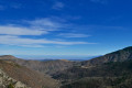
(6) Continue left towards Ras de Prat Cabrera, initially on level ground for about a hundred metres, then continue up a steep climb with numerous hairpin bends and emerge from the forest at an elevation of 1,663 m. Stunning views.
In the event of snow and without equipment => you must turn back as the path is now on a slope for 250 m.
(7) Continue carefully south-west, climbing the sloping path and then along the ridge. The path then veers slightly to the right, staying below the ridge on the left-hand side. Descend and reach a fork (signpost).
(8) Head fully left towards the viewpoint (landscaped viewing point).
(9) Turn back to the fork you passed earlier.
(8) Continue south along the downhill path. You will reach an area with a gap in the fence and signposts. This brings you back to the junction with the current route of the GR®36.
Please note that, if necessary, it is possible to head straight down to the left into the woods.
Red and white markings of the GR®36
(10) Leave the section of the GR®36 on your left, which will be the return route. Continue south-west on the GR®36 and join a wide track further down. Follow it to the left.
(11) At the right-hand bend (beautiful view), head up to the left (south-west) along the GR®36 towards Ras de Prat Cabrera (shaded goat pasture). You’ll soon reach this lovely spot. A lunch break is recommended here. Junction with GRP® – GR®10 and GR®10 variant.
(12) Turn back and rejoin the wide track.
(11) Continue along it to the right, in the opposite direction to the outward journey. Further on, at a Fork in the road, head up to the right (still on the GR®36) and you’ll soon reach the junction you passed on the way out.
(10) Turn right onto the GR®36, descending rapidly into the Bosc de Patriques. Take care. The descent is steep*, so take your time.
(13) At around 1,380 m, a path on the right leads to a viewpoint via a short round trip. Take care: there is a vertiginous drop. A very beautiful view. Turn back.
(13) Return to the GR®36 and continue the descent to the right. Much further down, you’ll reach the hamlet of Los Masos de Valmanya (Les Maisons). Signposts and various directions. Water point, toilets, bench, etc.
(14) Pass the car parks on the right and follow the D13d towards Valmanya.
(15) Further on, a path allows you to cut across the two bends in the road. Pass a restored farmhouse on your left. A little further on, you’ll reach another bend in the road.
(16) Leave the road by continuing to the left, between the rocks and a low wall, still on the GR®36. Descend quickly towards the village, then walk along the cemetery on your left and return to the car park (S/E).


 Visorando Member

 Moderate
  Very difficult
