Canigou Balcony and the Pinouse Mines

Ascent to Ras de Prat Cabrera, then a path overlooking the valley via the Balcon du Canigou, to the old iron mines at La Pinosa. Finally, an easy descent to Valmanya.

Details

12332176
Creation:
Last update:
Last review:
  • Walking
    Activity: Walking
  • ↔
    Distance: 12.49 mi
  • ◔
    Average duration: 9h 10 
  • ▲
    Difficulty: Difficult

  • ⚐
    Back to start: Yes
  • ↗
    Ascent: + 3,904 ft
  • ↘
    Descent: - 3,907 ft

  • ▲
    Highest point: 5,702 ft
  • ▼
    Lowest point: 2,841 ft

Photos

Description of the walk

This walk is similar to the one listed as no. 3308821, ‘Le Balcon du Canigou from Los Masos de Valmanya’, which is very well described, except that the circular walk is longer and includes an interesting section through the old Pinosa iron mines (Mines de la Pinouse).

To reach the starting point, you’ll need to take the D13 for about fifteen kilometres to Valmanya. The road is superb but a bit narrow!

(S/E) The route starts from the small village of Valmanya via the D13.

(1) Continue to the right along the D13 – which further on forms part of theGR®36– as far as Los Masos (els Masos), where you can also park, though in that case you’ll have to tackle this climb at the end!

(2) In Los Masos (from Valmanya), you’ll easily find the start of the path, marked by signposts and the red and white markings ofthe GR®36. Tackle the hardest bit first, as the entire climb takes place on this section! Much of the route passes through the very pleasant and shady Bosc de Patriques. You’ll reach a fork in the path with an alternative route forthe GR®36.

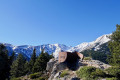
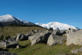
(3) On emerging from the woods, there’s a breathtaking view of the Canigou. You can catch your breath now – the hardest part is over!
Carry on straight ahead along a track to the Ras de Prat de Cabrera, which marks the junction ofthe GR®10,GR®36andGRP® Tour du Canigou. You’ll reach an open area with stunning views on both sides of the ridge. The perfect spot to settle down and enjoy a little picnic!

(4) Now carry on straight ahead towards the Ras de Prat Cabrera.

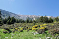
(5) From here, the path (marked in red and white bythe GR®10, which takes precedence over theGRP® Tour du Canigou) known as the Balcon du Canigou runs along a fairly steep slope, which can be quite daunting.

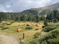
Cross a few streams, with some tricky sections involving a slight climb over boulders. Then, cross some scree and a pasture area with a few cows! The path is easy on this section. You’ll reach the recently renovated Abri du Pinatell.

(6) Continue along the Balcon du Canigou path, following the red and white markings; the rest of the route is more shaded.

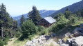
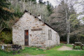
(7) Pass the Refuge de l’Estanyol. Continue along the path for nearly 200 m. The markings end here.

(8) Head down to the left through the undergrowth at the signpost marked: ‘Les Mines de la Pinouse’. The descent is a little steep but there is no danger. At the bottom, join a track.

(9) Start the short circular loop towards the Mines de la Pinouse by turning right.
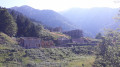
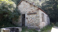
For the short circular loop: follow a signposted path or a newly laid track. You’ll then come across the site of the old iron mines – a surprising discovery given how remote the site is! Numerous building ruins are visible, as well as the entrance to the mines at the far end of the site. When I visited (July 2021), the site was partially under construction to maintain the buildings in good condition.

(10) Complete the circular loop and return to the previous junction on the track.

(9) Take the track to the right to head back down to the village of Valmanya.

(11) Join another, wider track and follow it to the right as far as the village.

(1) Cross the ford and head towards the village and the car park (S/E).

Waypoints

  1. S/E : mi 0 - alt. 2,844 ft - Valmanya car park
  2. 1 : mi 0.24 - alt. 2,936 ft - Ford
  3. 2 : mi 1.53 - alt. 3,389 ft - Els Masos (from Valmanya)
  4. 3 : mi 3.08 - alt. 5,469 ft - Junction
  5. 4 : mi 3.49 - alt. 5,469 ft - Open terrain. Leave the track
  6. 5 : mi 3.7 - alt. 5,699 ft - Ras de Prat Cabrera
  7. 6 : mi 6.16 - alt. 5,413 ft - Abri de Pinatell
  8. 7 : mi 7.67 - alt. 4,843 ft - Refuge de l'Estanyol
  9. 8 : mi 7.79 - alt. 4,823 ft - Track. Junction for a return trip to the mines
  10. 9 : mi 8.32 - alt. 4,088 ft - Pinouse Mines Circular Loop
  11. 10 : mi 8.72 - alt. 4,455 ft - Former Iron Mines of La Pinosa
  12. 11 : mi 10.05 - alt. 3,937 ft - Track suitable for vehicles
  13. S/E : mi 12.49 - alt. 2,841 ft - Valmanya car park

Notes

There are plenty of water sources as you cross several mountain streams. If required, the Pinatell and Estanyol shelters are open. You won’t need warm clothing if you’re doing this in the height of summer.

This route passes through a protected area, which may be subject to special regulations:

Always be cautious and plan ahead when you're outdoors. Visorando and the author of this route cannot be held responsible for any accidents occurring on this route.

The GR® and PR® markings are the intellectual property of the Fédération Française de Randonnée Pédestre.

Reviews and comments

4.5 / 5
Based on 2 reviews

Reliability of the description
4.5 / 5
Ease of following the route
4 / 5
Route interest
5 / 5
User 25609157
• Edited:

Overall rating : 4.7 / 5

Date of your route : May 18, 2026
Reliability of the description : ★★★★★ Very good
Ease of following the route : ★★★★☆ Good
Route interest : ★★★★★ Very good
Very busy route : No

A really lovely walk; the fallen trees in some places made the route more fun to navigate – it’s great to have a more natural feel to it! I agree with the suggestion to head to the viewpoint on the right at point #3 before continuing – it’s well worth it!
Hike in May = generally green scenery, still frozen in places. A thoroughly enjoyable walk

Machine-translated

jL3412
jL3412

Overall rating : 4.3 / 5

Date of your route : Nov 02, 2021
Reliability of the description : ★★★★☆ Good
Ease of following the route : ★★★★☆ Good
Route interest : ★★★★★ Very good
Very busy route : No

Hello,
A long hike, but well worth the effort. Thank you for suggesting it.
A lovely walk during this week at the end of October 2021 (completed on 30/10/2021).
The autumnal atmosphere was truly superb!
We just missed getting a close-up view of a herd of chamois.
I think the description could be improved.
POINT (1): “Continue to the right along the D13d …” This isn’t the D13.
“… which forms part of the GR36, AND FOLLOW THIS TRAIL to Los Masos …” This avoids any confusion for those relying entirely on the map. And it avoids a 400-metre stretch of road just after the stream next to Mas Verjau.
POINT (2): Perhaps emphasise more clearly that the climb is “LONG”.
POINT (3): I think it would be really worth adding that if you turn immediately right on leaving the woods, you can reach a beautiful panoramic viewpoint (almost 360°), developed by the “Grand site Canigou”, after a 500-metre walk along the ridge. I hope everyone will respect this place,...
POINT (7): For anyone who might be distracted whilst enjoying the table and benches at L’Estagnol, perhaps write: “Continue along the path, STRAIGHT AHEAD, for nearly 200 metres.”
POINT (8): I can confirm that in autumn the leaves cover the entire slope, effectively ‘hiding’ the path in several sections.
If you’re careful and have a bit of hiking experience, you’ll get through it without any trouble.
It might be worth noting that the path is NARROW. That it is SOMETIMES SLIGHTLY DEEP. That TOWARDS THE BOTTOM OF THE PATH, IT PASSES BESIDE A WATER TAKE (METAL TANK + PLASTIC PIPE) WHERE YOU CAN REFILL YOUR WATER.
I also think it’s worth pointing out that the track further down is VERY WIDE.

I therefore also suggest amending the map by removing the highlighting of the hairpin bends on the D13d after Mas Verjau.

Finally, as I couldn’t find a parking space in Valmanya itself (due to hunters’ vehicles), I parked just a little further up, also on the side of the D13 (towards La Bastide). Consequently, on the way back down, as I saw no mention of any notable places or views between (11) and (1), I left the suggested route upstream of the “Ribera del Castell” valley. I followed the PR (yellow markings), which stays on the left bank of this stream and leads back down to the D13, right next to the widened verge where I’d parked.
As this path is lovely (especially in this beautiful autumn), I think it’s worth suggesting shortening the route along the wide track, which is already very long from the Pinouse mines.

Machine-translated

Other walks in the area

For more walks, use our search engine .

The GPS track and description are the property of this route's author. Please do not copy them without permission.