


Refine your search for walks in Col Termier (2898m)
Col Termier (2898m) walks


 Le Grand Galibier
 Visorando Member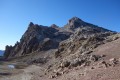
 11.85 mi
 +4,252 ft
 -4,236 ft
 9h 10
9h 10
 Very difficult
 Departure from Valloire (Savoie)
This legendary summit offers spectacular views of the Écrins mountains dominated by La Barre and La Meije, Goléon, the Aiguilles d'Arves, Mont Blanc, Viso, Queyras and the Swiss Valais, where Liskamm and Monte Rosa rise up. It is also a popular area for ibex.
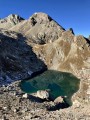
Grand Galibier from the Pont de l'Alp
 11.67 mi
+5,348 ft
-5,341 ft
8 hrs
Very difficult
Departure from Le Monêtier-les-Bains (Hautes-Alpes)
11.67 mi
+5,348 ft
-5,341 ft
8 hrs
Very difficult
Departure from Le Monêtier-les-Bains (Hautes-Alpes)
A magnificent hike leading to the legendary Grand Galibier viewpoint, from where you can admire almost the entire French Alps. Part of the hike is off-trail and often on poorly marked paths, but the most difficult part of the route is well marked with cairns.
On the agenda: unique panoramic views, numerous crystal-clear lakes, friendly wildlife, wild valleys dating back to the Ice Age, all under the deep blue skies of the Hautes-Alpes.
Walks near Col Termier (2898m)
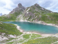
Lac de la Ponsonnière – Refuge des Drayères
 5.88 mi
+640 ft
-1,909 ft
3h 15
5.88 mi
+640 ft
-1,909 ft
3h 15
 Moderate
Departure from Le Monêtier-les-Bains (Hautes-Alpes)
Moderate
Departure from Le Monêtier-les-Bains (Hautes-Alpes)
This second, slightly easier stage takes us past four magnificent lakes: Lac des Cerces, Lac du Grand Ban, Lac Rond and Lac de la Clarée
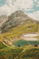
Lac des Cerces - Lacs de la Madeleine via Pointe des Cerces
 7.84 mi
+3,963 ft
-3,261 ft
8 hrs
Very difficult
Departure from Valloire (Savoie)
7.84 mi
+3,963 ft
-3,261 ft
8 hrs
Very difficult
Departure from Valloire (Savoie)
Day 2 in the Clarée Valley: ascent of Pointe des Cerces (unmarked mountain route), passage to Lac and Source de la Clarée and climb to the second bivouac at Lacs de la Madeleine (off-trail on the final section).
As with the other parts of this circular, this route is intended for experienced hikers who are accustomed to high mountains.
From the Col du Lautaret to the Alpe de Villard d'Arène
 3.99 mi
+463 ft
-315 ft
2h 15
Moderate
Departure from Villar-d'Arêne (Hautes-Alpes)
3.99 mi
+463 ft
-315 ft
2h 15
Moderate
Departure from Villar-d'Arêne (Hautes-Alpes)
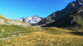
Stage1 of the Tour du Combeynot: From the Col du Lautaret to the Alpe de Villar-d'Arêne refuge via the schistose crevasse trail overlooking the Romanche valley. Unique view of the Écrins and Meije peaks.
The Combeynot Circuit in 4 stages
 24.21 mi
+5,413 ft
-5,344 ft
4 days
Moderate
Departure from Villar-d'Arêne (Hautes-Alpes)
24.21 mi
+5,413 ft
-5,344 ft
4 days
Moderate
Departure from Villar-d'Arêne (Hautes-Alpes)
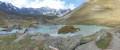
Set against a backdrop of rocks and glaciers, beneath the peaks of the Agneaux, Pic Gaspard and La Meije (3,983 m), the route winds its way through mountain pastures, larch forests and mountain hamlets. Whether along the Romanche or the banks of the Guisane, biodiversity unfolds with every step. With breathtaking views, the trail takes you on a journey through tradition and the high mountains.
From Le Lauzet to the Col du Lautaret
4.19 mi
+1,325 ft
-26 ft
3h 05
Moderate
Departure from Le Monêtier-les-Bains (Hautes-Alpes)
Stage4 of the Tour du Combeynot: from the Guisane Valley to the Col du Lautaret
Refuge des Drayères – Pont de l’Alpe
 9.08 mi
+2,014 ft
-3,563 ft
5h 55
Moderate
Departure from Névache (Hautes-Alpes)
9.08 mi
+2,014 ft
-3,563 ft
5h 55
Moderate
Departure from Névache (Hautes-Alpes)
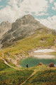
3rd and final stage. Starting from the Refuge des Drayères, head up to the source of the Clarée and return to Pont de l’Alpe via the Col de la Ponsonnière. A tour of the Massif des Cerces taking in numerous lakes, each more beautiful than the last: in turn, the Clarée, Rond, Grand Ban, Cerces, Ponsonnière and, finally, the Grand Lac.
Refuge des Drayeres – Valmeinier 1,800
 10.62 mi
+2,500 ft
-3,848 ft
7h 05
10.62 mi
+2,500 ft
-3,848 ft
7h 05
 Difficult
Departure from Névache (Hautes-Alpes)
Difficult
Departure from Névache (Hautes-Alpes)
The final stage of this route runs from the Refuge des Drayeres in the Clarée Valley to the resort of Valmeinier. You will pass the Deuil des Rochilles before emerging onto three magnificent high-altitude lakes: Lac de la Clarée, Lac Rond and Lac du Grand Ban. Next comes the ascent of the Col des Plagnettes, followed by the descent with the rocky ridge of the Grande Paré to your left and the Aiguille Noire to your right, then the ascent of the Pas des Griffes, before descending back to Valmeinier, the end point of this 5-day route.
The Chemin de Ronde between Laval and Biaune
 7.22 mi
+1,680 ft
-2,484 ft
4h 45
Moderate
Departure from Névache (Hautes-Alpes)
7.22 mi
+1,680 ft
-2,484 ft
4h 45
Moderate
Departure from Névache (Hautes-Alpes)
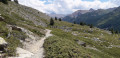
Supported by theGRP® Tour du Mont Thabor, this trail overlooks the upper Clarée Valley and offers magnificent views of this famous valley throughout the route.
Laval Refuge – Lac Blanc
 5.65 mi
+3,192 ft
-1,243 ft
5h 25
Difficult
Departure from Névache (Hautes-Alpes)
5.65 mi
+3,192 ft
-1,243 ft
5h 25
Difficult
Departure from Névache (Hautes-Alpes)
The first day offers the chance to explore the lakes of the Haute Clarée and camp at the foot of the Thabor amidst spectacular scenery.
Laval car park - Lac des Cerces
 7.23 mi
+3,537 ft
-2,254 ft
7 hrs
Very difficult
Departure from Névache (Hautes-Alpes)
7.23 mi
+3,537 ft
-2,254 ft
7 hrs
Very difficult
Departure from Névache (Hautes-Alpes)
First day of a 4-day circular starting from the Laval car park in the Upper Clarée Valley. As with the other parts of this circular, this route is intended for experienced hikers who are accustomed to high mountains.