


Refine your search for walks in Col de Salidès (1014m)
Col de Salidès (1014m) walks


No walk here yet
There are no hikes starting from or close to “Col de Salidès (1014m)”
Walks near Col de Salidès (1014m)
 In the Aigoual National Forest, starting from L'Espérou
 Visorando Member
 6.78 mi
 +633 ft
 -1,352 ft
 3h 40
 Moderate
 Departure from Dourbies (Gard)
The hike begins in the Cévennes National Park. This first stage takes place in the Aigoual State Forest, which forms part of the “Les Causses et les Cévennes” site, listed as a UNESCO World Heritage Site. We follow the drovers' road linking Languedoc to Aubrac, still used today by sheep to reach the summer pastures of the Aigoual.
Puech Pounchut
 5.53 mi
+1,371 ft
-1,191 ft
3h 45
Moderate
Departure from Meyrueis (Lozère)
This walk is located on the north side of the Aigoual massif in the Cevennes.
At the summit of the hike you will have a beautiful view of the Causse Mejean and the Valley of Jonte. On a clear day looking west you can see the Millau viaduct.
From Meyrueis to Nivoliers via Aures
 9.59 mi
+1,575 ft
-797 ft
5h 45
Moderate
Departure from Meyrueis (Lozère)
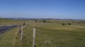
A stage that allows you to fully appreciate the wide open spaces of the Causse! A very pleasant walk, with some beautiful views along the edge of the plateau.
Meyrueis – L’Espérou
10.15 mi
+2,789 ft
-1,066 ft
7h 05
Moderate
Departure from Meyrueis (Lozère)
Walk from the village of Meyrueis (Causse Noir) in the Cévennes to get closer to Mont Aigoual.
Meyrueis – Hyelzas
 8.77 mi
+1,401 ft
-538 ft
5h 15
Moderate
Departure from Meyrueis (Lozère)
Thisfirst stage of the Tour du Causse Méjean takes the hiker up onto the Causse from Meyrueis on the banks of the Jonte. A gentle climb to get you going, featuring a picturesque stretch before reaching the Causse, the Aven Armand, and a renowned cheese dairy at the entrance to the pretty hamlet of Hyelzas. If you arrive early enough, you may be able to visit the Ferme Caussenarde in Hyelzas.
Ascent to the Causse de Blandas from the villages of the Arre Valley
10.96 mi
+1,696 ft
-2,995 ft
6h 30
Moderate
Departure from Bréau-et-Salagosse (Gard)
We follow the drovers' road linking Languedoc to Aubrac, still used today by sheep to reach the summer pastures of the Aigoual. We begin by descending into the villages and hamlets of the Arre Valley. The silk industry has left its mark here: old spinning mills and watermills. After a pleasant stroll along the Arre, where trout abound, the going gets tough with the climb up to the Causse de Blandas. Once at the top, there is a radical change of scenery.
Cassagnas - Saint-Étienne-Vallée-Française (Lébou)
 11.81 mi
+1,204 ft
-3,015 ft
6h 30
 Difficult
Departure from Cassagnas (Lozère)
Eleventh stage of a complete journey on the Chemin de Stevenson between Le Puy-en-Velay and Alès. This stage includes significant changes to the GR®70 signposting. This stage lies in the heart of the Cévennes National Park.
From Nivoliers to Mas-Saint-Chély: exploring the megaliths
 8.03 mi
+509 ft
-469 ft
4h 10
Moderate
Departure from Hures-la-Parade (Lozère)
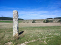
A transitional stage, with little change in altitude. Still the wide open spaces of the Causse, with a few megaliths along the way.
Saint-Etienne-Vallée-Française (Lébou) - Mialet (Audibert)
 12.72 mi
+2,940 ft
-2,552 ft
7 hrs
 Very difficult
Departure from Saint-Étienne-Vallée-Française (Lozère)
Twelfth stage of a complete journey on the Chemin de Stevenson between Le Puy-en-Velay and Alès. This stage may include significant changes to the GR®70 signposting. It passes through several valleys among the Gardon rivers.
Florac - Cassagnas
 12.36 mi
+1,818 ft
-971 ft
7h 15
Difficult
Departure from Florac (Lozère)
Tenth stage of a complete journey on the Chemin de Stevenson between Le Puy-en-Velay and Alès. This stage may involve significant changes to the GR®70 signposting. This stage essentially follows the Mimente valley before it flows into the Tarnon at Florac.