


Refine your search for walks in Col de Reculaz (1807 m)
Col de Reculaz (1807 m) walks


 From the Grand St-Bernard Pass to Saint-Gingolph via the Alpine Passes Trail
 Visorando Member
 105.27 mi
 +35,554 ft
 -42,359 ft
 11 days
 Difficult
 Departure from Saint-Rhémy-en-Bosses (Aosta Valley)
This third section of the Chemin des cols Alpins offers magnificent panoramic views of the peaks of the Valais and French Alps. You’ll enjoy numerous panoramic viewpoints over the Combin Massif, the Mont Blanc Massif, Mont Ruan and the Dents du Midi Massif. You’ll stop off at several lakes: Lake Champex, Lake Emosson, Lake Taney and, finally, Lake Geneva.
Morgins – Torgon
11.45 mi
+3,068 ft
-3,780 ft
7h 55
Difficult
Departure from Troistorrents (Valais)
This ninth stage will take you from Morgins to Torgon. The start of the route climbs towards the Col des Portes du Culet, which offers a magnificent view of the Dents du Midi. The route continues towards Portes D’Onne and then on to the Tour de Don, where you can enjoy views of the Mont Blanc massif and Lake Geneva. A fairly steep ridge then leads to the Col de la Reculaz. Alpine pastures and forests alternate during the descent towards Torgon. At Les Fignards, you’ll cross a 150-metre-long footbridge , rising to a height of 28 metres above the Avançon torrent.
Walks near Col de Reculaz (1807 m)
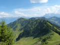
The Border Ridge and Pointe de Recon from le Morclan
 6.42 mi
+1,007 ft
-3,533 ft
3h 50
 Moderate
Departure from Châtel (Haute-Savoie)
A pleasant walk along the border ridge from the Morclan chair lift. Variations are possible (and described) to give more ascent. Opportunities for great views across the mountains in the Chatel Area and into Switzerland, including the Montreaux end of Lac Leman.
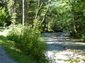
Beside the Dranse
 8.10 mi
+72 ft
-883 ft
3h 45
 Easy
Departure from Châtel (Haute-Savoie)
A pleasant walk beside the River Dranse from Chatel to Abondance, where it is possible to look around the Abbey. You can walk back the same way or there is a regular bus service in the valley. If you have a Chatel Multi-Pass the bus will be free.
Torgon – Taney
6.05 mi
+3,068 ft
-1,982 ft
5h 25
Difficult
Departure from Vionnaz (Valais)
This tenth stage will take you from Torgon to Lake Taney. The route begins with a fairly steep climb to La Caux, then becomes more pleasant as it reaches Le Planellet. Les Dents once again offer magnificent views. The route continues with a descent towards the Col de Blancsex, down to the Plan de l’Ortie. The path climbs back up towards La Charmille with a few tricky sections, but these are secured by chains. A final climb leads to the Col de Taney before reaching the lovely Lac de Taney.
La Chapelle d'Abondance - Refuge de Chesery
13.80 mi
+3,907 ft
-745 ft
9h 45
Difficult
Departure from La Chapelle-d'Abondance (Haute-Savoie)
Itinéraire de la traversée des Alpes. De La Chapelle d’Abondance passer par le Haut Giffre pour un intermède suisse. Cette étape domine la Haute Vallée de la Dranse d'Abondance, passe par le domaine skiable des Portes du Soleil.
Vous êtes sur une zone protégée. Voir la réglementation dans les informations pratiques.
From the Trébentaz Refuge to the Golèse Refuge
 17.44 mi
+4,196 ft
-4,911 ft
11h 40
Difficult
Departure from La Chapelle-d'Abondance (Haute-Savoie)
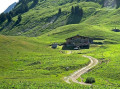
This third stage of the GTA takes you from the Chablais massif to the Giffre massif. It is very long but offers superb views of Les Dents Blanches and Les Dents du Midi in Switzerland. From the Trébentaz Refuge, the GR®5 detour crosses the Mattes ridge and rejoins the main GR®5 route. It descends towards the Pron mountain pasture, then skirts the Coincon ridge towards Lenlevay, descending into a wetland area and climbing back up to the Col de Bassachaux. It runs along the southern flank of the Crête des Rochassons and passes the Col de Chésery (1992 m) to enter Switzerland. It passes the Refuge de Chéseay, Lac Vert and climbs to Portes de l'Hiver, then descends to Chaux-Palin and continues along the hillside to La Pierre. After a short climb to the Col de Coux, it crosses back into France to cross the Torrent de Chardonnière and join the Col de Golèse and its refuge.
Taney – Saint-Gingolph
9.85 mi
+2,352 ft
-5,768 ft
6h 35
Difficult
Departure from Vouvry (Valais)
This eleventh stage will take you from Taney to Saint Gingolph. The route begins in the Loz valley at the foot of Mont Gardy and Les Jumelles, before climbing the final two passes, Lovenex and La Croix. The route continues along the River Morge, following the border with France. At Novel, the path turns towards Mont Cornin, passing through La Frîtaz and winding down towards Lake Geneva at Saint Gingolph.
From the Chalets de Bise to the Trébentaz Refuge
 8.20 mi
+3,924 ft
-2,740 ft
7h 10
Difficult
Departure from La Chapelle-d'Abondance (Haute-Savoie)
This second stage continues the traverse of the Chablais. The route winds through the beautiful Abondance valley amidst magnificent, tranquil scenery. From the Chalet de Bise, there is a steep climb up to the Pas de la Bosse. From the pass, the path descends to the chalets of Chevenne, then follows the Sechet stream, continuing the descent along the right bank to the Chapelle d’Abondance. It runs alongside the Thoules stream and then the Dranse, which it leaves at the hamlet of Le Moulin, before climbing towards Sur Bayard to the Chalet des Crottes. From there, it is best to leave the main GR®5 route and, via a western path, follow the detour leading to the Refuge de Trébentaz, as the Refuge de la Haute Bise – shown on the IGN map – no longer offers accommodation.
From Bise to Lake Fontaine via Ubine
5.35 mi
+1,742 ft
-2,293 ft
4h 00
Moderate
Departure from La Chapelle-d'Abondance (Haute-Savoie)
If you want to discover the mountains in all their forms, both mineral and human, take this challenging route.
You are in a protected area! See the regulations in the practical information section.
From Lac des Plagnes to Lac de Tavaneuse
 5.73 mi
+2,507 ft
-2,677 ft
4h 50
Difficult
Departure from Abondance (Haute-Savoie)
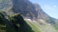
A linear hike from a lake accessible by car to a mountain lake in a wild setting, then back down into the valley. A very beautiful traverse at the foot of the impressive north faces of Pointe de la Chavache and Pointe d'Entre Deux Pertuis.
Refuge de Chesery - Samoens
13.81 mi
+2,080 ft
-6,129 ft
8h 10
Difficult
Departure from Abondance (Haute-Savoie)
Itinéraire de la traversée des Alpes. Départ du Chablais Suisse (Lac de Chesery) par une belle balade en balcon offrant un panorama sur le Massif des Dents Blanches et la Vallée du Giffre jusqu'au Col de Coux (frontière) pour rejoindre ensuite par une longue descente Samoens.