Route beneath the Magériaz from La Fougère

A route offering views over the River Leysse.
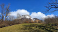
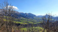
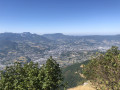
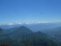
Magnificent views over the Thoiry valley towards La Thuile, with a view of the Pointe de la Galoppaz.
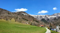
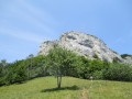
On the return journey, you’ll pass beneath the imposing Magériaz massif.

Details

n°6750766
Creation:
Last update:
Last review:
  • Walking
    Activity: Walking
  • ↔
    Distance: 4.94 mi
  • ◔
    Average duration: 3h 25 
  • ▲
    Difficulty: Moderate

  • ⚐
    Back to start: Yes
  • ↗
    Ascent: + 1,276 ft
  • ↘
    Descent: - 1,276 ft

  • ▲
    Highest point: 3,625 ft
  • ▼
    Lowest point: 2,349 ft

Photos

Description of the walk

Park by the rubbish bins just before the village of La Fougère, on the D 21, which can be reached from either Thoiry or Saint-Jean-d’Arvey.

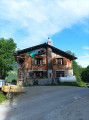
(S/E) Set off along the path towards the village. After the first two houses on the left, take the grassy path which leads to the tarmac path and go round a large farmstead on the right.

(1) At the signpost, turn left towards Roc des Rochettes and continue along this path until you reach an old, dilapidated cross.

(2) Take the path on the right which leads you to La Combe (in the commune of Les Déserts). Ignore the paths branching off to the right.

(3) Just past the La Combe sewage treatment works, take a path on the right which goes round the town hall and joins theGR® 96. Then turn right to join the Route des Mermets.

(4) Turn right and follow this road until you reach the Mermets turn-off.

(5) At the bend, carry straight on along a track and then a path which takes you to Labiaz, where you join theGRP® circuit of the Massif des Beauges.

(6) Follow it to the right towards Thorméroz (signpost) and carry on until you reach the signpost for La Fougère.

(7) Leave theGRP® and turn right towards La Fougère via La Palus (signposted). Cross several streams and arrive at this hamlet.

(8) Walk through this village and follow the wide path which continues along the Route de la Fougère.

(1) Turn left to reach the car park (S/E).

Waypoints

  1. S/E : mi 0 - alt. 2,349 ft - La Fougère – Car park near the bins
  2. 1 : mi 0.24 - alt. 2,500 ft - Junction at the end of the circular loop
  3. 2 : mi 0.43 - alt. 2,549 ft - Old, dilapidated cross - Leysse (rivière)
  4. 3 : mi 1.47 - alt. 3,031 ft - Junction - Leysse (rivière)
  5. 4 : mi 1.63 - alt. 3,091 ft - Route des Mermets
  6. 5 : mi 2.19 - alt. 3,274 ft - Mermets exit
  7. 6 : mi 2.43 - alt. 3,484 ft - Signpost, towards Thorméroz
  8. 7 : mi 3.38 - alt. 3,307 ft - Signpost for La Fougère
  9. 8 : mi 3.98 - alt. 2,864 ft - La Palus
  10. S/E : mi 4.94 - alt. 2,352 ft - La Fougère – Car park near the bins

Always be cautious and plan ahead when you're outdoors. Visorando and the author of this route cannot be held responsible for any accidents occurring on this route.

The GR® and PR® markings are the intellectual property of the Fédération Française de Randonnée Pédestre.

Reviews and comments

3.8 / 5
Based on 2 reviews

Reliability of the description
4 / 5
Ease of following the route
4.5 / 5
Route interest
3 / 5
Chaden
Chaden

Overall rating : 3.7 / 5

Date of your route : Feb 06, 2024
Reliability of the description : ★★★★☆ Good
Ease of following the route : ★★★★☆ Good
Route interest : ★★★☆☆ Average
Very busy route : No

Walk taken on 6 February 2024. No snow. A lovely route through the woods. Passed through some pretty little villages.
I started the walk at Les Mermets and, on the way back, I carried on straight on to La Combe (rather than returning to Les Mermets) as far as the Col de Plainpalais, and then came back via the GRP trail through the Massif des Bauges. This final section is described in the walk ‘From the Deserts to the Col de Plainpalais’. This makes for a hike of almost 14 km with a bit over 700 m of elevation gain.

Machine-translated

etr73
etr73

It’s true, there’s a lot of tarmac, but I wanted to stick to a walk that could be done in half a day.

Machine-translated

MaitreFolace
MaitreFolace
• Edited:

Overall rating : 4 / 5

Date of your route : Apr 27, 2021
Reliability of the description : ★★★★☆ Good
Ease of following the route : ★★★★★ Very good
Route interest : ★★★☆☆ Average
Very busy route : No

For once, I was a bit disappointed by this route, which doesn’t offer much compared to the other routes in the area; out of 8 km, more than 3 km are on tarmac, which I think is quite a lot.
At the start, after the first two houses, I had the impression that the path veering off to the left led to a private property, so I asked a local resident who kindly confirmed that I was on the right track. I didn’t see a sign at point 1, but you can’t go wrong (in fact, there are no signposts at all before point 6). The climb through the forest is gentle and easy. Then it’s tarmac as you cross La Combe; at Les Mermets, I turned right too early at the ‘1000m’ mark, but I quickly realised my mistake as the route on the map is spot on. Just before point 6, you come back onto the path and the signposting; the rest of the way is straightforward, though there’s still too much tarmac for my liking towards the end. Total time walking at a leisurely pace: 2 hours 25 minutes. I didn’t come across anyone, although there were cars in the car park.

Machine-translated

Other walks in the area

For more walks, use our search engine .

The GPS track and description are the property of this route's author. Please do not copy them without permission.