


Refine your search for walks in Col de la Croix de Millet (773m)
Col de la Croix de Millet (773m) walks


 Cham du Cros circular from Croix de Millet
 Visorando Member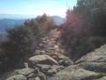
 10.46 mi
 +1,982 ft
 -1,965 ft
 6h 30
6h 30
 Moderate
 Departure from Prunet (Ardèche)
Between Prunet and Jaujac, the Col de la Croix de Millet offers a beautiful view of the Ligne valley to the south and the Lignon valley to the north.
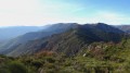
The climb to the Col du Merle and the return after Pissas are through woodland, while the bare ridges of the Cham du Cros offer beautiful views of the southern Ardèche from the Vagorge valley and the Tour de Brison in the Cévennes, the Rhône valley and Mont Ventoux to the east, and Mont Lozère to the west.
La Cham du Cros from the Col de la Croix de Millet
 6.81 mi
+1,594 ft
-1,598 ft
4h 30
Moderate
Departure from Prunet (Ardèche)
6.81 mi
+1,594 ft
-1,598 ft
4h 30
Moderate
Departure from Prunet (Ardèche)
La Cham du Cros is the peak at the eastern end of the Tanargue massif. From there, the view stretches from the mountains of the south to the north of the Alps and, on a clear day, as far as Mont Blanc.
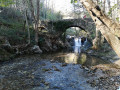
Tour of Prunet via the Col de la Croix de Millet and the Pont de Cannelle
 7.16 mi
+1,499 ft
-1,512 ft
4h 35
Moderate
Departure from Prunet (Ardèche)
7.16 mi
+1,499 ft
-1,512 ft
4h 35
Moderate
Departure from Prunet (Ardèche)
After the Sainte-Philomène Chapel, the highest point (3) of the forest road (890m) offers a stunning aerial view of Jaujac and its volcanic caldera. To the east, the foothills of the Vercors; closer by, the Coiron, the Escrinet and the Roche de Gourdon; below, to the north, Jaujac and the Lignon valley; and to the west, the Tanargue and the Cham du Cros.
Walks near Col de la Croix de Millet (773m)
Sainte-Marguerite – western slope: from Neyrac-les-Bains to the Col d’Aizac
 Tourism professional
 11.49 mi
+3,533 ft
-2,677 ft
8h 20
Moderate
Departure from Meyras (Ardèche)
11.49 mi
+3,533 ft
-2,677 ft
8h 20
Moderate
Departure from Meyras (Ardèche)
The first stage of the Sainte Marguerite circular route, which takes you from Neyrac-les-Bains, a spa town on the banks of the Ardèche, to Aizac, a small village in the Ardèche Cévennes, a stone’s throw from Antraigues-sur-Volane.
Leaving behind the lowland holm oaks, you head into the heart of the chestnut groves! From the banks of the Ardèche, you follow three of its tributaries: the Fontolière, the Bourges and finally the Besorgues, which flow along the valley floor and at the foot of picturesque villages. A very sunny walk.
Rocher de Cheylard - from the Col d'Aizac to the Ray-Pic
 11.84 mi
+4,206 ft
-2,972 ft
9h 05
11.84 mi
+4,206 ft
-2,972 ft
9h 05
 Difficult
Departure from Aizac (Ardèche)
Difficult
Departure from Aizac (Ardèche)
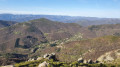
Second stage of this two-day loop around the Rocher de Cheylard, which takes you back to your starting point from the previous day via a different route: the Ray-Pic waterfall.After passing the summit of the Rouyon massif, descend towards the Besorgues river and climb up the other side towards the Ardèche plateau, where broom gives way to wild blueberries.
The Three Valleys - From Aizac to Saint-Julien-du-Serre
 12.33 mi
+2,195 ft
-3,173 ft
7h 35
Moderate
Departure from Aizac (Ardèche)
12.33 mi
+2,195 ft
-3,173 ft
7h 35
Moderate
Departure from Aizac (Ardèche)
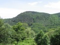
This second stage of the Three Valleys circular walk takes you to Saint-Julien-du-Serre, the starting point of the previous day’s walk, via a different route.
Following the ridge for the first part, you will once again descend into the coolness of the three valleys. You’ll pass through the magnificent hamlet of Thieurre, perched on its rocky outcrop offering breathtaking views of the Lower Ardèche, the Volane Valley and the Besorgues Valley.
Antraigues-sur-Volane Circular Loop: from the Col d’Aizac to Bise
 13.84 mi
+3,255 ft
-3,478 ft
9h 10
Difficult
Departure from Aizac (Ardèche)
13.84 mi
+3,255 ft
-3,478 ft
9h 10
Difficult
Departure from Aizac (Ardèche)
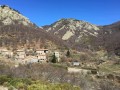
The second circular stage of the Grand Boucle d’Antraigues-sur-Volane, which, via a different route, takes you back to your starting point from the previous day: Bise. You’ll discover, in particular, the more rocky side of the Volane Valley upstream from Antraigues-sur-Volane. Then there are sections along the ridges, inviting you to contemplate the wild natural surroundings.
Sainte-Marguerite – via the summit: from the Col d’Aizac to Neyrac-les-Bains
 11.69 mi
+2,598 ft
-3,471 ft
7h 40
Moderate
Departure from Aizac (Ardèche)
11.69 mi
+2,598 ft
-3,471 ft
7h 40
Moderate
Departure from Aizac (Ardèche)
Second stage of the Sainte-Marguerite circular route, which takes you back via a different route to your starting point from the previous day: Neyrac-les-Bains.
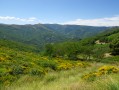
The first section is high up, taking you over the summit – the highest point of the two-day walk – offering breathtaking views of the Lower Ardèche, the Tanargue, the Ardèche Plateau and the surrounding valleys.
The second section focuses more on built and/or historical heritage, featuring the village of Niègles, the castles of Vantadour and Hautségur, and the Via Domitia.
Around Chauzon
 6.86 mi
+617 ft
-617 ft
3h 40
Moderate
Departure from Balazuc (Ardèche)
6.86 mi
+617 ft
-617 ft
3h 40
Moderate
Departure from Balazuc (Ardèche)
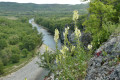
A varied hike that takes you along a small canyon. Not to be done on a very hot day.
13/02/2024: Route modified following a municipal order. See practical information.
The Three Valleys - From Saint-Julien-du-Serre to Aizac
 11.84 mi
+2,612 ft
-1,670 ft
7h 45
Moderate
Departure from Saint-Julien-du-Serre (Ardèche)
11.84 mi
+2,612 ft
-1,670 ft
7h 45
Moderate
Departure from Saint-Julien-du-Serre (Ardèche)
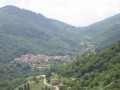
This first stage of the circular Three Valleys Loop takes you from Saint-Julien-du-Serre to Aizac. After a gentle warm-up on flat terrain in the Oize Valley, discover the land of the chestnut in the Cévennes of the Ardèche! Pass through hamlets tucked away along the paths and picturesque villages: Saint-Andéol-de-Vals, Genestelle, Antraigues-sur-Volane, Aizac. Sometimes at the bottom of the valley, sometimes along the ridge... often in the shade.
 From Vogüe to La Roque
50.99 mi
+1,063 ft
-1,398 ft
More than 12 hrs
Moderate
Departure from Vogüé (Ardèche)
This route takes you down the Ardèche from Voguë to the Old Rhône, covering 80 km and allowing you to discover this river.Note: the elevation differences mentioned here are incorrect, due to measurements taken in the gorges. The actual elevation difference is 140 m downhill.
Circular Loop of Antraigues-sur-Volane: from Bise to the Col d'Aizac
 13.65 mi
+3,563 ft
-3,353 ft
9h 25
Difficult
Departure from Genestelle (Ardèche)
13.65 mi
+3,563 ft
-3,353 ft
9h 25
Difficult
Departure from Genestelle (Ardèche)
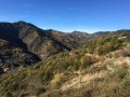
First circular stage of the Grand Boucle d'Antraigues-sur-Volane, which takes you from Bise, a small hamlet at the bottom of the valley, to Aizac, a small village in the Cévennes of the Ardèche, perched on its pass between Volane and Besorgues.
With crystal-clear rivers, passes offering breathtaking views and numerous hamlets along the way, the mountains are far from barren: life, water and nature are everywhere.